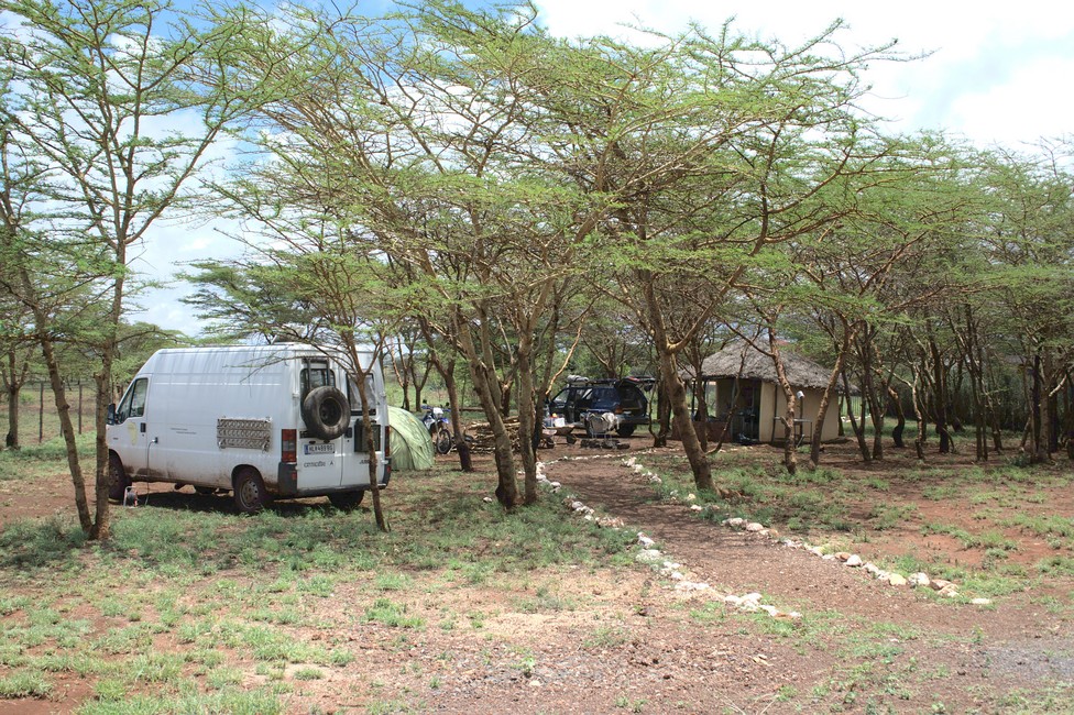
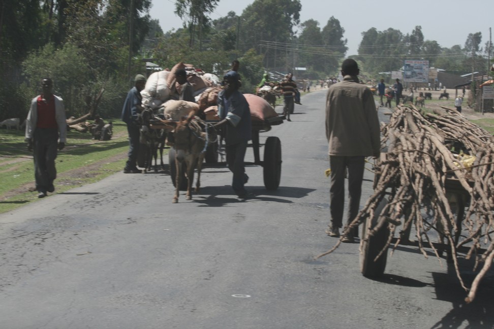
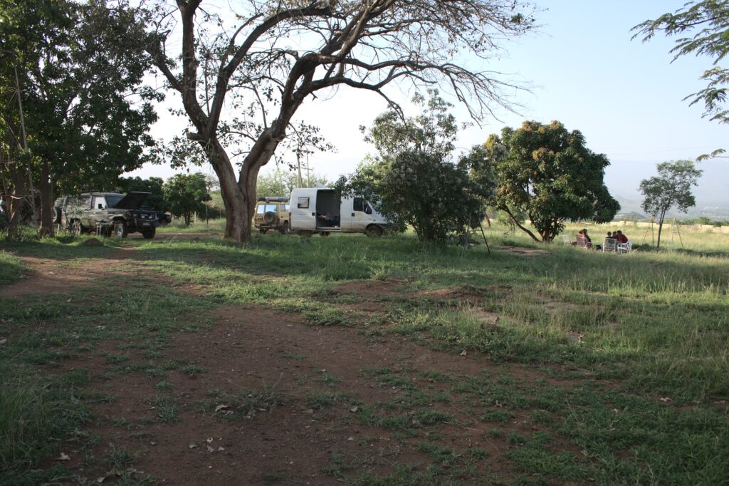
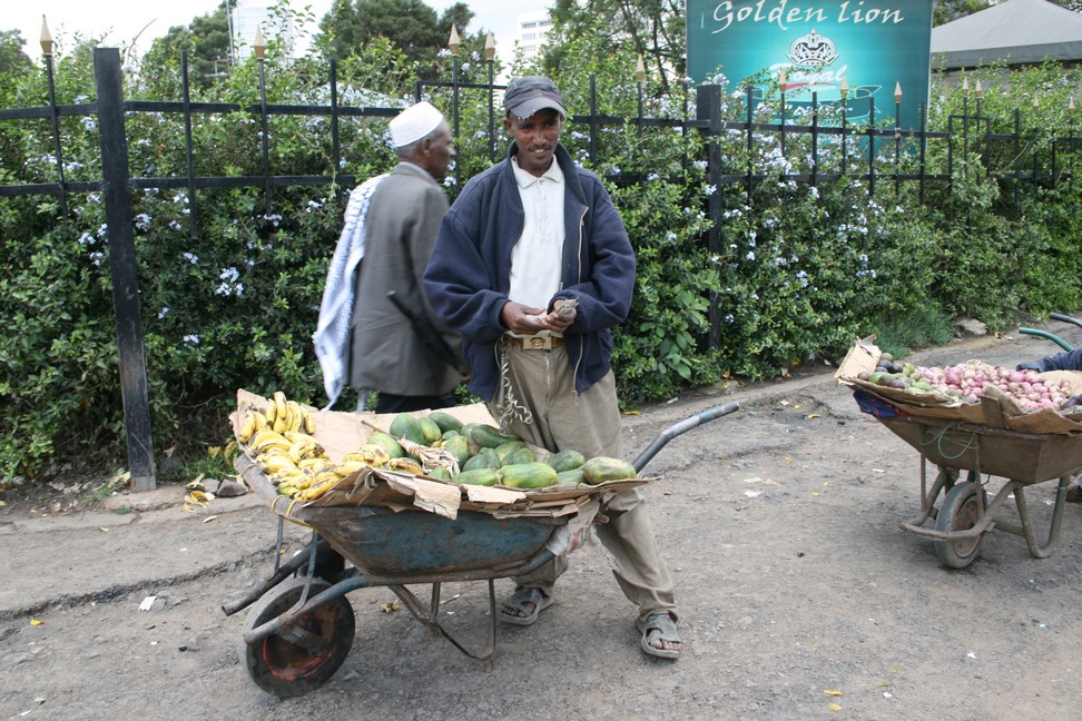
Buffalo Springs National Park is our next destination. With last strength we make it to Isiolo in the Gadissa Lodge, 15 kilometers from the lodge our bearing gave up. Now, some good advice, because at the end of the world it is difficult to get spare parts for our vehicle.
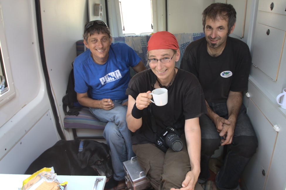
Sibille and Wolfgang have also arrived, and a mechanic who takes a close look at the problem.
The problem is quickly identified, we need new wheel bearings and the housing must be welded. Not so easy. With luck we could get new wheel bearings, Wolfgang is a mechanic and supervises the proper installation and soon we are ready to drive again.
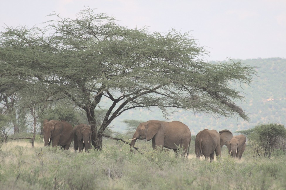
In the National Park motorcycles are not allowed, so we do a two-day trip to the park with Wolfgang and Sibille, with our van. We have to smuggle Tara, what we managed, and after the gate, we see our first elephants.
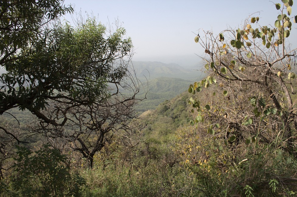
Buffalo Springs National Park
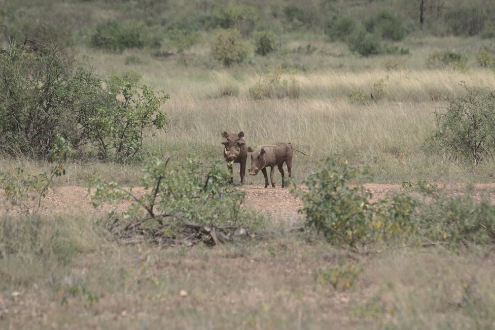
We are excited because so much luck we did not expect. We watch the elephants for a while, and on the game drive warthogs cross our way.
Buffalo Springs National Park
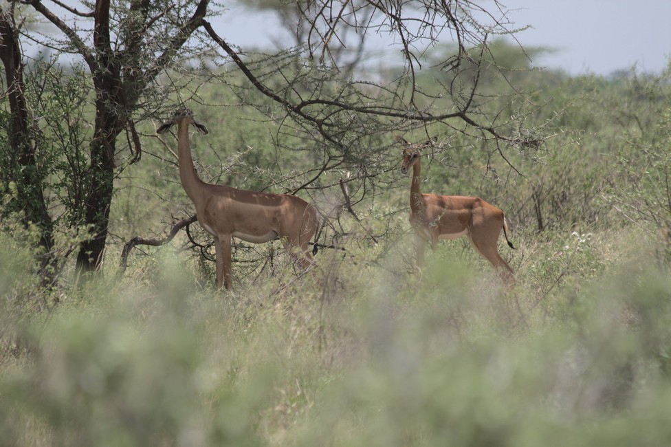
After a short drive, even the long-necked gerenuk was crossing our way. Gerenuks are gazelles and only found in Buffalo Springs National Park.
Buffalo Springs National Park – Gerenuks
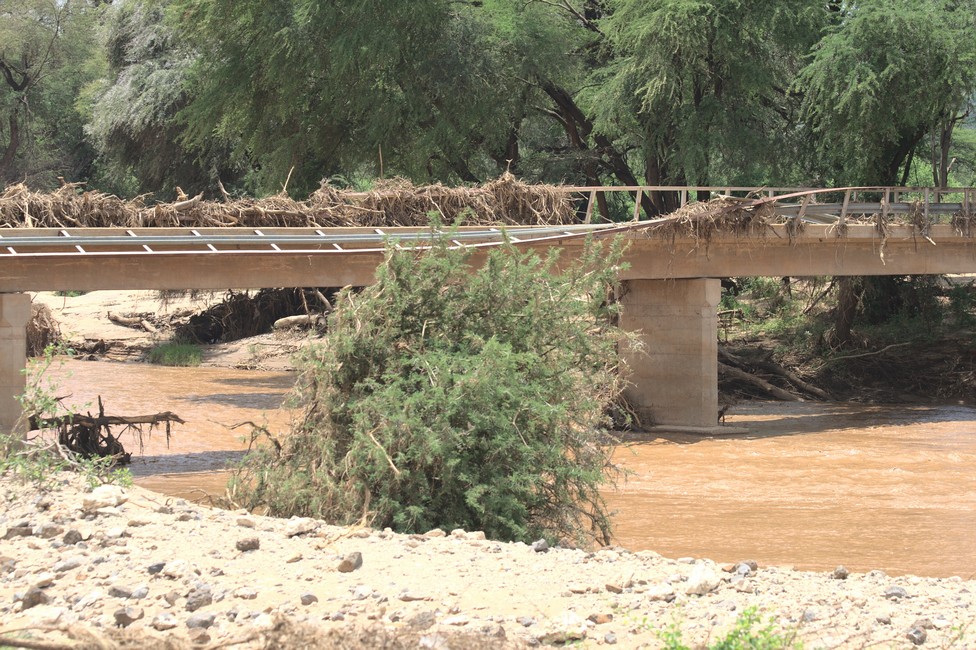
After the heavy rains of recent days, the Ewaso Ngivo river, the bridge to Samburu National Park was badly damaged, so there is no way for us to cross. But we still see Grevy’s zebras and lyre antelopes.
Bridge to Samburu National Park
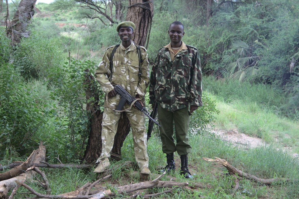
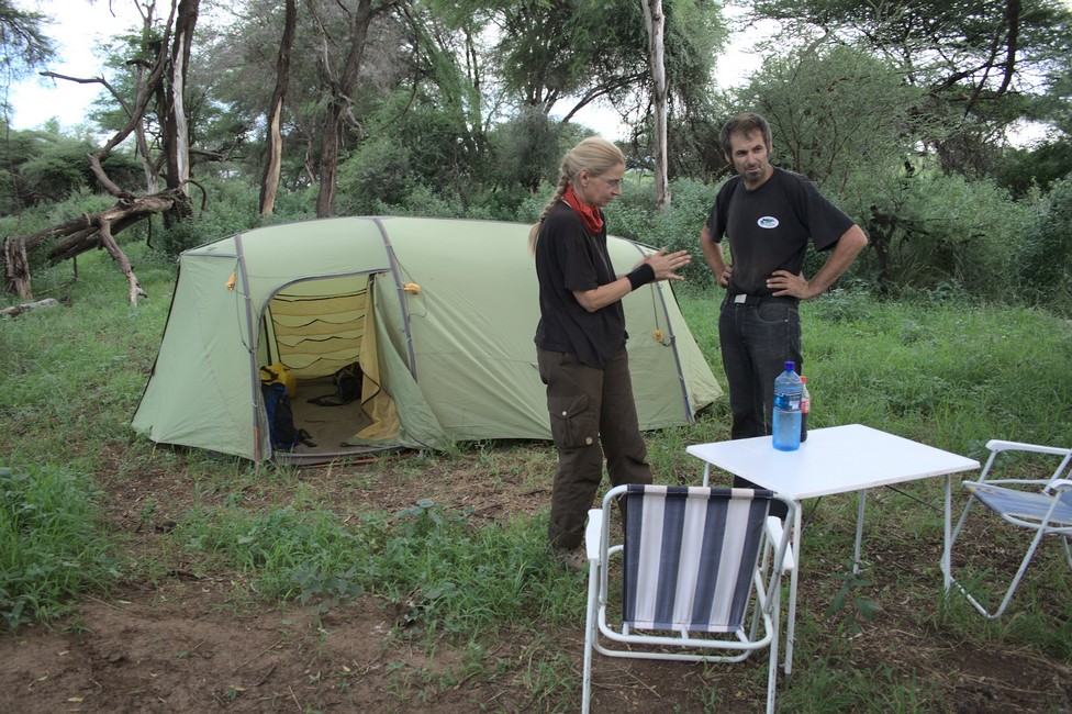
It’s getting late and we set up our bush camp. Sibille and Wolfgang will sleep in tents, Alexandra makes a bush walk with the armed guards of our night camp.
coffee break in the vanRanger in the National ParkBush camp with Sibille and Wolfgang
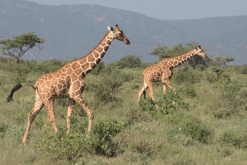
The new morning greets us with beautiful giraffes, what more could you expect from life.
Giraffe
The reticulated giraffe is living in northern Kenya, as opposed to the southern Masai giraffe, which has a different pattern. At the moment, here is mating season, so we can observe how couples tie their necks around each other, the prelude to the actual mating.
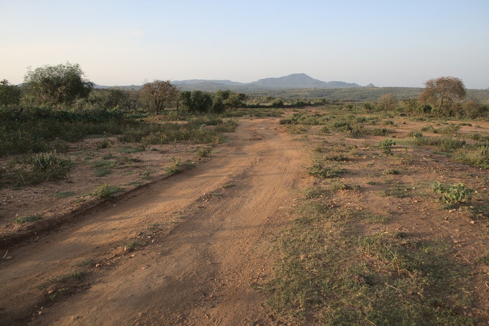
The next morning we leave the Omo region and Turmi and drive through a beautiful landscape. Our goal is the Kenyan border. From the border onwards on Kenyan side it is dangerous in many ways. On the one hand, the Moyale road is difficult, on the other hand, there are always reported serious robberies.
Road to Kenyan Border
But for us it is the only route to Kenya, as the route along Lake Turkana via Omorate can not be done without four-wheel drive.
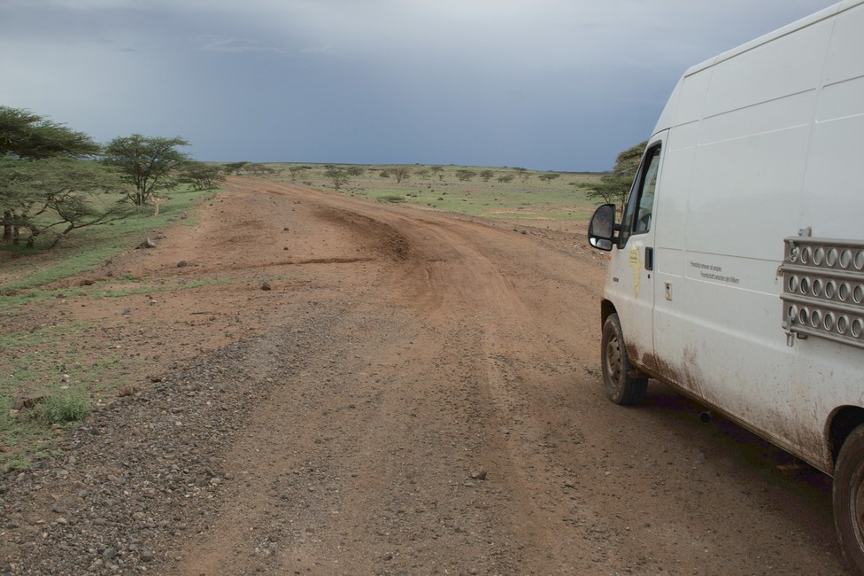
We have a noise at the vehicle, but cannot localize it maybe a shock absorber, or a wheel bearing, but it does not help to know, for up to Marsabit about 1,000 miles from here, there is anyway no village to be able to fix it, so only hope remains.
We see our first marabou storks, a sure sign that we penetrate deeper into East Africa. We liked Ethiopia very much, we’ll visit it again in the near or distant future. You cannot make plans in Africa there are too many unknown factors.
Marabu Stork
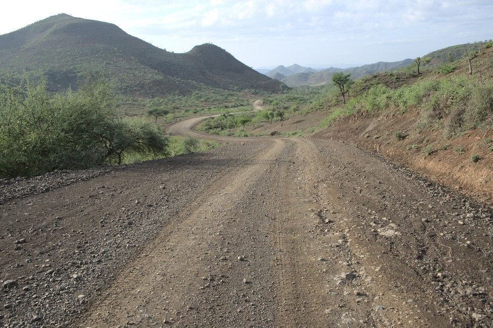
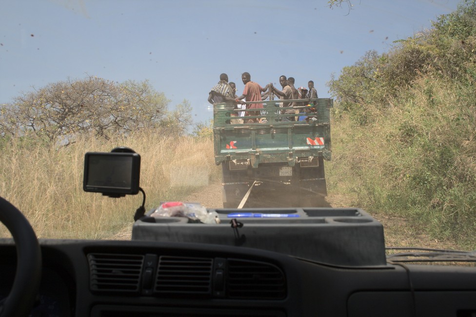
The border crossing into Kenya was no problem and now we drive on the frightened Moyale road to Marsabit and Isiolo. We hear many horror stories and, moreover, the rainy season has started, which makes things not easier. We are lucky not being forced to drive in convoy, although it is reported of robberies. The track allows a max of 20km/h , so it will take us for the 500 kilometers distance – with a lot of luck just two days.
Border Village Moyale
It is difficult to drive because heavy trucks have left deep ruts and we must always balance the van on the higher parts of the road not to slip into the ruts.
Kenya Marsabit – Moyale Road
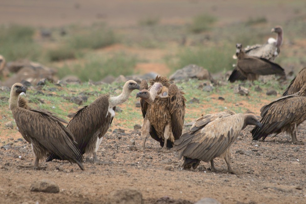
After 14 continuous hours of driving we reach the halfway town Marsabit and promptly drown in mud in the flooded town. With the help of the sand ladders and many helpers we can free ourselves and reach after a violent spin on a curve in the mud, Henry’s Camp Site.
Vultures – hopefully everybody survived
At the campsite we meet again Cape Townian Joachim and the two German motorcyclists Wolfgang and Sibille.
Marsabit Campsite
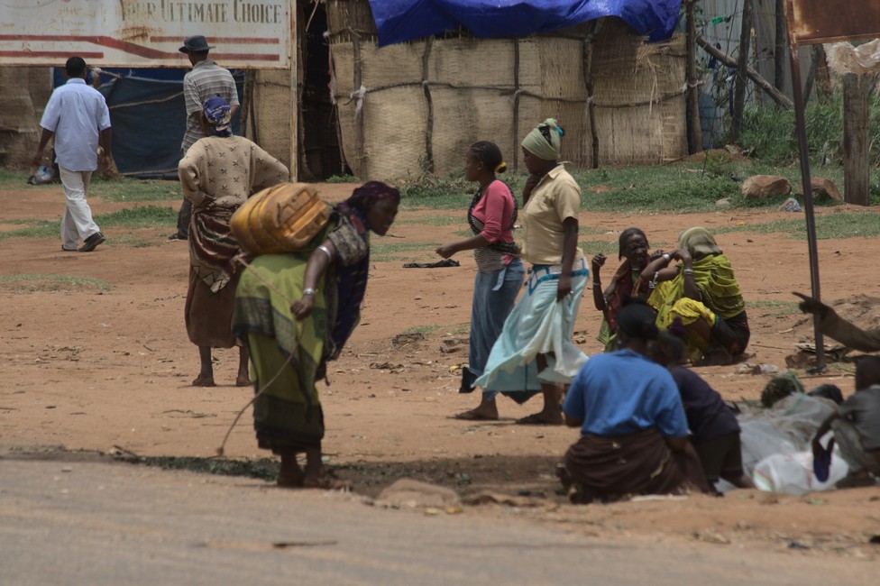
We wait here a few days until the weather improves, enjoy Henry’s private Bakery and cheese and make a walk with Wolfgang and Sibille to the market of Marsabit.
At the market of Marsabit, there is an abundance of goods, other than in Ethiopia, and we stock up our supply with some food to survive the next 250 kilometers.
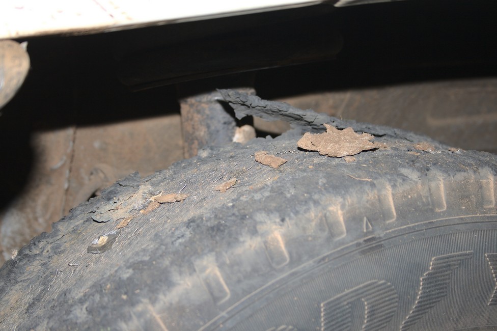
We hear about the weekly market in Turmi. On the way back, we still encounter a group of young warriors. They are full body painted with beautiful patterns. Again, we must pay. With mixed feelings we leave the area, knowing that we have made our contribution to its possible demise. We cannot think a lot, because we already have caught up with reality. We do not get up a mountain, it is too steep, we are too heavy. Unloading also does not help. We try hard but ruin our front tires to the mesh. Blessing in disguise, a truck comes by, after long negotiations they tow us up the hill for 500 birr (about 37 U.S. dollars), 300 meters up the mountain.
too steep for us we need help
Somewhat annoyed by the insolence we have no choice but to pay. Also, this is Africa.
Arriving at the hill we pack our rescue belt back again. From here there are no steep mountains more to Jinka. I wonder if I switch to the spare tire here, I decide against it, maybe the tires stay to Jinka, where I can change the tires at the camp. We also hope that we can get our dimension in Jinka, then we fit it to these rims.
broken tire
Annoyed and disappointed we drive on the wire meshes on to Jinka. It should be another 10 kilometers.
I have no idea whether we survive driving through water with these tires, let’s try it s, we can always change them.
Worked, now a river crossing, supposed to go well.
Well gone and already we are in Jinka. The place is the last outpost and who wants to Omo should stock up here thoroughly, gasoline, water, food, and there is a market where you can buy fruits and vegetables.
The village is very busy because within a day’s journey, there is nothing here, the farmers come from the surrounding villages in long marches here to sell a cow or deliver the crops.
We stop here, but we do not get tires. So quickly we change to our spare tires and without spare wheel, we go to Key Afer.
There we meet again, Joachim, a South African of German descent, we had met for the first time in Lalibela. He is on his way home to Cape Town. Spontaneously, he invites us to spend a few days with him in Cape Town. But Cape Town is still a long way and we will not know how long it will take us there. But here we buy a heavily used spare tire for 150 U.S. dollars, at least we have one.
Together with Joachim we make our way to Turmi, we have heard of the weekly market, where different tribes come together from all over the area to trade at the market.
Road toTurmi
The track is not bad, the red soil in the dry state can be well traveled, but when it rains, these slopes are huge slides and muddy.
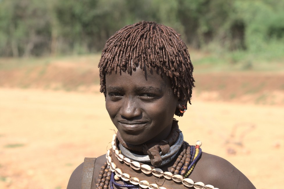
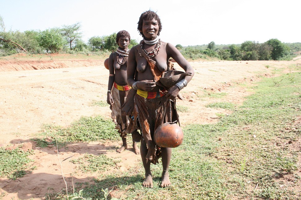
We meet the first Hamer – women, very friendly people with always a smile on the lips. A strong contrast to the Mursi.
woman of the Hamer tribe
We stop, of course, two different cultures, but just as curious as we, are the Hamer – women. We say goodbye and soon arrive in Turmi.
Hamer People
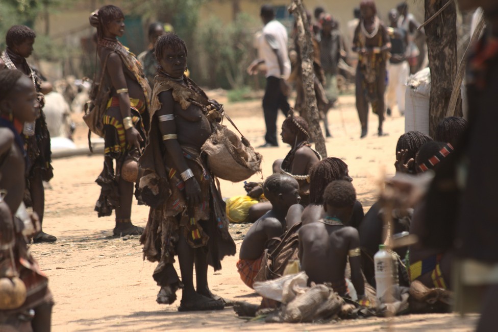
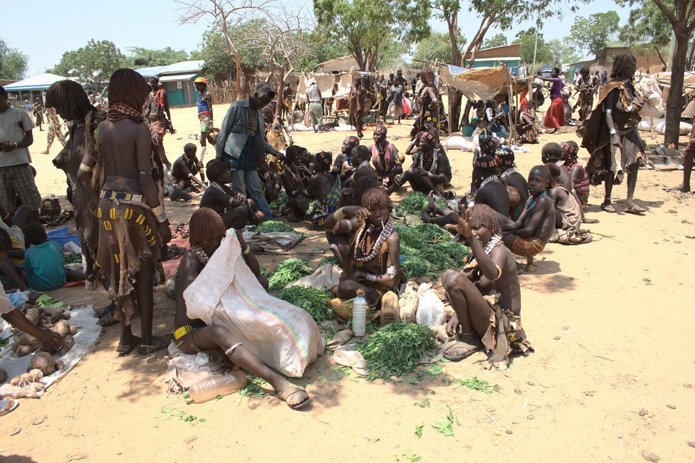
In Turmi the market has already started, we leave the car at the campground, and walk to the market. The ethnic mix is interesting. We plunge into the crowd and enjoy.
weekly market in Turmi
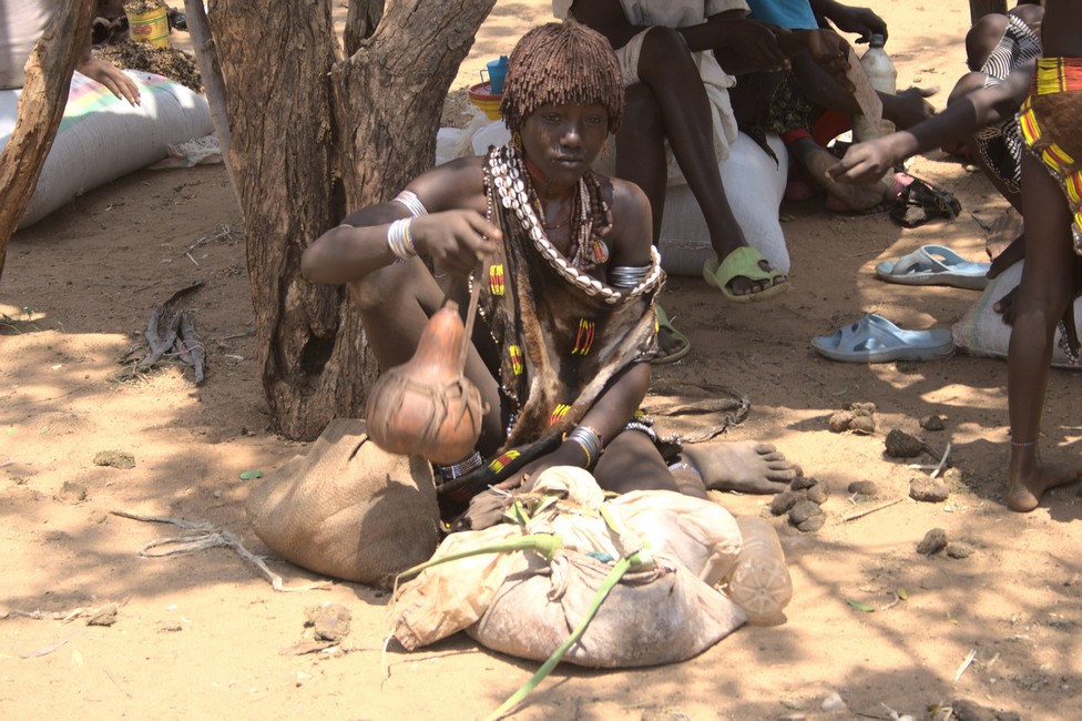
There are all sorts of things here to buy. Fresh fruit and vegetables are offered by Karo women.
The market stalls are kept simple, a few wooden poles and a piece of fabric roof and finished is the market stall.
Woman of the Karo tribe
The Karo people are a very small tribe, it is estimated that there are only about 1,000 tribal members left. They are closely related with the Hamer, what makes their differentiation difficult. Originally they were ranchers, but they have lost, due to anthrax disease, most of their animals, and today they live mainly from agriculture. Also, they are notable for body painting. Also significant is the headdress of men.
On the market there are also many utensils and jewelry to buy, jewelry plays an important part in the lives of the Karos, but also an important part of the Hamer.
weekly market in Turmi
Numerous gourds can be found in different style, form and ornamentation. It is an everyday vessel in which milk, oil or cereal is stored.
There are wooden headrests, which are used as pillows.We can not imagine that this is comfortable, but must be good, because they are used in almost all of Africa.
And little fetish figurines may not be missed, otherwise it would be no African market.
For a while we watch a craftsman at the carving. He proudly shows us his art.
But not only we marvel, also we strange creatures are admired. We often wonder what they think about us, but our language skills do not allow for conversation. Too bad.
Hamer woman
Of course they want to sell something, but we often get the impression that the sale is not in the foreground, but a welcomed reason to get in contact with us strangers, to see how we are and what we carry with us.
We are exhausted and go back to the shady campsite. It is a community campsite. It offers plenty of shade, fireplaces, and showers, the water from an old oil barrel is fed into the line. Simple and good.
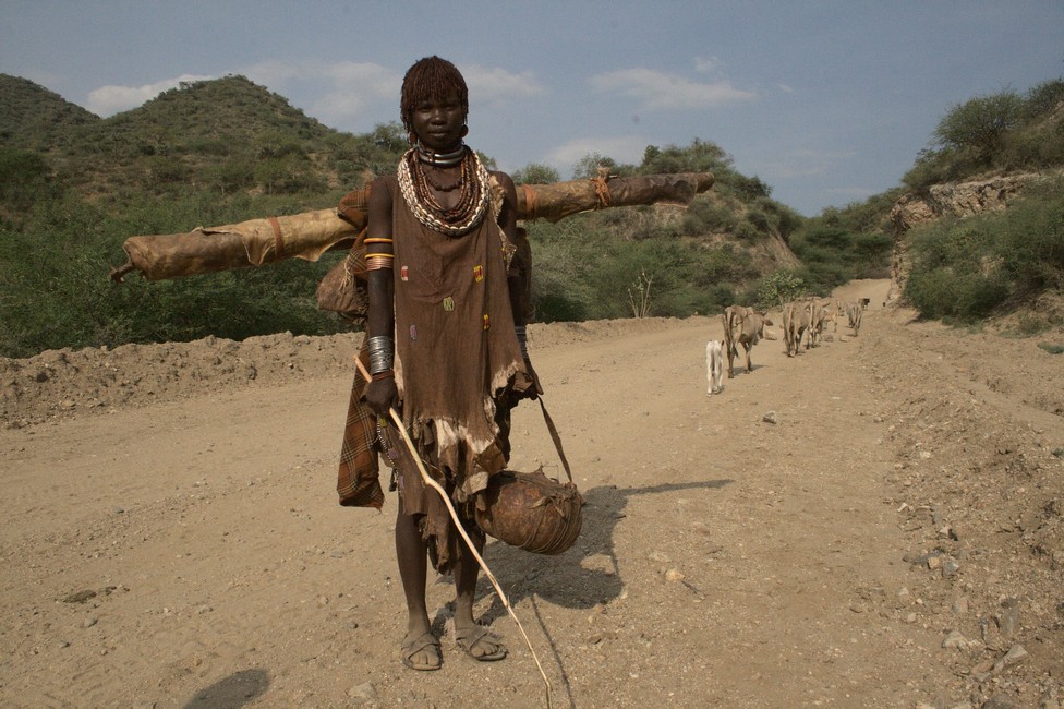
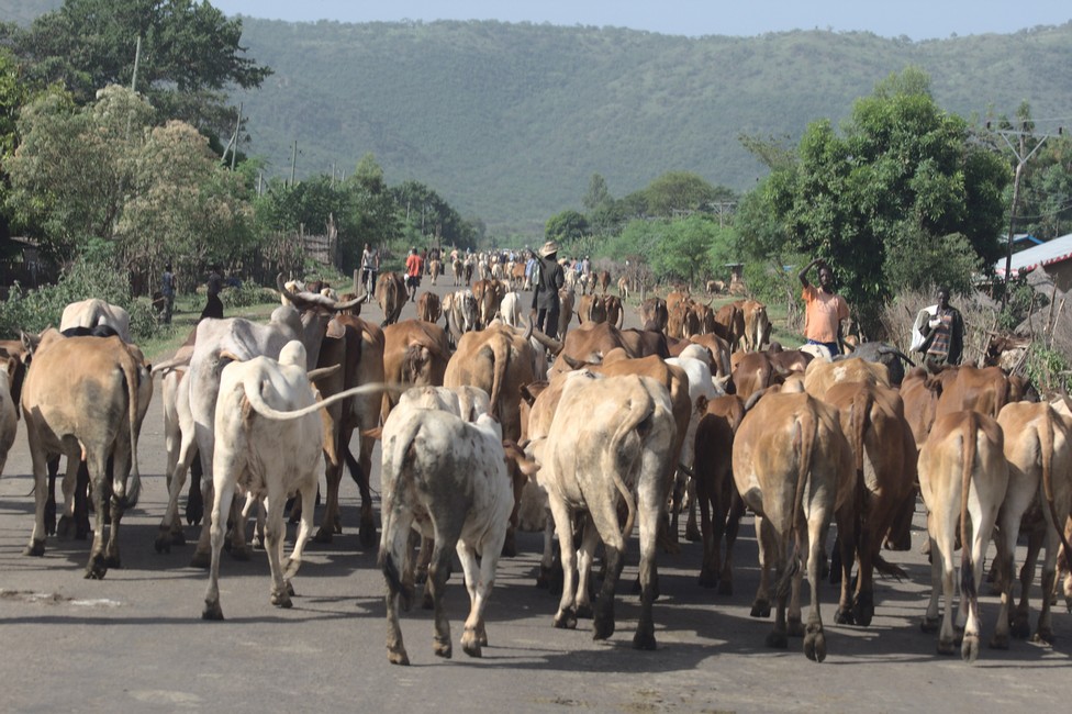
The next day we leave early for the Mursi tribe, because we want to go as far as possible, and the information about the road conditions are very vague. So we start in the morning and immediately are slowed down by a herd of cattle.
road traffic
The cattle is followed by goats, trucks and cars rummage through the crowd, that is Africa.
Now things get tight, nobody knows really, where to go, but here in Africa everybody respects the others, everyone can use anything and have the same rights, as an African woman once told us in a shop: “Africa is sharing” and this is actually true.
Ethiopian village
A little later we are once again on a gravel road. Average speed is walking speed, because we could go on foot, but driving is still more comfortable.
Gravel roads are a big problem for vehicles, even for off-road vehicles, but for our European road limousine a gravel road cannot be driven without damage. We are planning to buy a Land Rover in South Africa and continue. But the problem is to sell the van.
Even here in absolutely remote areas, roads are being built. Often gravel roads are completely replaced, but often only repaired after the rainy season, because the waters wash away the loose material and every season they need to be repaired.
Feasible only here in Africa because labor costs are very low, a road worker earns about 100 US$ monthly.
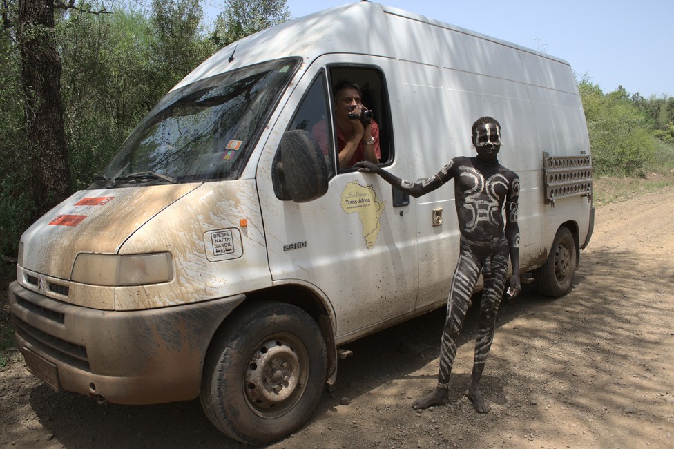
We must take a guide and an armed soldier, as the Mursis are dangerous, and soon Mursi warriors block the road.
Mursi tribe
They do not want to let us pass – our guide negotiates. What they want is not clear. It is not money. Our leader speaks the language of the Mursi because he has lived a long time with Mursi people, on an outpost of civilization.
After some back and forth and a little pressure with our vehicle, they give the road free. Our guide is a bit concerned.
After a few kilometers, we reach a Mursi village. We are viewed at suspiciously.
Mursi tribe
Our guide explains to the chief who we are and where we come from and the purpose of our visit.
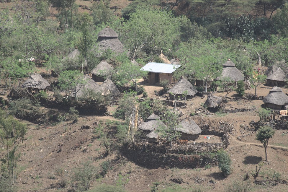
The Mursi live in Stone Age. They are a small tribe of less than 4,000 people who live between Jinka and the Omo river in a barren landscape. Their main villages are situated on a plateau surrounded by mountains, which does not lead to progress because of the remoteness.
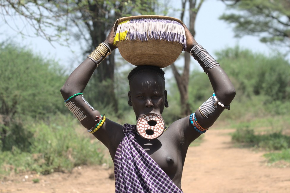
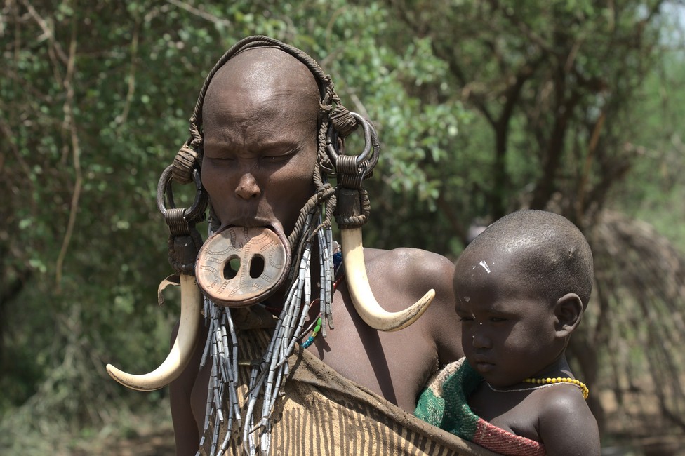
The Mursi are cattle farmers, utilized are mainly blood and milk.After the rainy season, they also have a little agriculture, especially on the banks of the Omo, after the high water has drained. The most striking feature of the Mursi woman is the unusual beauty clay plates, which they wear in the cut lips. Scarification and body painting are for beauty, not only for women but for men as well. In the Mursi there is still circumcision of girls and young women. It can be observed that the living conditions of the Mursi in the last 50 years have not changed. They live in the same inhospitable area, the housing situation has not changed, new are hand-operated water pumps and a police station was built. Sources of income have not been established. By decreasing density of wild animals hunting is difficult. There formerly common animals such as antelopes, oryx, zebras, ostriches, giraffes and buffalo are found only in small numbers.
The only income they have recently, is the entrance fee to their villages, and you must pay for each photo. If you want to negotiate fairly well, they very easy get aggressive. Unfortunately, these revenues are often converted into alcohol which means a huge problem in their villages.
Mursi tribe
The future of the Mursi is uncertain. Many questions arise to which there are no answers, or answers that are no solutions. The danger that they degenerate into living objects is high, the chance that they may retain their traditonal way of life is low. Due to the seclusion in which they live, these processes can be delayed but not stopped. Will Mago National Park be a living ethno museum? We do not know and can only hope the best for this ethnic group.
Despite many warnings we decide to go to the Mursi people, the plate lip people. It’s a pretty long distance and a very bad road, but we want to go there. But before we visit Nechisar National Park.
We leave the Rift Valley and turn onto a dirt road towards Arba Minch. Here again, life changes dramatically. In Africa, progress and development takes place only along paved roads. Once you get on a gravel road, people live back 100 years. Donkey carts and huts dominate the landscape. This has to do with the distances. On a paved road you need an hour for 100 kilometers on a bad gravel road a whole day. This inhibits the transport of goods and merchandise, and also the way to educational institutions are in fact unattainable.
rural Ethiopia
We drive along the lake Abaya and have only a few miles to Arba Minch. Since we cannot visit Nechisar National Park without 4×4, we join two Dutch couples and take a boat trip to the Nechisar National Park .
rural Ethiopia
With a minivan from Toyota, we go to the shore of the lake where the boat men wait for us. The Dutch are as well on their way to Cape Town. We have a lot of fun with the two couples, so the tour promises to be quite funny.
Nechisar National Park
The last few meters, we have to walk to the boat and the adventure begins here, because we need some kind of balancing over a wooden ladder that is just laid on the water. In each hand bags and backpacks, of course we get our feet wet, thank God there are no crocodiles around.
Nechisar National Park
Quickly we are sitting in the boat and off we go. The boat ride is nice, because the scenery is beautiful and the temperature on the lake is not too hot, the breeze of the wind cools a bit.
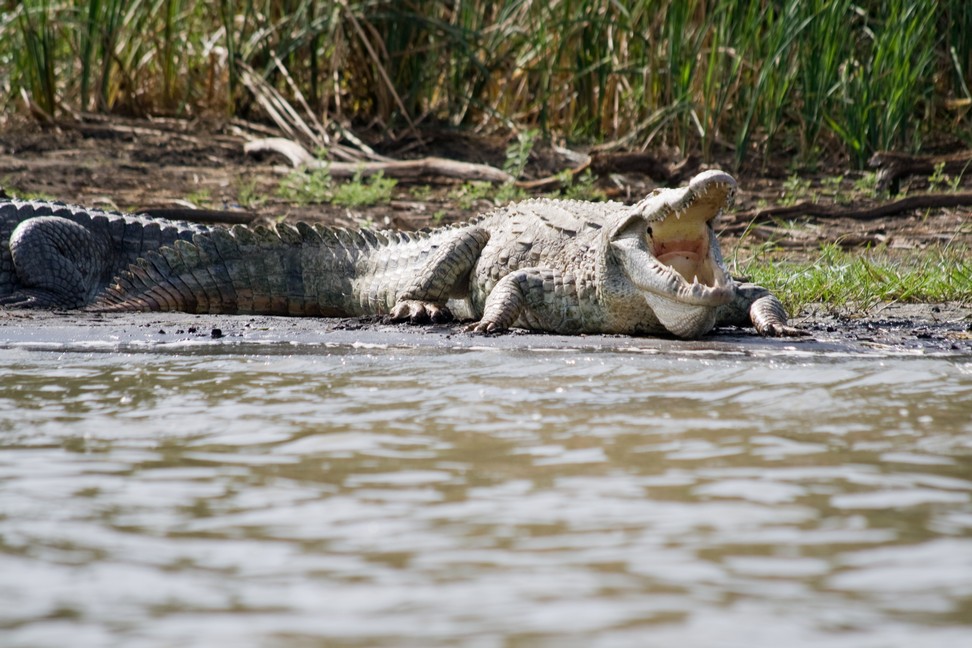
After just a short drive, we see the first crocodiles. Impressive are the huge animals. Up to five meters in length, they can grow,explains the boatmen.
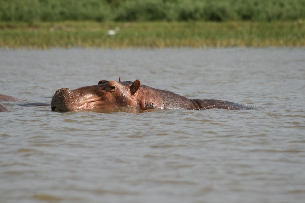
The boatsman sees hippos in the distance. We drive closer. Hippos are more dangerous than crocodiles for boats because if they feel disturbed, they sometimes attack a boat, dive under the boat and throw it over. There are frequent accidents with hippos report the locals.
Nechisar National Park
Also impressive is a pelican colony, but the waves get higher and the nutshell rocks pretty hard. We must return to shore.
The trip was shorter than planned, but was a great experience and the boatmen were very busy to show us a lot of animals. Again wet feet, the rest of the day we spend on the terrace of the campsite, which is connected to a hotel. From here we have a great view of the park.
Campsite
In Ethiopia, there is actually no camping, so it is customary, that hotels let their lawn for camping, usually you get the key for a room, so you can use the shower and toilet.
On a new bridge we cross over the Blue Nile and make the break after the bridge to enjoy the view of the Nile.
Blue Nile before Addis Ababa
The Blue Nile rises in the highlands of Ethiopia and during the rainy season from August to September delivers 68% of the Nile water. End of August the flood reaches Aswan and late September Cairo. During this period the White Nile, which originates in central Africa, provides very little water.
We have reached Addis Ababa, where we check in at Wim’s Holland House at the campsite. Wim is a popular meeting place for Overlanders and we also meet other long-distance travelers.
Like Michel and Laurence with their Land Rover, they are from Switzerland and started months earlier.
Wim is Dutch, and his wife Ethiopian, and together they run the restaurant and campground.
New are the two German motorcyclists Wolfgang and Sibille, who started with their motor bikes in Germany and go to Cape Town.
Blue Nile before Addis Ababa
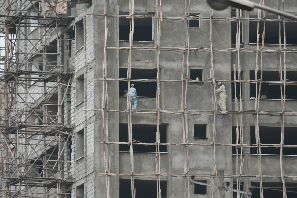
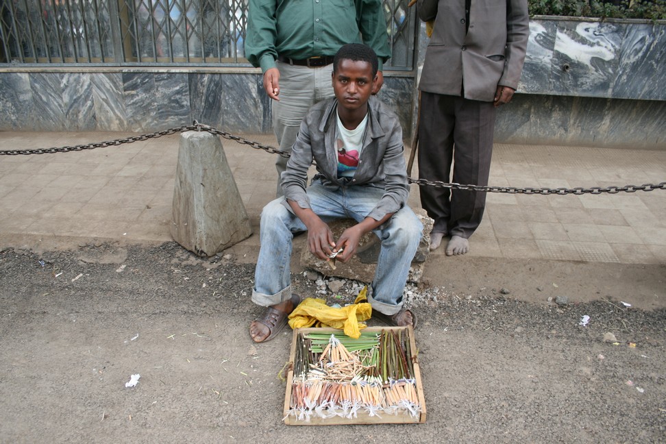
Addis Ababa is a loud city and construction sites are everywhere. Interesting is how they build it.
Addis Ababa Street seller
Lots of sellers try to find their luck and income in the streets of Addis Ababa. Also vegetables are sold in the streets in an unusual way.
Veggie Seller
Because we recognized that we will not make the trip to Cape Town in the scheduled time, my wife Alexandra reluctantly quit her job in Austria. Now we are free and no longer have the pressure, to be somewhere at a certain time. We drive to Lake Langano.
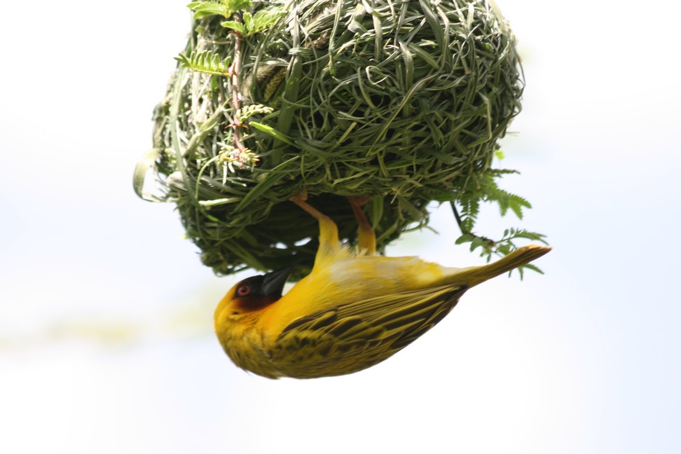
The weather gets dramatically worse, but we enjoy the ride anyway, because there are so many things to see along the road and now that we have time, we decide not to be stressed because of the weather.
weaver bird at Lake Langano
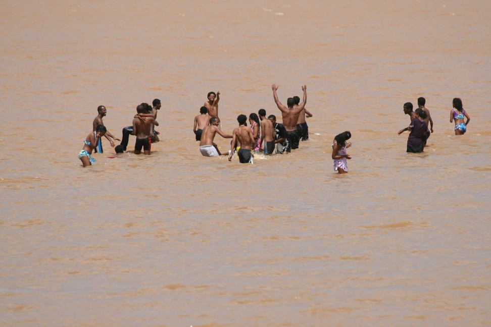
At Lake Langano we make a stop. Swimming in the lake is due to the high ash content, absolutely safe, there is no risk of schistosomiasis, and the water is really pink and feels very soapy.
Bathing in pink Lake Langano
Here we stay for a few days and relax. Alexandra uses the soapy water for washing clothes.
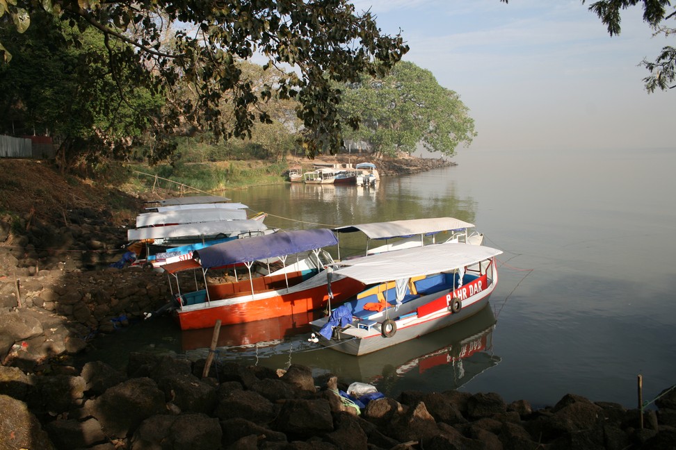
We organize a boat trip to the Lake Tana island monasteries. In the morning we leave. In a nutshell, with a very nice boat man and three other participants, we start to the first island.
Lake Tana Tour boats
Our first monastery is Entos Eyesu. It is a circular building with simple construction on a hill overlooking the lake. It is an active monastery, two monks live in the compound. Not at all monasteries women are allowed to enter.
Monk on the island
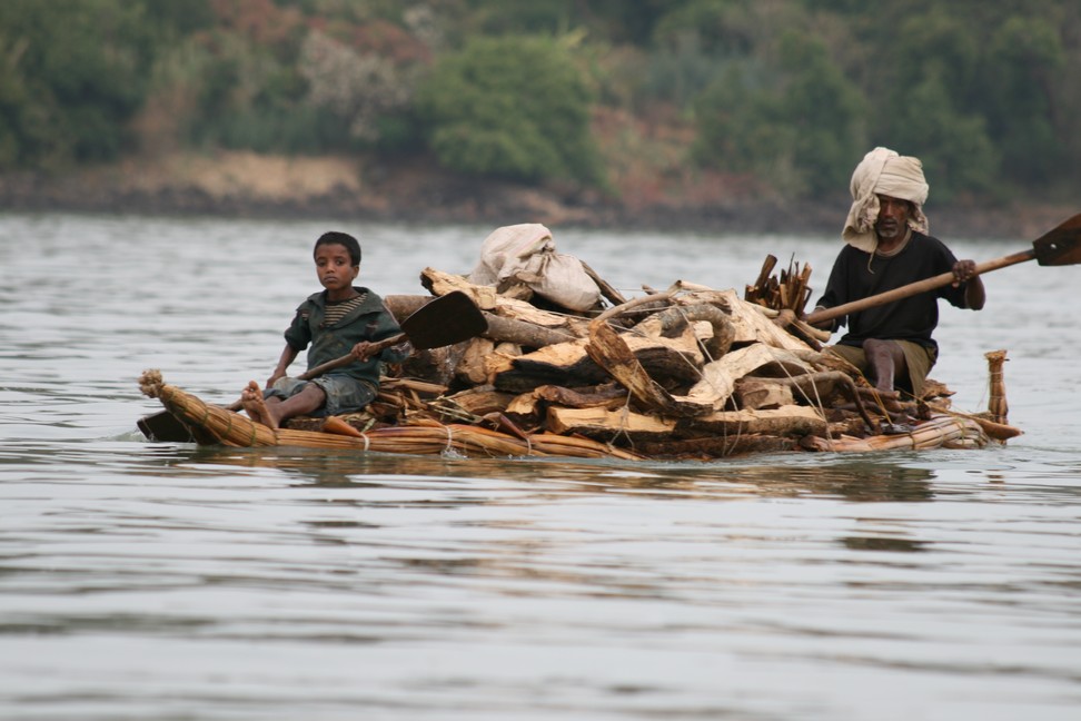
On the way at Lake Tana we see many Papyrus boats. The boats can be up to 10 meters long and are made of papyrus stalks, which are tied into bundles. The lines are obtained from the fig tree. After some time of usage it must be dried again. To date, a large part of all goods, such as wood are transported with such boats between the islands and the mainland. Supposedly, the boats can carry up to half a ton.
Papyrus Boat transporting fire wood
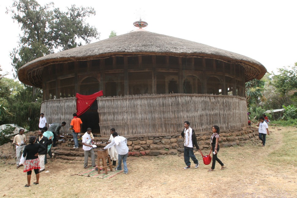
We land on the island monastery Zeghie. Actually a peninsula that is accessible only during the dry season over land. As more visitors come here, souvenir stalls have established. A simple building forms the entrance to the monastery area.
The monastery church is well attended. It is a simple wooden structure with grass roof, beams and wonderful structure which forms a covered porch.
Monastery at Lake Tana Island
The interior is rich with images. The paintings are mainly from the period before 1900. Very much alive here are the various saints and their legends from the Bible are painted, for example, the escape of the Israelites from Egypt.
Near the monastery district an ancient monk watches the monastery’s treasures. We marvel at the four silver crowns, a coronation robe and an ancient manuscript. We are surprised that these originals are not better protected.
We take some pictures, admiring the Kalashnikov and walk back to the jetty, where we wait for the others. Here we see the everyday life of Ethiopians. Fetching water from the lake despite Bilharzioses, which is carried in jars and cans for miles to their houses.
One monastery is still on our agenda. Dehre Maryam. The building can not assume that it was a famous monastery, in which even two councils were held. Despite its simplicity it pleases us.
We also marvel at one of the oldest manuscripts, the tetra Psalter with valuable illustrations, dated between 1360 and 1380.
Our day trip is over. In brisk ride we go back to Bahir Dar.
At the campsite we make ourselves more comfortable and in the morning we start to Addis Ababa, we must organize the yellow card insurance and want to get Kenya visa.
Lalibela is our next destination. The animals and humans have not yet adapted to the higher speeds on tar, therefore, extreme care is necessary while driving.
Traffic on the roads
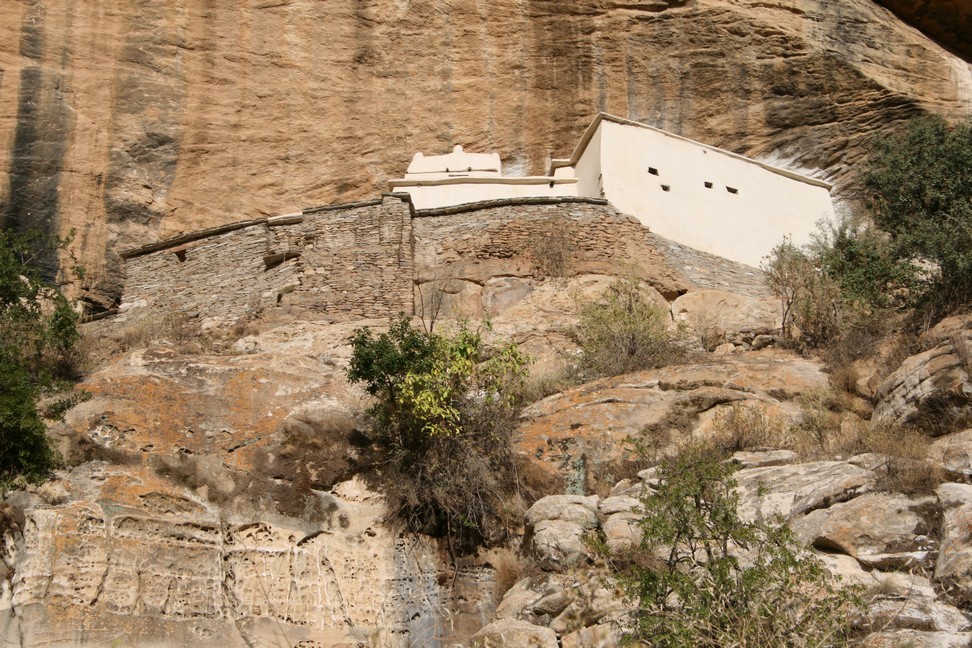
In the mountainous hinterland beyond Adigrat Bine and Bodo want to visit a rock monastery. Picturesque it is on the edge. As we can see the wooden stairs structure, we do not want to climb up any more but Bodo and Bine give it a try.
Monastery on the rock
From here our route runs just to the south, we want to get to Lalibela, but until there it is still two days to drive.
We find a place to sleep beside the road and quite a few children are here to observe us. My wife asks them a lot of questions which the boys do not like and they are leaving, which ensured a good night.
After the obligatory cup of coffee in the morning, we travel on.
The last 30 kilometers before Lalibela, we are already tired of the corrugated road and increase our speed to 70km/h because you do not feel the pumps at that speed and sail over the pumps but you have little control over the vehicle. Conclusion: I can hear our bearings.
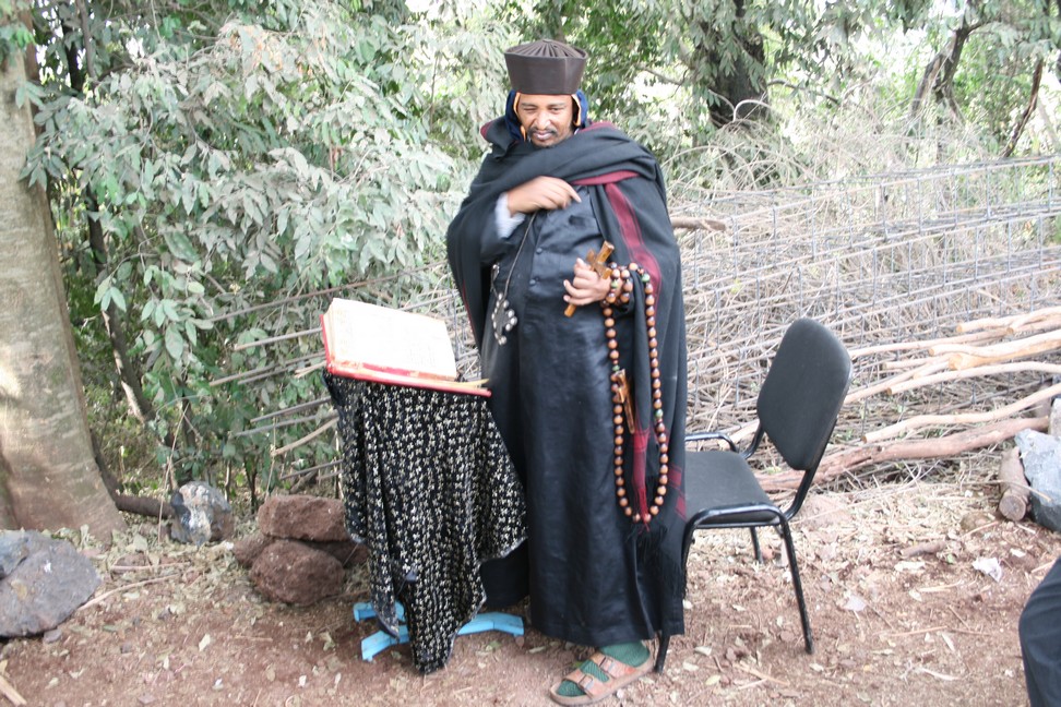
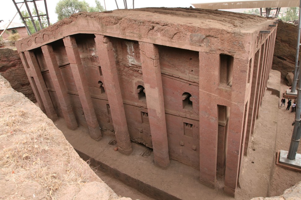
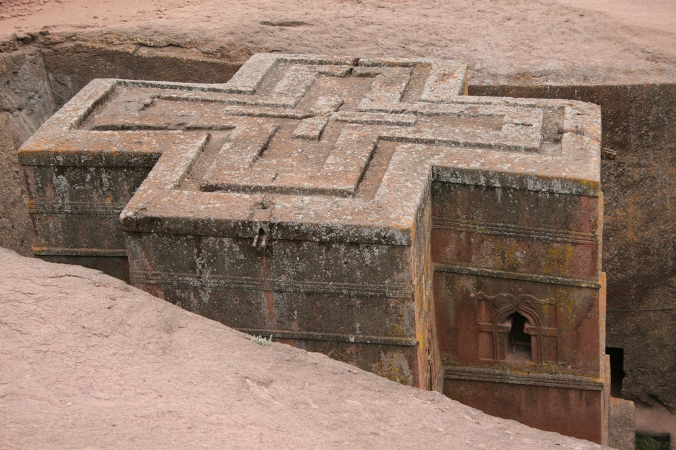
They belong to the last rock-hewn churches built in the 12th Century. These churches are rectangular layout, as opposed to churches built round the 16th Century. However, each of the 11 churches has its own character. King Lalibela had built the church into the red tuff, so the legend says. Angels have continued to be built them at night and accomplished so double the work performance.
Lalibela Monastery
More realistic is, that they had been built under several kings, among whom was a King Lalibela. It is still not entirely clear why there is this unique concentration of various rock buildings. Lalibela is a symbolic representation of Jerusalem. There is a place Golgotha, a grave of Adam, and a grave of Jesus.
Lalibela Monastery
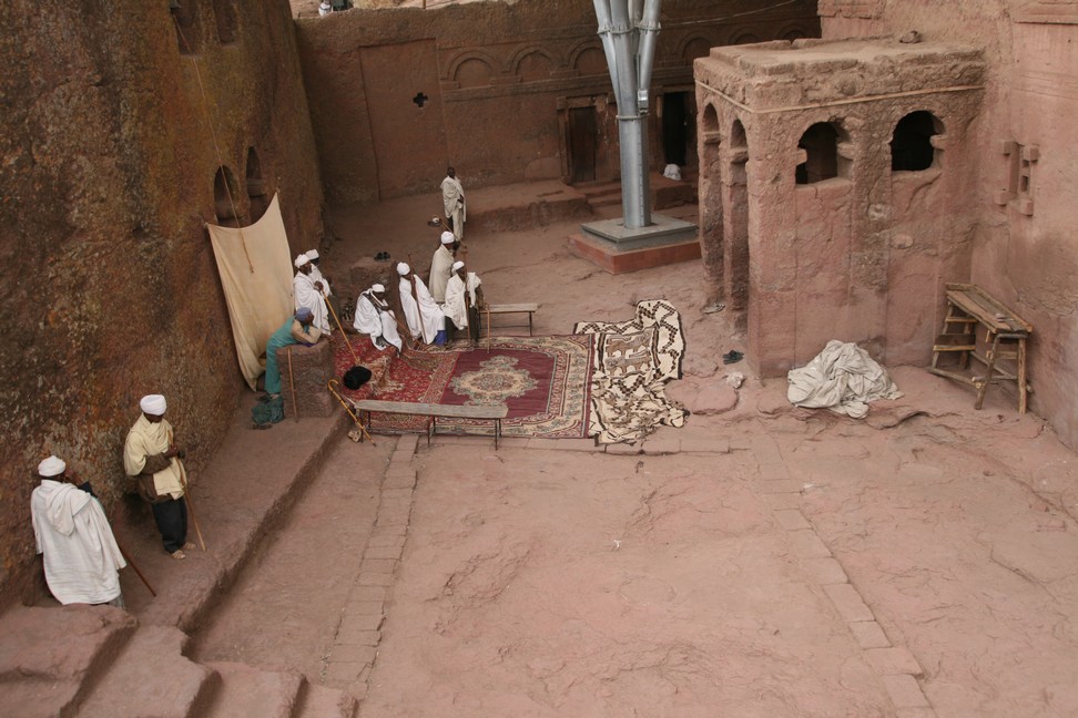
Although a fee must be paid for the entrance, Lalibela is not a museum but an active faith center, there are still active services held in front of believers and they speak their prayers and religious songs.
Unfortunately, this also is the place where we separate from Bine and Bodo after two months of traveling together. Bodo and Bine go a different route, it takes us to Bahir Dar on Lake Tana.
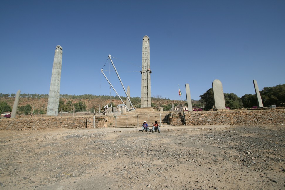
The fallen stela was already broken at the time of its construction. Stelae are markers of tombs. Over time they have developed into high-rise buildings decorated with entrance door and floors, similar to the houses as they are found in Yemen.
Axum Stelae
The major Aksum monuments in the town are the steles, which can be seen already from the distance. These obelisks date back 1,700 years and are for sure the identity of the Ethiopians. The bigger site is the Northern Stelae Parkwith the Great Stele reaching 33 metres in the heights and it is said that it has fallen and broken already during construction. The Obelisk of Axum was robbed by the Italian army in 1937, and returned to Ethiopia in 2005 and reerected in 2008. The 2nd tallest is the King Ezana’s Stele with 24 metres in height. Three other stelae are 18.2 m, 15.8 m and 15.3 m (50 ft) high. The stelae mark graves The Gudit Stelae to the west of town, unlike the northern area, are interspersed with mostly 4th century tombs.
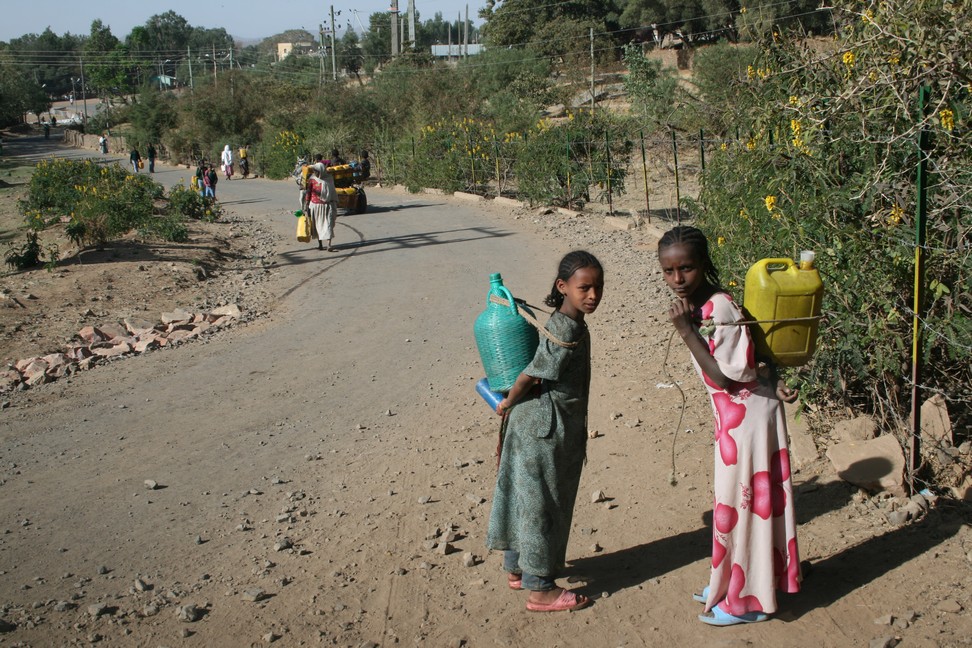
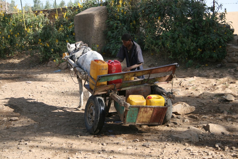
Axum – Kids collect water
We are more interested in the carts with the yellow and red tanks. They transport water from the river or pond, because there is no running water in the houses of Axum.
Public water transport
We leave Axum north from here there is brand new tarmac and it is a pleasure to glide through the beautiful landscape.
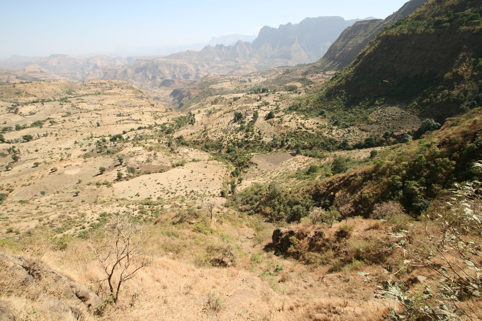
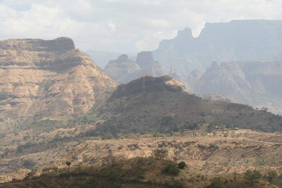
The Ethiopian highlands are of rugged beauty, sparsely populated, averaging over 2,000 meters above sea level. Only a few roads go from north to south, little traffic, therefore gravel roads, only maintained rarely.
Ethiopian Highlands Road
Ethiopia spends little money for infrastructure, mountain roads are expensive to maintain and build. We move forward slowly. We are heavily loaden, have spare diesel on board, and the slopes are difficult. For hours we meet no other vehicle.
We enjoy the scenery, enjoy the deep gorges and forget the effort it takes to travel here.
Ethiopian Highlands Road
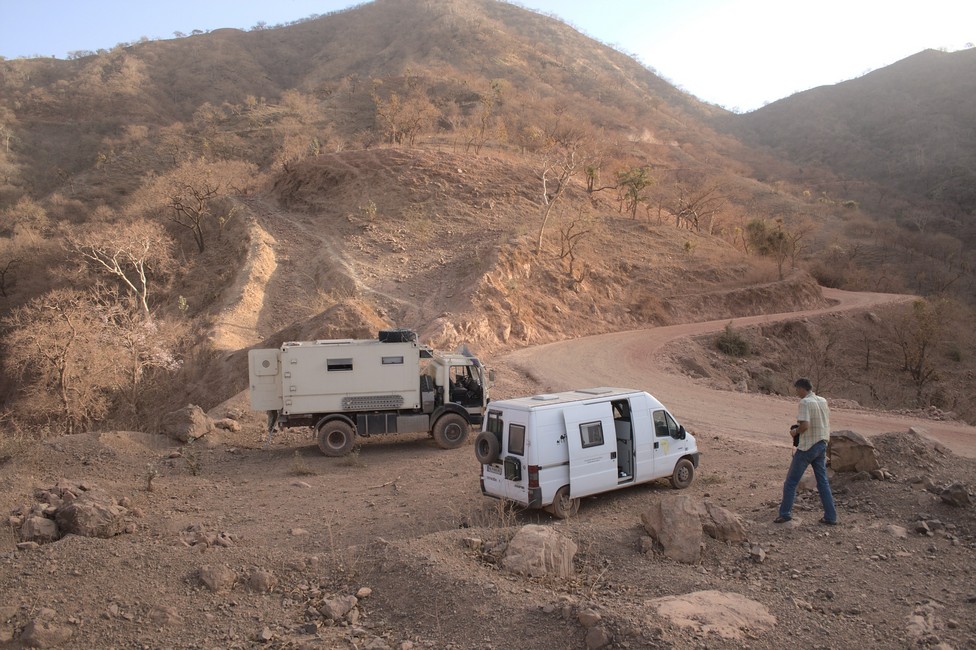
We are exhausted and take a coffee break. The entire transportation of goods to the north runs through this route. Truck drivers know the route and need two days from Gondar to Axum. We will take us four days.
Coffee Break
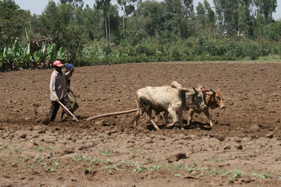
There are only a few villages in the north. The farmers live in scattered huts and plough the barren ground. They plant corn and other crops and keep cattle, but more frequently goats.
The northern highland is divided into broad plateaus characterized by table mountains and deep valleys. While the population in Europe has settled in highland valleys, here they inhabit the high plateaus. The valleys divide the land and prevent communication in many places. The valley sections north of Gondar are the borders between the provinces Begemder, Tigray and Simien.
As soon as we stop at the roadside, out of nowhere numerous children appear. They are usually shy at first, but curiosity wins and they get closer. Bodo shares his snack. The heads of the girls and boys are shaved to prevent lice and fleas, probably. Traditionally they wear floor-length dresses.
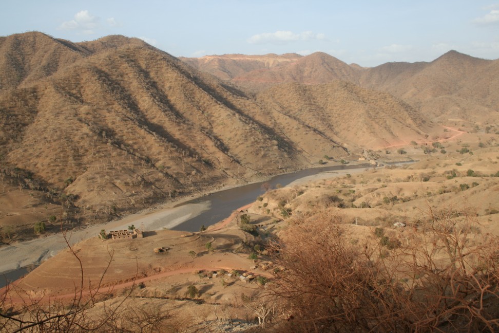
The red earth is for us like hell, because the fine dust gets in our vehicles and covers everything with a thick layer. It is already late afternoon and we are tired. We begin to look for a place to stay. The road winds down to the river Tekezze where we want to set up our camp.
Camp above the river
Early morning we scare up a camel, which can not decide which side it prefers to escape.
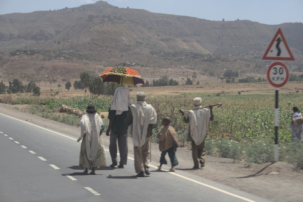
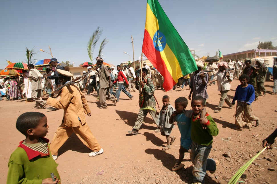
In a bigger village we find ourselves in a procession. It could be a national or religious holiday. We do not know, but the colorful umbrellas are beautiful to look at.
Political or religious we do not know
A detour. Road construction is in full process across the country. Above all, China is building the roads, in return for economic impact and the hedging of future markets for Chinese goods.
After some time we reach Axum and take a look at the columns.