Category Archives: Uncategorized

South Africa and back to Namibia – why? 115

But it comes different. We were denied entry to South Africa because our dog is supposed not to have the correct papers, The Import permit has expired and we have traveled through countries that would be extremely dangerous. We must return.

South Africa and back
Back to Oppi Koppi

We are already on the way back to the north and no longer understand the world. We think about what we could do. We decide to drive back to Kamanjab, because we know there folks, who may have an idea of how we get other papers for Tara.

South Africa and back
Back in Oppi Koppi

That means 1,300 kilometers back to Kamanjab. After three days we are again in Kamanjab on Oppi Koppi with Marianne and Vital.

Our old campsite spot is even available. We meet a couple, he a German, she a Mexican, they travelled from Mexico’s to South America to Africa and want to continue to Asia. They are already some years on the road.

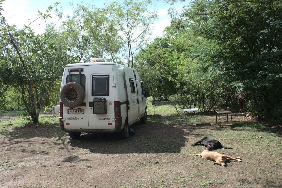
Elli wants to cook Mexican chili for us today. Hectic is on our picnic table. Ingredients are cut, vegetables cleaned and meat prepared.

To our pleasure, Traudl and Udo arrived with their ​​dog and their vintage truck. We met them during our last stay in Kamanjab.

Iwa, their dog goes straight under our camping table. Traudl and Udo are already retired and so-called winter birds, they spend the European winter in Africa, the rest of the year in Europe.

We all spend a wonderful evening together with red wine and chilli.

The next day is a school class performed a dance.

South Africa and back
Children singing at Oppi Koppi

On Oppi – Koppi Sundowner Donkey tour is offered by the owners Marianne and Vital. We want to see this. In the early evening the tour starts with a typical donkey cart, which is also used by the population, the Damara. The guides, Elias and Reynold, are employed at the Restcamp Oppi – Koppi. The income from the donkey ride will also directly benefit the employees, because it is a social project. Half of the money is withheld by Vital and saved. From that building material is purchased to build stone houses for the employees. Manpower and expertise is provided for free by Vital. Thus the employees are offered a better life, because they can give up their shanties and move in their own stone house.

South Africa and back
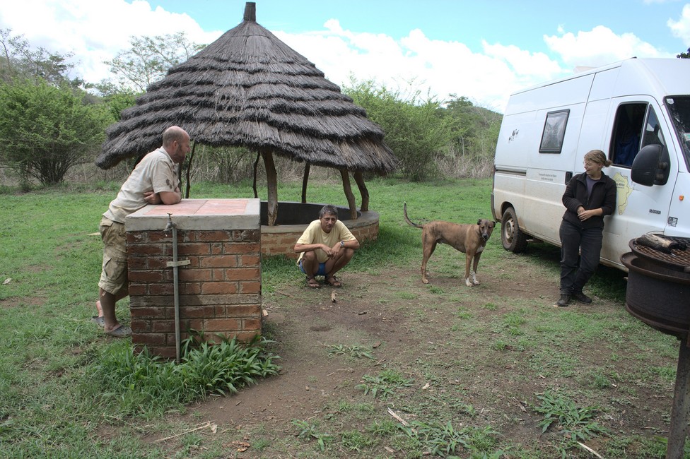
Vital and me

With the guests on the cart they drive through the residential area of ​​the Damara. They stop on a hill. The last few meters guests have to walk, because the path is too steep for the donkeys. Arriving at the hill cool drinks are served and guests can admire the magnificent view and picturesque sunset. Namibia receives little rain in this area, so the Donkey Tour is available all year round. After sunset, the tour continues. It goes to a local disco, where guests can immerse into the real Africa.

South Africa and back
We at Oppi Koppi

Here lives the black population of Kamanjab, mainly Damara and Herero. The living conditions are poor, but there is entertainment for people. With a cold beer, guests can mingle with the locals. It’s wonderful to watch the rhythmic dance of the black people. Later we return to the lodge where you can spend the evening at the bar. Vital and Marianne have created a great project and we hope for them that many guests book this interesting tour, which not only offers deep insight into the lifestyle of the population, but it still helps to improve the lives of local people.

complete Namibia overlanding guide

Previous

Next

Fish River Canyon 114

We leave Kolmanskop, because we go into the Fish River Canyon.

The wind whips the desert sand on the tarmac. Soon we reach fertile areas and the landscape becomes greener and greener. On good tgravel, it’s the last 70 kilometers to the canyon. We stop outside the park on a camp site so we can leave early tomorrow.

Fish River Canyon
Fish River Canyon Campsite

Even from the distance you can see the sharp-edged table mountains from which the canyon was formed.

Not by erosion, but by intrusion the broad valley came into existance through which the Fish River draws its tracks, but only the smaller portion of the canyon was formed by the river. After the Grand Canyon in the USA, the Fish River Canyon is the second largest in the world, but no less impressive.

Fish River Canyon
Canyon

It is 161 kilometers long and its depth varies between 450 to 550 meters. Until the origin of Earth’s evolution, one can watch. The steep embankments of dark rock emerged in the Precambrian. Two billion years ago, these layers were sandstone, shale and lava. By folding, pressure and heat they turned into meta morphous rock.This took place about a billion years before our era. The dark lines that run through the rock is cold magma originated 100 million years later. After a further 250 million years ago came the phase of erosion. A lake covered the whole of southern Namibia. At its base sediments were deposited. 500 million years ago there was a reduction in the Earth’s crust and the north-south valley was created by the collapse of the crust.

Fish River Canyon
Fish River Canyon

The incision through the Fish River was only in the Cenozoic about 50 million years ago.
Fish River Canyon
Fish River Canyon

Day trips in the canyon, even a partial descent are prohibited, as it always led to death casualities. Who wants to undertake the four-day walk, 85 kilometers, needs a very good condition. The hike can be made only in winter, the temperatures vary from 35 degrees to an impressive down to the freezing point. There are no cabins or camp sites and the hike will be notified in advance, per day maximum of 40 people are allowed in the canyon.

Fish River Canyon
Fish River Canyon

We are deeply impressed and continue, today we want to cross the border to South Africa. We inform Joachim and Tina in Cape Town that we will arrive in the coming days.

complete Namibia overlanding guide

Previous

Next

Tiras Mountains to Luderitz 113

We are back on the road. Our next stop will be the Tiras Mountains. They are on the edge of the Namib Desert and are characterized by bright red mountains and red dunes. On the plains the grass is silver and provides a good habitat for ostriches.

Tiras Mountains to Luderitz
Tiras Mountains

Again, we are overwhelmed by the tremendous scenery and can not believe, that there are such beautiful places on our planet.

We sit at the campsite and watch the changing of the light and no matter where we turn our heads, we see only great nature.

Tiras Mountains to Luderitz
Campsite Tiras Mountains

Tara also enjoys it and sometimes she sits and looks into the distance as if they had similar feelings and thoughts as we do.
We are back on the road.
Tiras Mountains to Luderitz
Road to Luderitz

The scenery changes from desert to grassland and again to desert until we arrive in Luderitz.

Tiras Mountains to Luderitz
Campsite Luderitz

We are in the courtyard of the hostel, and discover two Austrians, with their ancient Magirus Deutz truck. They are long-term travelers, but at the moment they alternately stay for six months in southern Africa and a half year in Austria.

Tiras Mountains to Luderitz
Magirus Deutz

They are funny people and we have a lot of fun with them.

We drive to Diaz Point. A stone cross erected by the Portuguese Bartolomeus Diaz when he landed here more than 500 years ago. A 1911-built wooden walkway leads up to the cross.

Tiras Mountains to Luderitz
Luderitz Diaz Point

For us it is just too cold here on the Atlantic and we hurry back to Lüderitz in the sheltered town.

From the Rock Church we have a good view over the bay of Luderitz.

Rock church Luderitz

1883 the area was bought by a German merchant Adolf Luderitz from a Nama captain. The background was guano fertilizer deposits. The German Emperor placed the territory under German protection, but this led to conflict with the British from the Cape, because those had annexed the territory.

Tiras Mountains to Luderitz
Overview Luderitz

There was never a really blossom in Lüderitz. In 1950 more and more people left the city.

Interesting is the former diamond town Kolmanskop. Founded by an ox-cart driver, soon August Stauch a railway official took over who was to monitor the train here.


In 1908, Mr. Lewala discovered diamonds here and Stauch immediately secured the mineral rights. Lewala worked for him and made him a millionaire with his knowledge.

Tiras Mountains to Luderitz
Kolmanskop

1956 ended the diamond rush, the last inhabitants left the place. Since then, the desert gets house by house.

Tiras Mountains to Luderitz
Kolmanskop

complete Namibia overlanding guide

Previous

Next

Sossusvlei 112

We are on our way to Sossusvlei.

Sossusvlei
Road to Soussusvlei

Alexandra is waiting with Tara in front of the gate because the dog is not allowed inside.

Sossusvlei
At the Gate. Our Dog Tara is not allowed in

So I have to go alone, but do not stay long because it’s all become very touristy.

Sossusvlei
Our Driver Tara can have a rest now

20 years ago there was not even a national park and you could move freely. That for natural beauty must be paid, should be reconsidered.

Sossusvlei
Sossusvlei Dune 45

The dunes are up to 225 meters high and are among the highest sand dunes in the world. The highest in China are up to 500 meters. Despite dissatisfaction with the fees I’m fascinated by the scenic beauty of the desert.

Sossusvlei
Sossusvlei Dunes

Sossusvlei is a famous and iconic destination located within the Namib Naukluft National Park in Namibia. It is a clay pan surrounded by towering sand dunes and is known for its stunning and surreal natural beauty.

Sossusvlei is situated in the Namib Desert. It is approximately 380 kilometers (236 miles) southwest of Windhoek, the capital city of Namibia.

Sossusvlei
Sossusvlei Dunes

The main attraction of Sossusvlei is its massive sand dunes, which are among the highest in the world. These dunes, often referred to as star dunes, reach heights of up to 300 meters (984 feet). The sand dunes are known for their vibrant colors, ranging from deep reds to golden hues, particularly during sunrise and sunset.

In addition to the towering dunes, Sossusvlei is famous for its dead camelthorn trees that stand in stark contrast to the surrounding landscape. These trees have been preserved due to the extremely dry conditions of the area and provide a dramatic and haunting backdrop for photography.

Sossusvlei

Sossusvlei itself is a clay pan that fills with water during rare and heavy rainfall events, although it is typically dry for the majority of the year. Nearby is Deadvlei, another clay pan famous for its white pan floor and the surreal sight of dead camelthorn trees set against the red dunes. The contrasting colors and textures make for a striking visual experience.

Climbing the dunes is a popular option, allowing you to witness breathtaking views from the top. Dune 45, named after its location 45 kilometers (28 miles) from the Sesriem Gate, is a popular dune to climb. Additionally, guided walks and nature drives are available, providing opportunities to learn about the desert’s ecology, flora, and fauna.

complete Namibia overlanding guide

Previous

Next

Namib Naukluft National Park 111

We leave Swakop, as it is called short, and soon find ourselves back in the desert, the Namib Naukluft National Park.

Namib Naukluft National Park

The scenery is magnificent and we take our time.

Namib Naukluft National Park

It is getting late and we check in at Rostock Ritz. Sounds good, but it is a simple camping amidst perfect scenery.

Namib Naukluft National Park

The driveway to the front desk is several kilometers long, as is the entrance to the campground. The price of one night corresponds with the name.

Namib Naukluft National Park
Rostock Ritz Campsite

But nothing helps, we camp quite nice and there is hot water.

In the evening we read more about Namib Naukluft National Park. It is one of the largest national parks in Africa. It covers an area of about 49,768 square kilometers (19,216 square miles) and encompasses parts of both the Namib Desert, one of the oldest deserts in the world, and the Naukluft Mountain Range.

Some of the highlights:

Sesriem Canyon: This natural gorge was formed by the Tsauchab River and is located near the park’s entrance. Visitors can walk along the canyon, which features unique rock formations and allows for a closer look at the area’s geology.

Namib-Naukluft National Park encompasses a significant portion of the Namib Desert, which is considered one of the oldest deserts on Earth. The desert’s unique ecosystem supports a variety of plant and animal life that have adapted to survive in the arid conditions.

The Naukluft Mountain Range runs through the park and offers a striking contrast to the desert landscape. The mountains provide opportunities for hiking, scenic drives, and exploring rugged terrain.

Despite the harsh desert conditions, Namib-Naukluft National Park is home to a surprising array of wildlife. Visitors may spot oryx, springbok, zebra, jackals, and a variety of bird species. The park is also known for its smaller desert-adapted creatures like lizards and insects.

The next day we still drive through the National Park but our destination is Sossusvlei.

We get as close as possible to the dunes to stay overnight at a nice campsite to start early in the morning into the dunes.

Namib Naukluft National Park
Campsite in Namib Naukluft NP
Namib Naukluft National Park

complete Namibia overlanding guide

Previous

Next

Swakopmund 110

We leave Spitzkoppe and go on nice tar road through desert-like landscape to Swakopmund. We do not stay long and only do a little sightseeing.

Swakopmund
Swakopmund Pier

The pier was built in 1911 in the German tradition. On the jetty, as it is called, there are walkers and anglers. 1884 South West Africa as Namibia was then called, became a German colony and in 1892 Swakopmund was born, because they needed a port to transport the minerals to Germany. The city looks more like a small German town than an African city, it could also be on the Baltic or North Sea in Europe.

Swakopmund
Swakopmund Beach

The former train station built in the Wilhelmine style, is now a luxury hotel. It was built in 1901, but soon ran out of money and was completed through a cash donation of a German privateer.

Swakopmund
typical house

It is certainly one of the finest railway buildings of its time.

Swakopmund
famous lighthouse

Swakopmund Facts:

Swakopmund is a coastal town in Namibia, located on the western coast of the country. It is situated about 352 kilometers (219 miles) west of the capital city, Windhoek. Swakopmund is a popular tourist destination known for its German colonial architecture, beautiful beaches, and outdoor activities.

Here are some key features and attractions of Swakopmund:

  1. German Influence: Swakopmund showcases its rich German colonial history through its architecture, with many buildings reflecting a distinct German style. The town has a unique blend of African and European cultures.
  2. Beaches: Swakopmund is famous for its scenic beaches along the Atlantic Ocean. The coastline offers opportunities for sunbathing, leisurely walks, and water sports such as swimming, surfing, and kiteboarding.
  3. Adventure Activities: The town is a hub for adventure seekers. Visitors can enjoy activities like quad biking, sandboarding, skydiving, dune buggy rides, and camel riding in the nearby Namib Desert. Swakopmund is often referred to as the adventure capital of Namibia.
  4. Swakopmund Museum: The Swakopmund Museum provides insights into the history, culture, and natural heritage of the region. It houses exhibits on Namibian fauna, indigenous peoples, colonial history, and geology.
  5. Kristall Galerie: This unique gallery is dedicated to minerals and gemstones found in Namibia and the surrounding region. It displays a wide variety of exquisite crystals and gemstones, including quartz, tourmaline, and amethyst.
  6. National Marine Aquarium: Located on the beachfront, the National Marine Aquarium showcases the diverse marine life found along the Namibian coast. Visitors can observe various species of fish, sharks, turtles, and other marine creatures.
  7. Swakopmund Jetty: The iconic Swakopmund Jetty stretches out into the ocean, offering panoramic views of the coastline and serving as a popular spot for strolling, fishing, and enjoying the sunset.
  8. Shopping and Dining: It boasts a range of shops, boutiques, and craft markets where visitors can find unique souvenirs, local artwork, and handcrafted jewelry. The town also offers a wide selection of restaurants, cafes, and bars serving a variety of cuisines.
  9. Day Trips: It serves as a gateway to many exciting day trip destinations. Visitors can explore the nearby Namib-Naukluft National Park, home to the famous Sossusvlei and Deadvlei desert landscapes, or embark on a boat tour to see seals, dolphins, and marine bird colonies along the coast.
Swakopmund
railway station

Swakopmund’s mild coastal climate, picturesque surroundings, and range of activities make it a popular vacation spot for both locals and international tourists.

complete Namibia overlanding guide

Previous

Next

Spitzkoppe – adventurous to get there 109

The next morning we cross the river bed and drive on, leaving Twyvelfontein. Stopping on the lonely road to catch a view of the Brandberg, a mountain range. We are on the road to Spitzkoppe, a rock formation that we necessarily want to see. Initially, the road is well, then it means crossing a river. Through the river there is a concrete foundation, so no problem. Water is not much in the river. But it comes really bad. The river has washed away the concrete at the end and left a sharp edge , without four-wheel we need momentum, so I push the gas pedal. Done, but it was close. We would not want to get stuck in the river. So what is the lection: Never ever cross a river without walking through before you drive. Theoretically, but hardly anybody does.

Spitzkoppe
Spitzkoppe already in sight

Hardly overcome the shock, there already come the hills of Spitzkoppe in sight. We have to drive fast, because our cooling fan has failed and the engine gets too hot when we have too little airflow for cooling. With the last strength, we make it to the entrance of the camp. Now let it cool first.

When crossing the river the cooling fan motor got a lot of mud, cleaned up quickly, it worked again.

Spitzkoppe
Spitzkoppe Campsite

We are looking a bit and drive around, find a perfect camp spot at a rock.

Spitzkoppe
Spitzkoppe

The mountains were formed by intrusion 200 million years ago when magma penetrated into the older rock layers. Wind and weather have eroded the less resistant rocks over millions of years, exposing the granite core. That there is an amazing amount of plant and animal life, is due to the special water conditions, because the clouds rain down more frequently than in the lowlands. The rain collects in underground reservoirs formed from rock crevices where water is used for weeks afterwards as a breeding ground.

Spitzkoppe
Spitzkoppe

complete Namibia overlanding guide

Previous

Next

Twyfelfontein 108

After we left Petrified Forest Khorixas, we drive a little further to Twyfelfontein. A World Heritage Site by Unesco.

Twyfelfontein
Twyfelfontein Road

With a guide, we entered the site. The rock arena is ideally situated slightly increased between protecting hillsides and panoramic views across the savannah.

Twyfelfontein
Remains of the Farm House

The farm house of the former owner. “Dubious Well,” called the farmer his land, because the well bubbles only irregular.

Twyfelfontein
Rock Engravings

The tour around the area takes about an hour and early morning or late afternoon should be best because of the heat.

Twyfelfontein
Rock Engravings

Whether the art that is carved into the rock is derived from the San or the Damara is not known. The San people, of whom one knows that they had 100 years ago rock carvings, showing human and animal figures , but today they have no relation to the rock art and their legends say that the images are made by gods.

Twyfelfontein
Twyvelfountain

With quartz stones the engravings were carved into the sandstone. Under overhangs are actually even paintings. All kinds of animals such as lions, elephants, giraffes and rhinos are shown. In between abstract patterns.

About the motive of the representations, science knows nothing. It could be works of hunters in order to summon hunting success. A date is hardly feasible, because tools found here are from the Neolithic period, to associate the images to this period is impossible. The surface of the sandstone does not tell anything about about age, either because the environmental conditions are unpredictable here. Probably the images are between several thousand years and a few hundred years old.

We enjoy the tranquility of this mystic place in Twyfelfontein. and the beautiful landscape in which people left their works of art. But we need to continue and set up camp at the nearby campsite.

The campsite is on the dry riverbed of the Huab River, which only leads periodically water.

Twyfelfontein
Our van at the right at the river bed

Occasionally elephants are sighted, we have no luck.

complete Namibia overlanding guide

Previous

Next

Petrified Forest Khorixas 107

We go on the “pad” to the petrified forest near Khorixas, which means something like street. We left Kamanjab most likely for ever. The scenery is wonderful and we come to Khorixas, where we camp and accidentally meet a couple with a Land Rover, that we had met months earlier in Nairobi. Africa is small.

The gravel roads are perfect in Namibia. Exemplary maintained and they, therefore, allow very high speeds, which ensures a fast progress. So we are also quick at petrified Forest.

Petrified Forest Khorixas
petrified forest Khorixas

With a guide, we wander through the site. The partially completely preserved petrified trunks of a primeval forest are distributed in the landscape. They grew 300 million years ago, but not here. It is believed that they were transported by rivers. Fossilization takes place under air. The trunks were covered with sand, thus they could not rot.

Petrified Forest Khorixas
petrified forest Khorixas

Then acid water penetrated into the cells of the wood and thus layer by layer became stone. Good to recognize are the annual rings. Between the trunks grows Welwitschia, a wonderful place,when it is noon, however, it gets very hot.

Petrified Forest Khorixas
petrified forest Khorixas

It is a popular tourist destination located in the Kunene Region of Namibia, Africa. It is a vast area of land that contains ancient trees that have been turned to stone, estimated to be around 280 million years old. The Petrified Forest is believed to have formed during the Permian period when the area was covered by a vast forest. The trees were gradually buried under layers of sediment and over time, the organic matter was replaced by minerals, resulting in the petrification of the trees.

Petrified Forest Khorixas
petrified forest Khorixas

Today, visitors can see the petrified tree trunks and stumps that have been exposed by erosion. The trees are now made of stone, but their original shapes and textures can still be seen. Some of the trees are up to 30 meters in length and several meters in diameter.

In addition to the petrified trees, the area is also home to a variety of wildlife, including baboons, kudus, and various species of birds. It is a unique and fascinating natural wonder that offers visitors a glimpse into the ancient past of the Earth.

complete Namibia overlanding guide

Previous

Next

Porcupines at Kamanjab in Namibia 106

After New Year, we move on and go through the Caprivi passing Grootfonein to Kamanjab, where we check in at Vital and Marianne the owners of Oppi – Koppi Restcamp.

oppi koppi
Oppi Koppi Rest Camp at Vital and Marianne

The site is idyllic and the owners are nice people. What we do not yet know that we will spend almost a year here.

After a couple of days our friends who we were traveling with from Kenya to Uganda Stephen and Steffi arrive at Oppi Koppi. They wanted to find work in South Africa but could not find, so they started working at Oppi Koppi.

Steffi and Stephen
Steffi and Stephen
Porcupines
Camping at Oppi Koppi

At the campsite we discover a chameleon. Suspicious, it turns its eyes in all directions. The coloring is adjusted to the background, but not only that, but the mood of the animal can be read from the color.

oppi koppi
Cameleon at Oppi Koppi

On Oppi – Koppi, we get acquainted with the German-Namibian Kathrin who runs the Porcupine Camp near to Kamanjab. We go to visit her.

Porcupines
Kathrin at Porcupines Lodge

The rest camp is situated in beautiful countryside. The lodge is simple,with tents and has a campground. The specialty here are porcupines that live in the wild, but at night if they want, go in for a snack. We want to see this, of course.

Porcupines
Campsite at Porcupines Lodge

Kathrin tells us much about their socalled children, as she calls the animals. She shows us the different species of stings which these pretty animals have on their backs. We sit with her with coffee and cake, and quite forget how fast time goes by. It has become dim and Kathrin has quickly spread the food and turned on the radio, because they are used. Now we have to wait.

Once it is dark the first porcupines appear.

Porcupines
Porcupines

They look cute and are surprisingly not very shy. Kathrin must provide more food, because they have huge appetite today.

It does not take long and there are several at the feeding station. They are surprisingly large. We thought they were much smaller.

When there is food, there is ranking and they fight a bit to get the largest portion, which produces a rattling noise.

It was a nice evening, but we say goodbye to Kathrin and say goodbye to Marianne and Vital, we do not yet know that we have been back here in two weeks. We go on the “pad”, which means something like street.

complete Namibia overlanding guide

Previous

Next