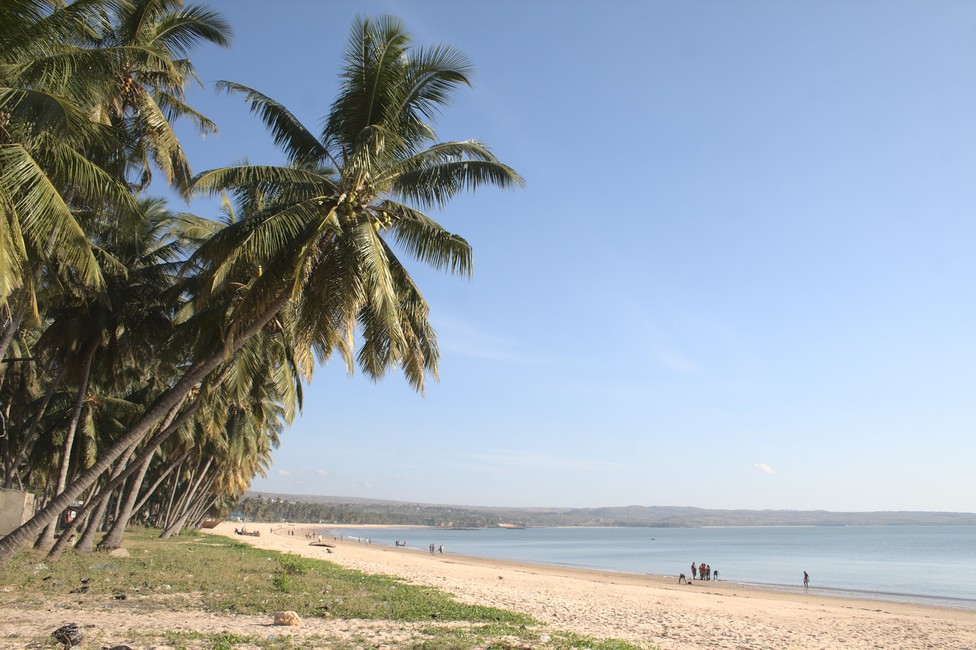
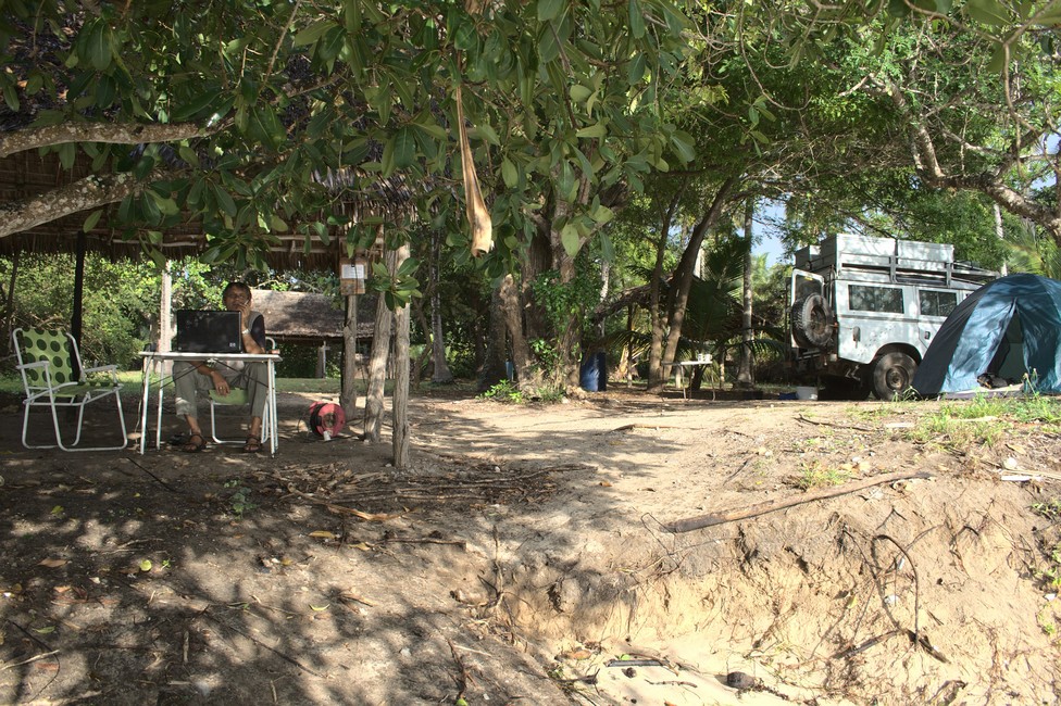
December 18, 2012 Christine and Martin arrived unexpectedly. Suddenly, they were standing next to the car. We hadn’t expected them yet. We had only agreed to meet at Tiwi Beach and then continue our journey together. The days passed quickly, and we had a lot of fun with the two of them. We spent Christmas together. Martin tried to prepare a good Christmas menu. For this purpose, he ordered lobster from the fishermen. However, no one wanted to kill the lobster. Lobsters are thrown into hot water to be eaten. So Martin canceled the lobster order because we were all against it. As an alternative, we had pasta with sauce and a delicious dessert for dessert.
December 30, 2012 We learned that there would be a huge celebration in Tiwi Beach for New Year’s Eve. Up to 2500 people are expected at the campsite. It sounded like mega stress, so we decided to leave Tiwi Beach. After a stop in Mombasa to do some shopping at Nakumatt, we headed to Kilifi. There, we camped in the wild. We could stand there undisturbed and greatly enjoyed the wild nature.
December 31, 2012 We had to go shopping for New Year’s Eve, so we drove the 30 kilometers back to Kilifi to buy fillet from the butcher. We were planning to have fillet with fried potatoes. We spent New Year’s Eve on a hill in Kilifi with a view of the sea in a lodge. Alex prepared the fillet and fried potatoes, but the two of them didn’t want to eat. Christine went to bed as she had a headache, and Martin went with her. So we cooked the New Year’s Eve meal alone. When we started eating, Martin joined us after all because he was hungry, and he ate the New Year’s Eve meal with us. Soon, New Year’s Eve was over for us, and we all went to bed relatively early.
January 1, 2013 Later in the morning, we headed towards Malindi. On the way, we ran out of gas. We initially thought it was a carburetor problem, but it soon became apparent that we simply had too little gas in the tank. Martin and I went to the nearest gas station to get gasoline. Finally, we reached Malindi and camped by the sea.
January 2, 2012 The next morning, we moved to the Malindi Campsite, and Martin and Christine arrived in the evening.
January 5, 2012 Martin and Christine flew to Lamu for four days, and in the meantime, we looked after their dog, Momo. She enjoyed the evening barbecues with us; she is a well-behaved dog. Momo eats everything with us, which can’t be said for Kristin. She’s a bit picky when it comes to food.
January 10, 2012 In the morning, the mechanic came and installed a new gasket between the exhaust. Then we got a new tent because the old one had apparently been destroyed by the night guards while we were shopping. Priscilla felt very sorry about it. She is the owner of the camp. Meanwhile, Christine and Martin had returned from their trip to Lamu. We planned to continue our journey the next day.
Best time to visit: November–February Difficulty: 3.5/5 Road conditions: Mixed paved highways, rough rural roads, seasonal challenges in remote areas Visa situation: eVisa available for many travelers; vehicle paperwork required
Why Overland Benin?
Benin is one of West Africa’s most approachable overlanding destinations.
Often overshadowed by larger neighbors, Benin offers a surprisingly rewarding mix of manageable road travel, rich culture, wildlife, and Atlantic coastline access.
Why it stands out:
relatively accessible West African overlanding
fascinating cultural heritage
voodoo history and traditions
wildlife in Pendjari
Atlantic beaches
easier logistics than some neighboring routes
authentic regional travel atmosphere
Benin works particularly well for travelers crossing West Africa who want a destination that combines cultural depth with practical overlanding.
One day you can be exploring historic Ouidah, the next driving north through rural landscapes toward safari country near Pendjari National Park.
Main Overlanding Routes
1. South Benin Cultural Route
8
Route: Cotonou – Ouidah – Grand Popo – Porto-Novo Distance: approx. 200–350 km Road type: mostly paved Fuel: easy availability
Here are 12 hidden places in Europe most tourists don’t know about—beautiful destinations that are often overshadowed by famous cities like Paris, Rome, or Barcelona. If you enjoy discovering quiet, authentic, and scenic locations, these spots are amazing. 🌍✨
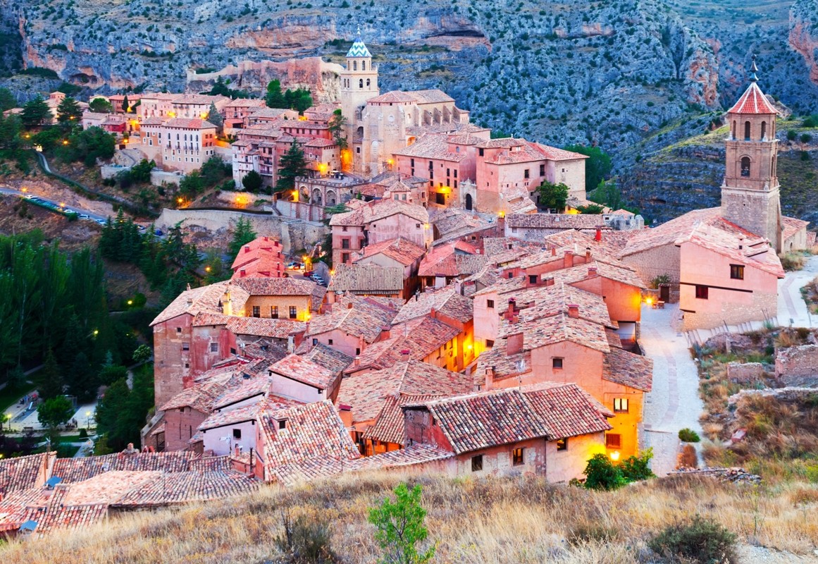
1. Albarracín, Spain
4
Hidden in the mountains of the region of Aragon, Albarracín looks like a medieval fairytale.
Why visit
Pink-colored medieval houses
Ancient defensive walls
One of Spain’s most beautiful historic villages
2. Hallstatt Skywalk & Obertraun Area, Austria
4
Most visitors rush through Hallstatt, but the surrounding region like Obertraun and the Skywalk viewpoint offers breathtaking views of the Dachstein Alps.
Why visit
Stunning alpine panoramas
Salt mine history
Peaceful lakeside trails
3. Giethoorn, Netherlands
4
Often called the “Dutch Venice,” Giethoorn has no roads in its center—only canals and wooden bridges.
Why visit
Boat-only transportation
Charming thatched-roof cottages
Extremely peaceful atmosphere
4. Kotor Old Town, Montenegro
4
Kotor is tucked inside the dramatic Bay of Kotor and surrounded by mountains.
Why visit
Venetian-style architecture
Epic fortress hike
Adriatic fjord-like scenery
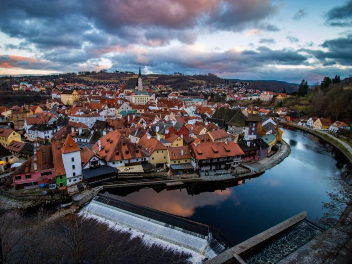
5. Český Krumlov, Czech Republic
4
This magical town in South Bohemian Region looks like a miniature Prague.
Why visit
Massive Renaissance castle
Fairytale streets
Scenic river curves
6. Dinant, Belgium
4
Dinant sits dramatically between cliffs and the Meuse River.
Why visit
Cliffside citadel views
Saxophone-themed art (birthplace of Adolphe Sax)
Gorgeous river scenery
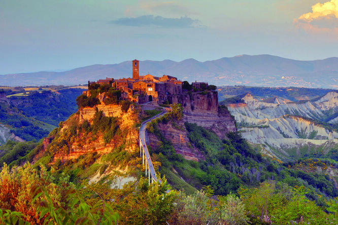
7. Civita di Bagnoregio, Italy
4
Known as “The Dying City,” Civita di Bagnoregio sits on a crumbling volcanic hill.
Why visit
One of Italy’s most unique towns
Access via a long pedestrian bridge
Incredible sunset views
8. Lake Bled’s Hidden Gorge, Slovenia
4
Just near Lake Bled lies the underrated Vintgar Gorge.
Why visit
Emerald river canyon
Wooden walkway trails
Waterfalls and rapids
9. Colmar, France
4
Located in Alsace, Colmar is one of Europe’s most colorful towns.
Why visit
Half-timbered houses
Flower-lined canals
Amazing Christmas markets
10. Ronda, Spain
4
Ronda sits above a dramatic gorge called El Tajo Gorge.
Why visit
The spectacular Puente Nuevo bridge
Dramatic canyon landscapes
Authentic Andalusian culture
11. Faroe Islands Villages
4
The remote Faroe Islands are one of Europe’s least visited but most dramatic landscapes.
Why visit
Grass-roof villages
Wild cliffs and waterfalls
Incredible photography spots
12. Meteora Monasteries Area, Greece
4
In central Greece, Meteora features monasteries built on towering rock pillars.
Why visit
One of Europe’s most surreal landscapes
UNESCO World Heritage site
Epic sunrise and sunset views
✅ Quick Tip: Many of these places are best visited early morning or off-season to avoid crowds.
Driving from Europe to Africa is one of the most exciting overland adventures. With proper preparation, you can travel thousands of kilometers across deserts, mountains, and diverse cultures. This guide explains the main steps to plan a successful Europe-to-Africa overland trip.
1. Choose Your Route
The first decision is where you will enter Africa. There are two main options.
Spain → Morocco (Most Common)
Ferry routes:
Algeciras → Tangier Med
Tarifa → Tangier Ville
Travel time: about 1–2 hours.
Advantages:
cheapest crossing
frequent ferries
Morocco is very overlander-friendly.
Italy → Tunisia
Ferry route:
Palermo (Sicily) → Tunis
Travel time: about 10–12 hours.
Advantages:
quieter entry point
easy access to the Sahara
good starting point for North Africa.
2. Decide How Far You Want to Travel
Africa is enormous, so decide early how long and how far you want to go.
Common overland routes:
North Africa Explorer
Morocco → Western Sahara → Mauritania → Senegal
Good for shorter trips (1–3 months).
East Africa Route
Egypt → Sudan → Ethiopia → Kenya → Tanzania
A classic expedition route.
Cairo to Cape Town
One of the world’s most famous overland journeys:
Egypt → Sudan → Ethiopia → Kenya → Tanzania → Zambia → Botswana → South Africa
This route can take 6–12 months.
3. Choose the Right Vehicle
Your vehicle is the heart of an overland trip.
Popular choices:
4×4 Vehicles
Examples:
Toyota Land Cruiser
Toyota Hilux
Land Rover Defender
Advantages:
reliable
strong suspension
excellent for rough roads.
Camper Vans
Advantages:
comfortable living space
good for paved routes
ideal for long trips.
Motorcycles
Many travelers cross Africa by motorcycle.
Advantages:
low fuel consumption
easier border crossings.
4. Prepare Important Documents
Border crossings require proper paperwork.
Essential documents include:
Passport
Valid for at least 6 months.
Visas
Many African countries require visas. Some can be obtained at borders.
Vehicle registration
Original registration documents are required.
Carnet de Passage
Some countries require this vehicle import document.
Common countries requiring it include:
Egypt
Kenya
Tanzania
International Driving Permit
Useful for police checks.
5. Plan Your Budget
Costs vary widely depending on your travel style.
Typical monthly costs for two people:
fuel: €300–€700
food: €200–€400
campsites: €100–€300
visas and borders: €200+
Estimated monthly budget:
€800–€1,500
Repairs or unexpected costs can increase this.
6. Pack the Right Equipment
Good preparation prevents many problems.
Essential gear:
Navigation
GPS device
offline maps
paper maps.
Recovery gear
recovery boards
tow straps
shovel.
Camping equipment
roof tent or ground tent
cooking equipment
water containers.
Safety equipment
first aid kit
satellite communicator
fire extinguisher.
7. Research Border Crossings
Border crossings in Africa can be slow and confusing.
Tips:
arrive early in the day
carry multiple passport copies
remain patient and polite
expect several checkpoints.
Reading recent traveler reports can help.
8. Learn Basic Safety Tips
Africa is generally welcoming, but preparation is important.
Key tips:
avoid driving at night
watch road conditions
secure valuables
respect local customs.
Local advice from other travelers is extremely helpful.
9. Plan Your Timeline
Africa travel takes longer than expected.
Examples:
Europe → Morocco: 1 week
North Africa: 3–6 weeks
Cairo → Cape Town: 6–12 months
Allow flexibility because borders, weather, or vehicle issues may cause delays.
10. Stay Flexible and Enjoy the Journey
Overlanding is about freedom and exploration.
Some of the best experiences happen when you:
change plans
take smaller roads
stay longer in interesting places.
Africa offers incredible landscapes, wildlife, and cultures that make the journey unforgettable.
Sudanese cemeteries are not merely resting places for the deceased but are repositories of the nation’s rich history, diverse culture, and religious traditions. With a history that spans millennia, Sudan’s cemeteries hold profound significance, reflecting the tapestry of its various ethnic, religious, and cultural influences. This essay explores Sudanese cemeteries, their historical roots, their connection to religious practices, and their role in preserving Sudan’s unique heritage.
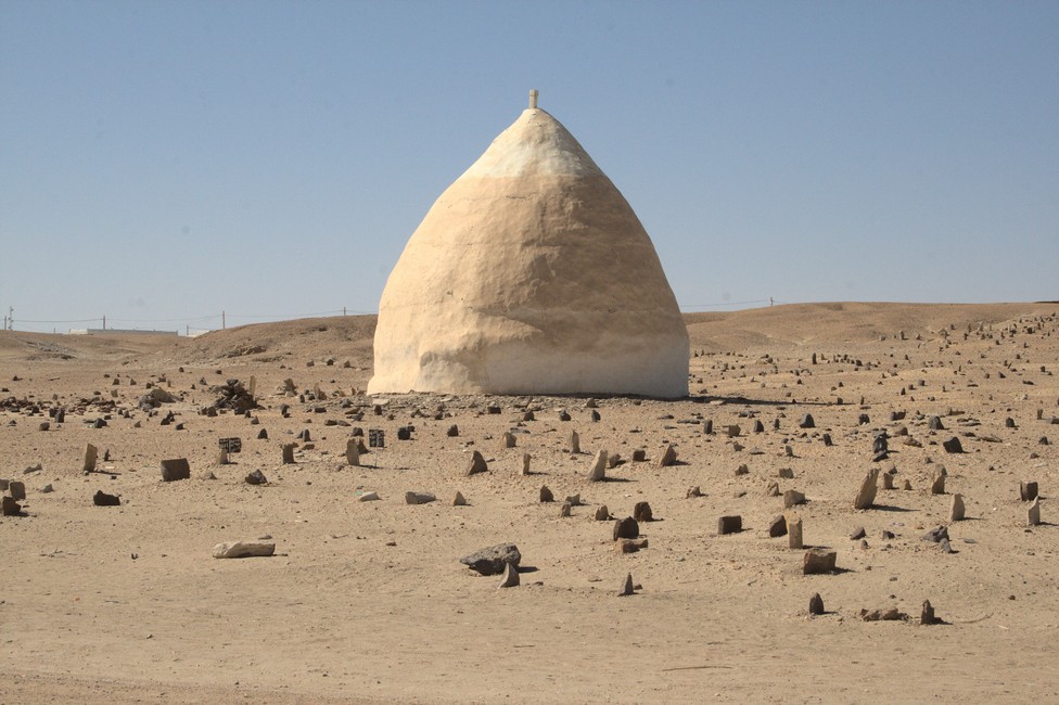
Grave Markers
Historical Roots of Sudanese Cemeteries
Sudan’s history is characterized by ancient civilizations, diverse ethnic groups, and a blend of cultures that have shaped the country’s cemeterial landscape. These historical roots provide an understanding of the evolution of Sudanese cemeteries.
Ancient Civilizations: Sudan has been home to several ancient civilizations, such as the Kingdom of Kush, the Kingdom of Meroë, and the Christian kingdoms of Nubia. The burial practices of these civilizations have left an indelible mark on Sudanese cemeteries. For example, the pyramids and burial chambers of Meroë, reminiscent of the Egyptian pyramids, are a testament to the historical grandeur of the region.
Nubian Burial Sites: The Nubian people have their distinctive burial traditions, which are evident in the intricate tombs and pyramids of the Nubian Desert. These burial sites provide insights into Nubian culture and the veneration of the dead.
Islamic Influence: With the spread of Islam across Sudan, Islamic burial customs have influenced cemeteries throughout the country. Islamic cemeteries adhere to the tradition of burying the deceased as soon as possible, facing the body towards Mecca, and marking graves with simple headstones.
Cultural and Religious Significance
Sudanese cemeteries are significant not only from a historical perspective but also from cultural and religious viewpoints. They are a reflection of the rich diversity of the nation’s cultural and religious fabric.
Islamic Cemeteries: In Sudan, the majority of the population practices Islam, and Islamic cemeteries are a prominent feature. These cemeteries are meticulously organized, following Islamic customs, and are often adorned with ornate mausoleums and shrines of revered religious figures.
Christian Cemeteries: Christianity has a long history in Sudan, particularly in the Nubian regions of the country. Christian cemeteries reflect the Christian faith’s practices, with crosses and Christian symbols adorning graves and headstones.
Traditional Sudanese Cemeteries: In addition to Islamic and Christian cemeteries, Sudan has cemeteries that reflect indigenous traditions and diverse ethnic groups. These cemeteries may feature unique burial practices, grave markers, and cultural elements specific to the local communities.
Sufi Shrines: Sudan has a strong Sufi presence, and the cemeteries often include the tombs and shrines of Sufi saints and leaders. These shrines are places of pilgrimage and devotion for Sufi adherents.
Funerary Traditions
Funerary traditions in Sudanese cemeteries are deeply rooted in cultural and religious practices. These traditions play a crucial role in honoring the deceased and providing solace to the bereaved.
Islamic Burial Customs: Islamic burial customs in Sudan involve washing the deceased, shrouding the body in a simple white cloth, and burying it in a grave facing the Qibla (the direction of Mecca). These customs are carried out with reverence and are often performed swiftly after death.
Traditional Practices: Various ethnic groups in Sudan have their unique funerary traditions, which may include ceremonies, rituals, and songs. These traditions are passed down through generations and serve to celebrate the life of the departed.
Cemetery Architecture
Sudanese cemeteries are not only about the resting places but also the architectural elements that adorn them, creating a distinct visual identity.
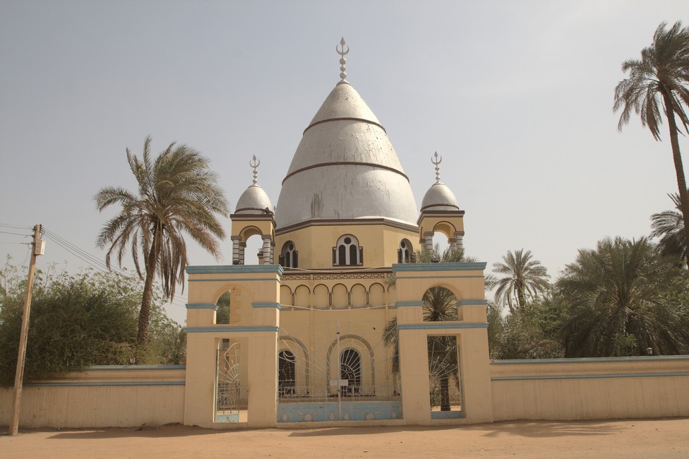
Mausoleums: Many Sudanese cemeteries, especially those with Islamic significance, feature mausoleums and shrines. These structures are often elaborately designed and serve as places of veneration for religious figures and saints.
Grave Markers: Different cemeteries in Sudan use various grave markers, from simple headstones to ornate sculptures. These markers can offer insights into the cultural and religious affiliations of the deceased.
Tomb of the Mahdi
Cultural Heritage and Preservation
Sudanese cemeteries are an integral part of the nation’s cultural heritage, reflecting its history, diversity, and religious pluralism. Preserving these cemeteries is crucial for safeguarding Sudan’s unique legacy.
Cultural Diversity: Sudan is home to a mosaic of cultures, languages, and traditions. Its cemeteries showcase this diversity, serving as a testament to the coexistence of different communities and their respective practices.
Conservation Efforts: Efforts are underway to preserve and protect Sudanese cemeteries, especially those at risk of deterioration or destruction. These efforts often involve partnerships between local communities, heritage organizations, and government authorities.
Conclusion
Sudanese cemeteries are not merely places for burial but repositories of history, culture, and religious significance. They reflect the country’s rich and diverse heritage, with influences from ancient civilizations, religious practices, and indigenous traditions. These cemeteries are living testaments to the past and are essential for preserving Sudan’s unique cultural legacy.
We are exhausted, waiting for the veterinarian. It’s well past 5:00 PM. He was supposed to be there at 4:00 PM. Yes, this is Africa. Waiting is not foreign to us anymore; we’ve grown accustomed to it.
Tara lies exhausted between the two seats. She has grown old. The African sun is taking a toll on all three of us. TIP fees, road usage fees, and the veterinarian still need to be sorted out. At this border, things seem relatively uncomplicated. At the Tanzanian border, the officer accepted that our TIP had expired. However, the veterinarian on Kenyan side gave us a hard time. He wanted to send us back to South Africa, claiming that Tara’s passport was not valid, and we needed an import permit. He suggested that we should return to South Africa and arrange for an import permit there. I found negotiating with the veterinarian futile, so I called our friend Raj. He comes from an affluent Kenyan family, and we befriended him a few years ago. Raj was quick to offer assistance and said he would speak to the veterinarian. I handed the phone to the veterinarian, but it didn’t seem to help. Our friend said not to despair and that he would sort things out with the border officials. After a short while, the veterinarian received a call and promptly stamped the document. The border officials then waved us through.
By this time, it was already dark, a situation I didn’t like because driving at night in Africa is not a good idea. Tired and worn out, we arrived in the darkness at Tiwi Beach, specifically at the Twiga Lodge. In the following days, we spent our time at the Twiga Lodge’s campsite, with occasional trips to shop in Diani.
Tara needed to have her nails trimmed and the veterinarian managed the impossible. And, once again, the exhaust pipe was broken. We received a recommendation for a mechanic named Cowboy. He had a small workshop on a property in Ukunda. All in all, he was a very nice guy and attempted to repair the exhaust. He more or less succeeded.
November 9
In the morning, we left Tiwi Beach and headed towards Malindi. Our friend Raj, who had invited us to stay at his apartment, was waiting for us. So, for the first time, we went down outside the apartment to walk Tara, the manager of the facility saw us and wanted to kick us out immediately. However, when he heard our friend’s name, he became milder.
We celebrated my birthday at the pizzeria in the same building. Since we didn’t have internet access in our friend’s apartment, we decided to move to the camping site. The next morning, we finally moved to the Malindi camping site.
November 11
There was an Italian supermarket near the camping site. We found some good Italian wine and a Mocca machine there. We spent our days working on the computer.
November 19
The computer’s power adapter was broken, and we needed a new one. I took a Tuk Tuk to the city center to find a computer store. The salesperson was friendly, but I wasn’t sure if the power adapter would fit. I negotiated the price a bit, and he assured me that I could return it.
November 29
South African Dave, Jill’s husband, arrived. We met them in Tanzania. Dave came alone as Jill had to interrupt the trip because of her work, but was expected to come to Tiwi Beach in a few days. In the evening, we went to a nearby restaurant for dinner. Dave was in a great mood, and the evening was pleasant.
December 3
Unfortunately, the power adapter didn’t work. There were difficulties with the exchange. Dave accompanied me to the city to exchange it. Since the seller was unwilling to exchange it, we had to call the police. The police arrived, and the issue was resolved.
December 5: Malindi to Mombasa
On December 5, we left Malindi and drove to Mombasa. In Mombasa, we inquired about the repair of the exhaust again.
Eventually, we continued to Twiga Lodge, our beloved place. I spent the next few days repairing the car. I had to go to Mombasa several times to get parts. One day, I was in the workshop for a long time and Alexandra was getting worried. Tara had run away twice, walking to the end of the campsite, where she hyperventilated and sat in the grass. The second time it was already dark when she ran off. Eventually, she was found in the shower area, wagging her tail, so it was hard to be angry. The problem was that every time the neighbor pressed the central locking on the car, it made an unpleasant sound, causing her to run away out of fear. The next day, Alexandra asked the guests to park the car elsewhere since they couldn’t turn off the sound. They were very kind and immediately agreed.
December 16
Jill arrived at Mombasa Airport at midnight. Dave picked her up from there.
Peponi Beach Resort was our next destination to spend some days at the beach. Today we wanted to leave for Peponi but the battery of the Land Rover was gone. Car batteries in Africa do not last long, as the roads are terrible and the lead in the battery very soon starts to brake. So with the French guy I went to town to get a new one. Departure postponed.
17.10.2012
Finally. We left for Segera. The road was nice and the day was sunny. But everything was running too smooth and shortly after Segera the car just stopped. In Africa there countless motorbike taxis, so I stopped one and went back to the next town. Alexandra and Tara stayed at the truck. At the Hotel Segera (there was a campsite as well) the owner organised some guys to tow us back to the campsite.
With a Matatu, these little Toyota buses for local transport, we reached the Land Rover. The had a towing bar, but nothing to fix to the Matatu. So they took some ropes and fixed it somehow to the Land Rover. As it just went downhill it was not such a big issue and finally we arrived at the Hotel Segera and we towed the car to the campsite.
Although it got dark already the mechanics arrived and thought it would be the ignition coil, which sounded not likely as the one fixed was not really old. So they exchanged but this was not the reason for the brake down. As it was late they left and wanted to come next morning.
I had a look again, to find the reason for the break down and discovered that the points were broken. But we were too tired to fix it and too tired to head to Peponi Beach Resort as driving in the dark is anyway not a good idea so we ordered dinner at the hotel and went to bed.
18.10.2012
So the mechanics appeared early and as I had spare points they fixed it and we drove on to Pangani. The landscape was great and the road terrible. The points were exchanged but the truck did not run properly, so I was afraid that we might break down again. So I knew if we had to stop the engine it would not start again, so I tried to eep it running. And at the gate in front of the Peponi Lodge and campsite we had to stop because the gate was closed and so the Land Rover stalled.
Road to Peponi Beach Resort
Alex went in to book a campsite and we were lucky as the owner was a real Land Rover enthusiast and towed us with his old Land Rover Series 86 model 1951 to our spot. Very nice campsite!
20.10.2012
Dennis the owner of Peponi Beach Resort told us to help with his mechanics to fix our Land Rover. So we took a taxi to Tanga which was about 30 km away from Peponi on heavy dirt road to get some spare parts. We did not get all the stuff, so we returned back. Dennis told us that the next day we should go together.
21.10.2012
A day for a rest. The driving to Tanga was postponed for a day, so we had time to investigate the beach, which was just marvellous. Unbelievable such beaches really exist and the images you can see in magazines are not just faked images by a talented graphics. So we enjoyed the beach, the warm waters of the Indian Ocean.
Beach at the Indian Ocean
The Tanzanian coast along the Indian Ocean is renowned for its stunning beaches, clear blue waters, and diverse marine life. This coastline stretches for approximately 1,424 kilometers (885 miles) and offers a variety of beach destinations and attractions. Here are some notable areas along the Tanzanian coast by region:
Dar es Salaam: Dar es Salaam is Tanzania’s largest city and serves as a major gateway to the country. The city has several beaches, including Coco Beach and Kigamboni Beach. While these beaches may not be as pristine as those in more remote areas, they offer a convenient beach experience for city visitors.
Zanzibar: Zanzibar is an archipelago off the coast of Tanzania and is famous for its picturesque beaches. Some of the most well-known beaches on the main island of Unguja include Nungwi Beach, Kendwa Beach, and Bwejuu-Paje Beach. Zanzibar also has smaller islands, like Mnemba Island, known for its exclusivity and snorkeling opportunities.
Pemba Island: Located to the north of Zanzibar, Pemba Island is known for its lush, green landscape and unspoiled beaches. The island offers a quieter and more remote beach experience compared to Zanzibar.
Mafia Island: Mafia Island is another gem along Tanzania’s coast, known for its marine biodiversity and stunning beaches. Chole Bay and Ras Mbisi are two popular beach areas on the island.
Bagamoyo: Located to the north of Dar es Salaam, Bagamoyo is known for its historical significance as a former slave trade port. It also has beautiful beaches like Coco Beach, making it a popular day-trip destination from Dar es Salaam.
Kilwa: Kilwa is known for its historical ruins and serene beaches along the southern Tanzanian coast. Kilwa Kisiwani and Kilwa Masoko are notable areas to visit.
Tanga: Tanga is a coastal city in northern Tanzania with picturesque beaches, including Tongoni Beach and Peponi Beach, which is known for its coral reefs and marine life.
These are just a few of the many stunning beach destinations along the Tanzanian coast. Each offers its own unique charm and opportunities for relaxation, water sports, and cultural exploration.
22.10.2012
Dennis told us, that also he knew a welder in Tanga who could make us a new exhaust manifold. So the man took measure of the old part and promised to build a new one from scratch. We also got the other missing parts and drove back.
24.10.2012
We picked up the exhaust manifold from Tanga and Dennis and the mechanic fixed it, it fitted quite well.
25.10.2012
Shopping in Tanga and extending the visa. We were going with Matatu to Tanga. So we walked out of the campsite to the dirt road to get a Matatu. So about every now and then they appeared, the road to Tanga is not very busy, so it takes about 20 minutes until a Matatu appears.
Campsite at Peponi
At the immigartion the extended our visa only by 11 days, although we explained that our car broke down and that we were waiting for spares to arrive.
When we took the Matatu back to Peponi Beach Resort it was super crowded, normale fit in about 7-9 passenger, but when crowded they put in 20 and more. So it was already full when we left Tanga and on a stop outside the town we saw another one, where two guys took an elder lady and took er and laid her on top of other passengers. Such transport I had never seen before. But ours was nothing better. We did not get a seat of course so we had to stand in the Toyota. But it was so full and shaking, that I could not stabilize myself properly and was shaken with my leg in between the legs of a young lady sitting: I slipped more and deeper between her legs and finally the was no way deeper between her legs. I was sorry as I did not want to sexually harrass her but she just smiled and I said sorry. That s Africa as well.
Peponi Beach Resort and campsite is a real meeting point for overland travel enthusiasts and so we met Dave and Jill from UK and South Africa who were traveling along the East Coast of Africa. The couple was in their mid 50ies and were traveling with a roof tent. We also met a couple with a Land Rover Discovery from UK, but they lived in France, were quite young and already retired as they were fighting in a war I think it was Afghanistan. We also met a couple from Switzerland who were traveling from Switzerland down the West Coast of Africa which is mentally much more difficult, as there is more corruption and travellers are not treated too well by the authorities.
The couple was mentally at its end, they just wanted to go back home and asked if we could drive the car back to Europe. They would have paid any asked price. So it was clear for us that we had to comfort them a little bit and stabilize them. So we we were talking evenings and as we had come down via Sudan and Ethiopia we could ensure them, that this was not too difficult to manage and so they got confidence to continue their trip home at least until Kenya Mombasa to maybe get their a container to ship the truck to Europe.
31.10.2012
Ride to Tanga again to prepare our departure to Kenya. We were running out of visa days, so we did stock up our supplies and went back to Peponi. This time as the Matatus were full full, as the Africans say, we hired two TUK Tuks, knowing the the ride might be pumpy. And as expected it was felt even more pumpy in a Tuk Tuk than in a Matatu, but we had a lot of fun with the drivers and shaken heavily we arrived at the campsite.
Travel overland to Cape Town. We are waiting for the embarkation of our Vehicle to Tunisia. We want to cross the African continent by our camper van. The journey starts in Tunis with final destination Cape town, about 25.000 kilometres through the black continent.
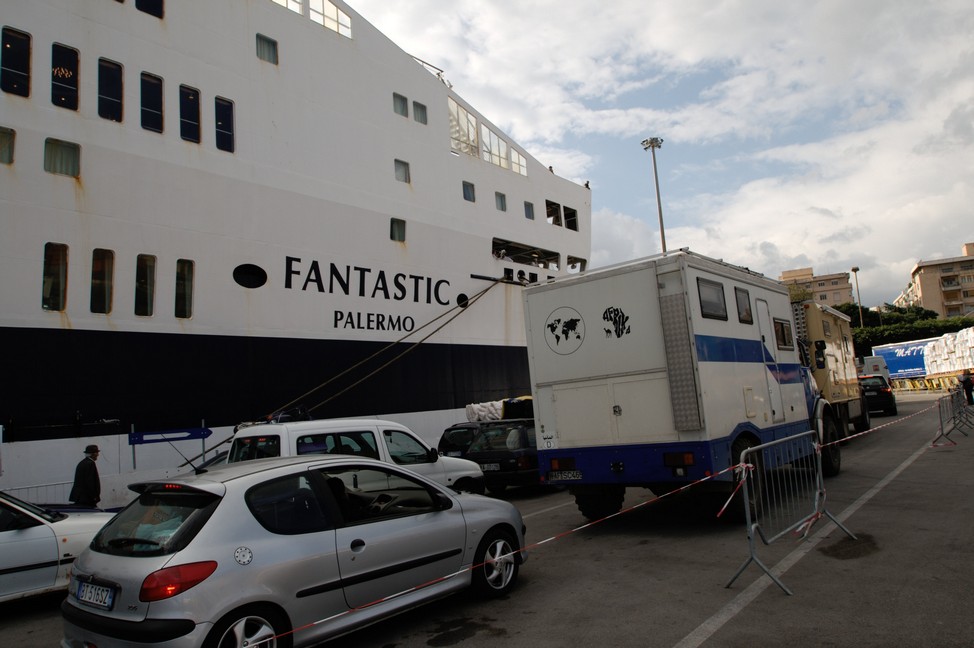
It is end of Novembre and we have a mild winter evening which is typical for the mediterranean coast. We are already on board the ferry, we – that’s me Eric, my wife Alexandra and our female Labrador dog Tara.
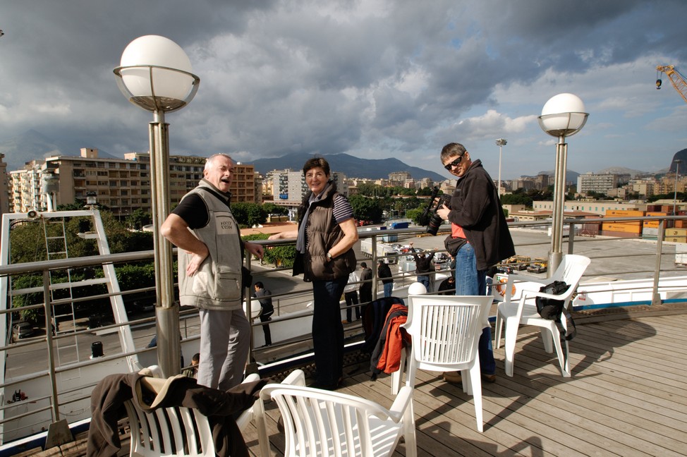
From the ferry we have a splendid view of Palermo. We have to wait until the ship is fully loaded. Here begins our uncertain adventure, our long lasting travel overland. After all the hectic preparations we have time to think about our project. Doubts are cast. “Crazy” is what our friends and acquaintances have called us for travelling by car through Africa. “Dangerous” they said – robberies and kidnappings are common there. Yes, we know that, but a lot of fears and concerns seem to us exaggerated. My only concern is our vehicle. An updated two-wheel drive Citroen van with a lot of electronics under the hood. And soon, my concerns are proved to be correct.
Travel Overland The Ferry
Finally we go. The ferry leaves the harbour towards Tunis. We only had two months preparation time. The car got another gear, equipment was organized and a meeting with other companion travellers had to be scheduled, because we do not travel alone. We are in a group of a total of five vehicles on the overland Africa trip, one of which is two tour guides who will lead us through Africa. But it will change quickly as a lot of things go wrong. We will meet on a campsite near Tunis. On board with us are Heidi and Guido, and Ursl and Hans.
We took the Matatu to Dar Es Salaam to buy spare parts for the Land Rover and an external Harddisc. At around noon we returned back to Paradise Guest House. There we spent a quiet night until around midnight. We woke up to hear loud screams and noises like someone had been beaten. The goats were making a loud noise as well. The Guest House owner was screaming loudly, but soon it was quiet again. We went out but could not see anything. In the kitchen the owner couple told us everything was fine. So we wet to bed again.
In the morning I went out and saw Salomon the owner in his garden. I asked him was going on in the night. He told us a guy, who we had known with a girl friend from Austria, had sex with a goat. Salomon caught him and had beaten him with a belt.
In the afternoon a Rasterman named Matunda came to the Lodge. He picked up the trousers of his friend the one who was beaten last night. Obviously he was ashamed for the guy and the guy himself was ashamed as well. He was never seen at the beach again, at least for the time we stayed there.
The gust house was nice but as there stayed a lot of young people a lot was going on. Matunda used one of the rooms as love nest. He was having sex with an American girl. She was screaming and moaning all day loudly, so it was difficult to concentrate to the work.
A French girl had each evening another guy in her room, no it was not a brothel.
20.09.2012 Dar To Bagamoyo
Finally we wanted to get on and headed to Bagamoyo Beach Resort. From Dar to Bagamoyo it was not too far and the route was scenic.
Building new accommodation at the Resort
We had a look at some other campsites before but Bagamoyo Beach Resort seemed the best choice at the moment. The campsite was situated behind the rooms, and there was a clean and good shower and a proper toilet. The campsite had a lot of palm trees on sandy ground so it was qute a nice campsite. We put up our huge tent and the small one. The Land Rover could park in the shade of the palm trees. Quite idyllic.
We walked to the fish market which was directly at the beach with all the dhows, very scenic. Under a huge shelter there were hundreds of small charcoal fires where the ladies fried fish in the pan. For about 1.50 USD you could eat there fried fish with rice – delicious.
In another shelter there were deep freezers and fresh fish to buy. We often got white snapper and a green fish of which we never found out the name. Of course bargaining was obligatory in Africa, everywhere.
Back at the campsite we did some computer work. In the evening we walked to the centre to have some chipsi mayai ( French Fries with eggs) or kuku na chipsi (Chicken with French Fries). Sometimes we ate at the dolphin bar, an open air bar just outside the camp.
Dhow at the fish market
18.09.2012 Dolhin Bar in Bagamoyo
In the evening at Dolphin bar we met a French guy who was married to a Tanzanian women from Dar. They had 2 children and were living next to the campsite in a house with garden. He invited us for breakfast in his house.
19.09.2012
We went for breakfast to the couple and had nice talks about everything and learned some deeper insights into Tanzanian life.
19.09.2012
In the afternoon a German guy arrived at the campsite with his motorbike, completely exhausted. When he wanted to put up his tent, he realized that he obviously had lost his tent. Must have been appened on his way to Bagamoyo. So we lent him our small tent and advised him to go to Dar to buy one for his further journey.
Thomas from Germany
When he came back from Dar to Bagamoyo he put up his newly bought tent, but was really disappointed because he had bought a tent for children, so it was much too short for him.
His plan was to go to Zanzibar on a dhow with the fisher men. So the French guy helped him to arrange the trip, and so he was supposed to be at the fish market at midnight to get on a dhow.
20.09.2012
In the morning Thomas completely exhausted appeared at the campsite and told us they were waiting whole night but the fisher man did not show up. So in the morning he gave up.
In the evening he asked us if we could go with him to a restaurant to have some food. He did not want to go alone, as when he went out alone, the girls approached him quite heavily, so he thought that we could protect him.
We agreed and went to Dolphin bar, where we had been before and had known the waitresses already. But it was unbelievable. As soon as they realized he was a single guy they approached him so heavily, showed him their breasts and openly invited him to have sex with the girls. They were not disturbed by us at all. So I told the girls that they should leave him alone and that we just want to eat.
24.09.2012
Extension of our TIP was on the agenda. Not really complicated. First we asked at the customs at the fish market but they told us we need to go to immigration not far from the market. Unusual that immigration had to do it. We entered the lady sent us to the bank to ask the exchange rate. We came back showed her the paper from the bank with the rate. She calculated the fee, we paid, she stamped, done. Matter of minutes.
In the morning we always made a walk to our chapati women for breakfast. The technique was sophisticated and not so easy to cook. But they were delicious and we came here every day.