Category Archives: ENG

Newfoundland and Labrador RV Road Trips

Newfoundland and Labrador 🇨🇦 is one of the most spectacular RV destinations in Atlantic Canada—with dramatic cliffs, fjords, iceberg coastlines, colorful fishing villages, and remote wilderness. Because of the province’s size and ferry access, many trips combine Newfoundland island loops and Labrador wilderness drives. Here are several excellent RV road trip ideas.


1. Viking Trail to L’Anse aux Meadows

https://images.openai.com/static-rsc-3/5zcIlMgY74U2zAV195mDHD4t_63D7-2E6ioj78nSQEMG4HfWM9vlugvfr1FyHlKdIBzR1qgFiPIdfxrLTPmECcYBj4LYps50gM_7x9kFkPU?purpose=fullsize&v=1
https://images.openai.com/static-rsc-3/5HRyyB0vEpU0mg4sdPNXCYGzLOtrO3ZgyYKj0K1AN4EcMitlqEMA9TJJ2c-7eUAAdctPrF1s5d6DrHhkYEaKRfWmIUW-CXsiFBmds__hIVE?purpose=fullsize&v=1
https://travel.destinationcanada.com/_next/image?q=75&url=https%3A%2F%2Fadmin.destinationcanada.com%2Fsites%2Fdefault%2Ffiles%2F2026-01%2Fdc-western-brook-pond-fjord-newfoundland-long-range-traverse.jpg&w=1920

4

Route:
Deer Lake → Gros Morne National Park → Viking Trail → L’Anse aux Meadows → St. Anthony

Distance: ~430 km
Ideal length: 4–6 days

Highlights

  • UNESCO Viking settlement at L’Anse aux Meadows
  • Dramatic fjords in Gros Morne
  • Boat tour of Western Brook Pond
  • Whale and iceberg viewing

RV Stops

  • Green Point Campground (Gros Morne)
  • Pistolet Bay Provincial Park
  • St. Anthony RV Park

2. Gros Morne National Park Explorer

https://images.openai.com/static-rsc-3/1T5eWI9G-LnzqlJjjBqERWd7mZtOc4ce_YXbLrJ-JABDOf-vaY1n_lpIXGbtJmH_uh9S-xC0eLDfCb0H7dg5Hl8wkeIBezr4GzA8k3MKKoM?purpose=fullsize&v=1
https://i2-prod.mirror.co.uk/article36039823.ece/ALTERNATES/s1200c/1_JS382793842.jpg
https://images.openai.com/static-rsc-3/N83Gmb2CatIJsMgN7umPArayb22w4JBxRoFMw0OWfFrjjsd6ua4Hef3MeCaTbYCDZP71xLSry9o8g9g9yiir74afF8WeNOyS4ahPUdmwTzM?purpose=fullsize&v=1

4

Route:
Deer Lake → Gros Morne National Park → Rocky Harbour → Trout River

Distance: ~200 km
Ideal length: 3–4 days

Highlights

  • Unique geology at Gros Morne Tablelands
  • Fjord boat tours
  • Coastal fishing villages
  • Hiking and wildlife viewing

RV Stops

  • Green Point Campground
  • Berry Hill Campground

3. Avalon Peninsula & St. John’s Loop

https://www.seesight-tours.com/_next/image?q=100&url=https%3A%2F%2Fres.cloudinary.com%2Fsee-sight-tours%2Fimage%2Fupload%2Fv1738668559%2Fstrapi%2FJellybean_Row_St_Johns_34c953ca50.webp&w=3840
https://images.openai.com/static-rsc-3/zycsZVtnM8_q8hPaXwZWWVnb-RIIhjwdhRRZDqfqsKsQa7oRpnFkW1v0zeJlfy-kRj-Rkik0G1YyUpyzO9Dzgjr1VX8q9NooG44K20F5m70?purpose=fullsize&v=1
https://images.openai.com/static-rsc-3/ye5Jup7DZfK0PCFHm1MfNsSanVDribn8vyWU2As405GGV_Bu1zqiEHuhGTgter5TCQefYzumqwL8w801dMzyq-t0FCbmb5rOhp98qKKMC3w?purpose=fullsize&v=1

4

Route:
St. John’s → Cape Spear → Avalon Peninsula → Cape St. Mary’s Ecological Reserve → St. John’s

Distance: ~300 km
Ideal length: 2–3 days

Highlights

  • Colorful “Jellybean Row” houses in St. John’s
  • Easternmost point of North America at Cape Spear
  • Massive seabird colonies
  • Coastal cliff drives

RV Stops

  • Pippy Park Campground
  • Cape Pine RV Park

4. Iceberg Alley Coastal Route

https://images.openai.com/static-rsc-3/54uF6LlFDYCh9f0NLNRnYep6hczCHtRgYUGmI8MogqSsHBdedRk4l_-qQJ1O7Iz96IN1LA9c3GBmcsozr1TYfwuOTeGjE7yb-HjI5q0kfJs?purpose=fullsize&v=1
https://images.openai.com/static-rsc-3/JS4LTM_pSpaJn4HGAAByN1RUOQpXVn8UBoPdRMDG86s4TF6OExwPDi2Uc-YxZAlQUeVfeysygHByivoEzIFJhAkiI0SkpEj_ES2AN8W6r30?purpose=fullsize&v=1
https://images.openai.com/static-rsc-3/T8vlWNN0mddtilT9CDi4pz1BK-VzK2NXAIQRpV6_5vP9hdIBhBuLWFgGdFkWlg_C13FLnm0-uJ-b8zGZNDhu0-PFvKVgL43NJHwB-LHRsgA?purpose=fullsize&v=1

4

Route:
Gander → Twillingate → Fogo Island

Distance: ~250 km
Ideal length: 3–4 days

Highlights

  • Iceberg viewing along Iceberg Alley
  • Whale watching
  • Rugged Atlantic coastlines
  • Traditional outport villages

RV Stops

  • Peyton’s Woods RV Park
  • Dildo Run Provincial Park
  • Brimstone Head RV Park (Fogo Island)

5. Labrador Coastal Expedition

https://images.ctfassets.net/r7p9m4b1iqbp/4OqBykYJ1t00rtqUaKHilw/11f09bf7720811aeff1c66cb68fe8a09/Karthika-Gupta-Labrador-Coast-Ellipse-Bay.jpg?fm=webp&q=90&w=1200
https://www.redbaywhalers.ca/mwm_files/home/sys/gallery/photos/1416151896-1.jpg
https://s3.ca-central-1.amazonaws.com/adventurecanada.com-assets2/content/hero-mindful-explorer/_1200x630_crop_center-center_82_none/tornat-mountains-aerial.jpg?mtime=1692398488

4

Route:
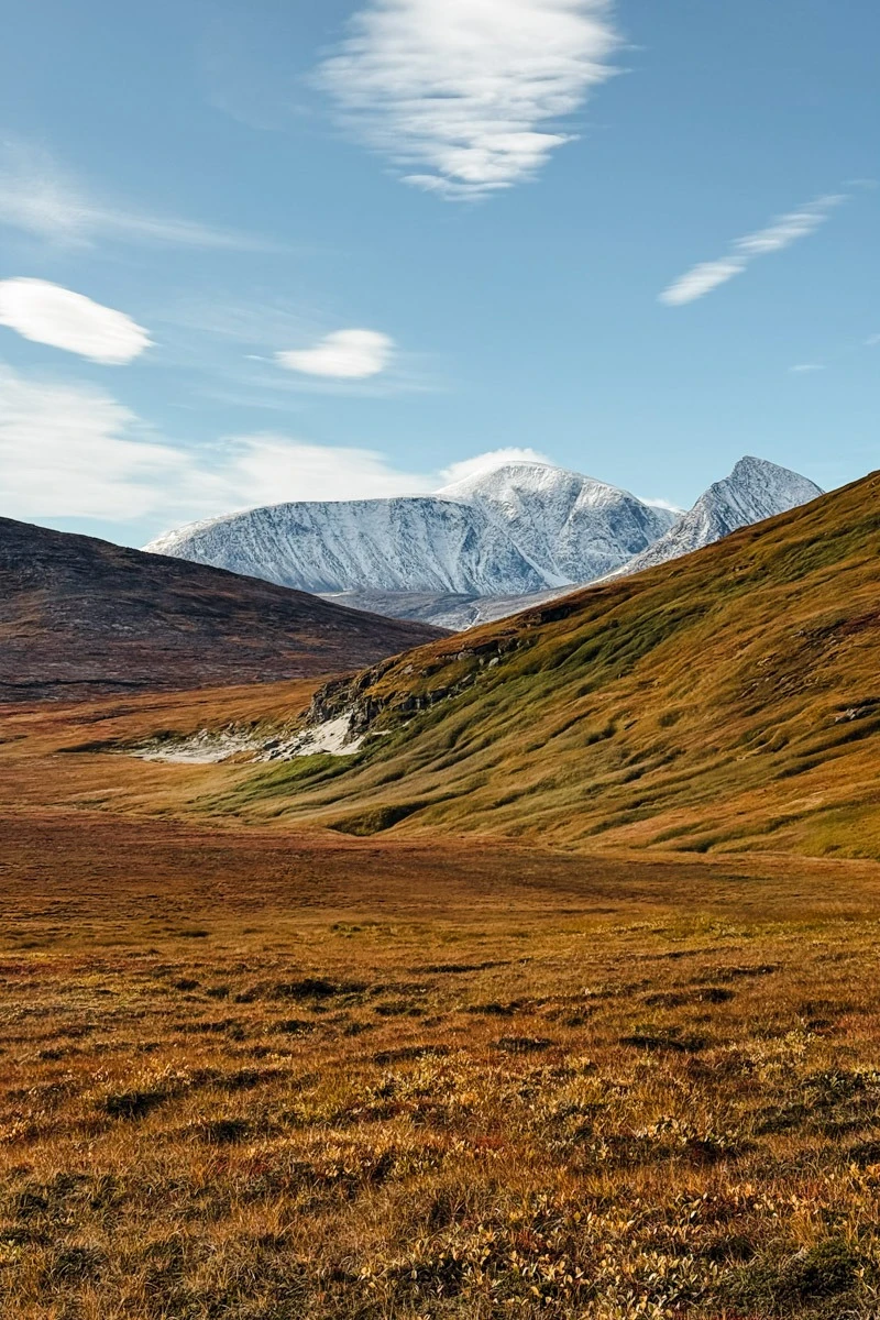
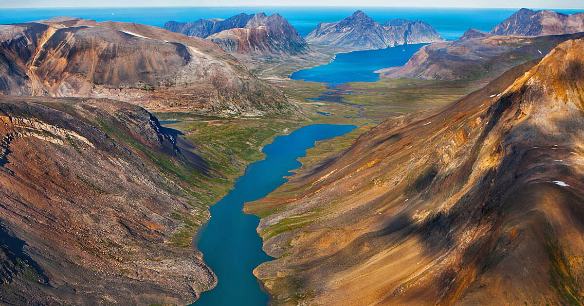
Blanc-Sablon → Red Bay → Happy Valley-Goose Bay → Torngat Mountains National Park

Distance: ~1,100 km+
Ideal length: 7–10 days

Highlights

  • Remote wilderness drives
  • Red Bay Basque Whaling Station
  • Arctic tundra landscapes
  • Northern wildlife

RV Notes

  • Long remote distances
  • Limited services

6. Ultimate Newfoundland RV Loop

https://i.sstatic.net/aWa5i.jpg
https://images.openai.com/static-rsc-3/Qli5km7sfBACeYLY0PKpGwvK33RWAYxCMZ3o-SQzkPwUY5mW1aCuy2UiTOFDnj9Q0Ueq9PaA3aVXvMTm7iMgbKs5A2TI_S-7KFxEPMNlj2c?purpose=fullsize&v=1
https://images.openai.com/static-rsc-3/0GK23swGWK_3Dgf4naMWAFTztoy47DtAcgN9wcob4KOWqfZHO6YL9ZC3-ZefIgyDRg6WamMEnXzpb0dJ4hbZJ_Y2dsRpc1IVvw2RxyQTwZU?purpose=fullsize&v=1

4

Route:
Port aux Basques → Gros Morne National Park → L’Anse aux Meadows → Twillingate → St. John’s → Port aux Basques

Distance: ~2,000 km
Ideal length: 10–14 days

Highlights

  • Viking history
  • Iceberg Alley
  • Fjords and mountains
  • Historic coastal towns

Quick Comparison

TripBest ForLength
Viking TrailViking history & fjords4–6 days
Gros Morne ExplorerNational park scenery3–4 days
Avalon PeninsulaCoastal cliffs & St. John’s2–3 days
Iceberg AlleyIcebergs & fishing villages3–4 days
Labrador ExpeditionRemote wilderness7–10 days
Ultimate Newfoundland LoopFull island highlights10–14 days

New Brunswick RV Road Trips

New Brunswick 🇨🇦 is a great RV road trip province with rugged Bay of Fundy coastlines, Acadian culture, historic towns, and beautiful forests. Because the province is relatively compact, many trips can be done as scenic loops starting from one city. Here are several excellent RV road trip ideas in New Brunswick.


1. Bay of Fundy Coastal Drive

https://images.openai.com/static-rsc-3/TokRqvzjO2vr_j5HJymPA5JH6KNyB2-tF8xKiZOg98f8MP99BKf2k2CXfUBtmOYRiIKWwoO69EAjnZOTmrLXL8DPkk7sGGF_iZ_hz4xEqIU?purpose=fullsize&v=1
https://images.openai.com/static-rsc-3/9MDw2460_ubXbTEaaicP70T5MhHtq7nD45sSQ9f7dwbhN8TsLzbsgU4HeQPTU3lHzO4klzlMLUvYKeDWqAEILqtreScyIdWo5CSqVuwvSWw?purpose=fullsize&v=1
https://images.openai.com/static-rsc-3/N43TOSDp8zMJ8Liv1xdkBz0A8FbQxGzIr5iNr02A47Wnx_7BREqVz3FGQQrKAFgsy8mIL3bPs4qm2uuY2b2CqT6xGlKDqort-qO1S_Uk1LE?purpose=fullsize&v=1

4

Route:
Moncton → Hopewell Rocks → Fundy National Park → Cape Enrage Lighthouse → Saint John

Distance: ~220 km (135 miles)
Ideal length: 2–3 days

Highlights

  • World’s highest tides on the Bay of Fundy
  • Walk on the ocean floor at Hopewell Rocks
  • Waterfalls and coastal hikes in Fundy National Park
  • Dramatic coastal cliffs

RV Stops

  • Chignecto Campground (Fundy National Park)
  • Century Farm Campground
  • Rockwood Park Campground

2. Acadian Coastal Route

https://cdn.audleytravel.com/270/355/79/538100-peggys-cove-canada.webp
https://www.mediastorehouse.com/t/251/canada-new-brunswick-northeastern-new-bruswick-19453706.jpg.webp
https://bostonglobe-prod.cdn.arcpublishing.com/resizer/v2/OI4TPTD23AI6FM2YPTMQNN7MFE.jpg?auth=a30fc57dfec4fa00f356822235d6359771619be54e2e8c672aa6a1de7e24f6d4&height=672&width=1200

4

Route:
Bathurst → Caraquet → Acadian Peninsula → Miscou Island Lighthouse

Distance: ~250 km
Ideal length: 3–4 days

Highlights

  • Acadian culture and seafood
  • Coastal fishing villages
  • Historic Village Historique Acadien
  • Birdwatching on Miscu Island

RV Stops

  • Caraquet Camping
  • Miscou Island Campground

3. Fundy Trail Parkway Scenic Drive

https://www.parcsnbparks.ca/uploads/galleries/53/image/medium_39523b0e8c.jpg
https://tourismnewbrunswick.ca/sites/default/files/images/wiki/Fundy%20Trail%20Parkway%20Cliff-Beach.jpg
https://static.wixstatic.com/media/2aab16_ff967081599e44678c2b8577011c30c0~mv2.jpg/v1/fill/w_354%2Ch_364%2Cal_c%2Cq_80%2Cusm_0.66_1.00_0.01%2Cenc_avif%2Cquality_auto/l.jpg

4

Route:
Saint John → Fundy Trail Parkway → St. Martins → Fundy National Park

Distance: ~120 km
Ideal length: 1–2 days

Highlights

  • Dramatic coastal viewpoints
  • Sea caves and cliffs
  • Suspension bridges and waterfalls
  • Scenic picnic areas

RV Stops

  • St. Martins RV Park
  • Fundy National Park Campgrounds

4. Appalachian Mountains & Western NB Loop

https://www.parcsnbparks.ca/uploads/park/7/winter_image/large_5e889e1912cc13645ea7c6b2b58f8216c96064b0dc4c203ceb7ab6c2294787c0.jpg
https://www.parcsnbparks.ca/uploads/stories/37/image/37283795_1602514256540627_5227630284823855104_n.jpg
https://tourismnewbrunswick.ca/sites/default/files/styles/content/public/images/wiki/MountCarleton1.jpg

4

Route:
Edmundston → Mount Carleton Provincial Park → Campbellton → Restigouche River

Distance: ~300 km
Ideal length: 3–4 days

Highlights

  • Highest peak in the Maritimes at Mount Carleton Provincial Park
  • Canoeing and fishing lakes
  • Appalachian forest scenery
  • Excellent fall foliage

RV Stops

  • Mount Carleton Campground
  • Sugarloaf Provincial Park Campground

5. St. Andrews & Passamaquoddy Bay Route

https://upload.wikimedia.org/wikipedia/commons/c/c8/Saint_Andrews%2C_New_Brunswick%2C_Canada_%28cropped%29_2.jpg
https://dynamic-media-cdn.tripadvisor.com/media/photo-o/2e/4e/55/10/parking-lot.jpg?h=-1&s=1&w=1200
https://upload.wikimedia.org/wikipedia/commons/0/07/CanCat_Beach_Deer_Island.jpg

4

Route:
Saint John → St. Andrews → Passamaquoddy Bay → Campobello Island

Distance: ~150 km
Ideal length: 2–3 days

Highlights

  • Historic seaside town of St. Andrews
  • Kingsbrae Garden
  • Whale watching tours
  • Roosevelt Campobello International Park

RV Stops

  • Kiwanis Oceanfront Camping
  • Herring Cove Provincial Park

6. Ultimate New Brunswick RV Loop

https://images.openai.com/static-rsc-3/yj9UoVUPBcNk0yOX6Rp-vkQvMr-WpeGKRrYeG1mWYyOhxlXbaFPtv4xqqc-F2S0nKRInR462r9YjsMZFhy8RKuS7pgDuzLpyyy5Yj6JoUeI?purpose=fullsize&v=1
https://www.parcsnbparks.ca/uploads/park/33/image/medium_3f672e5537208fa52ce877cfcf50b091294d8334a6dc327bff9a3b338f314ff1.jpg
https://cdn.audleytravel.com/270/355/79/538100-peggys-cove-canada.webp

4

Route:
Moncton → Hopewell Rocks → Fundy National Park → Saint John → St. Andrews → Bathurst → Caraquet → Moncton

Distance: ~800 km
Ideal length: 7–10 days

Highlights

  • Bay of Fundy tides
  • Acadian culture and seafood
  • Coastal cliffs and national parks
  • Historic seaside towns

Quick Comparison

TripBest ForLength
Bay of Fundy CoastIconic tides & cliffs2–3 days
Acadian PeninsulaCulture & fishing villages3–4 days
Fundy Trail ParkwayScenic coastal drive1–2 days
Appalachian NBMountains & wilderness3–4 days
St. Andrews RouteHistoric seaside towns2–3 days
Ultimate NB LoopFull province highlights7–10 days

Manitoba RV Road Trips

Manitoba 🇨🇦 is a fantastic RV destination with prairie landscapes, thousands of lakes, boreal forests, wildlife reserves, and Arctic tundra. From short weekend drives to major wilderness expeditions, here are several great RV road trip routes across Manitoba.


1. Whiteshell Provincial Park Lakes Loop

https://images.openai.com/static-rsc-3/x4KNywgFpmqEgzqUnxOM0__zOhP1rl6kNPHFinSubonnHglgPhbLgNBLD_8TXuPzZMf42lJCCojhkd1GFUcW2rOiBqpb4HaSRT_Pca53czw?purpose=fullsize&v=1
https://www.ehcanadatravel.com/images/manitoba/falcon-lake-accommodations-attractions.jpg
https://www.alltrails.com/mugen/image/location-app-router?q=90&url=https%3A%2F%2Fimages.alltrails.com%2FeyJidWNrZXQiOiJhc3NldHMuYWxsdHJhaWxzLmNvbSIsImtleSI6InVwbG9hZHMvcGhvdG8vaW1hZ2UvMjY0NzEzMDMvNGI5YzAyM2IxMmZlNjY1MzFiZmQ2MjQxMmE4N2UwN2QuanBnIiwiZWRpdHMiOnsidG9Gb3JtYXQiOiJ3ZWJwIiwicmVzaXplIjp7IndpZHRoIjoiMTA4MCIsImhlaWdodCI6IjcwMCIsImZpdCI6ImNvdmVyIn0sInJvdGF0ZSI6bnVsbCwianBlZyI6eyJ0cmVsbGlzUXVhbnRpc2F0aW9uIjp0cnVlLCJvdmVyc2hvb3REZXJpbmdpbmciOnRydWUsIm9wdGltaXNlU2NhbnMiOnRydWUsInF1YW50aXNhdGlvblRhYmxlIjozfX19&w=3840

4

Route:
Winnipeg → Falcon Lake → West Hawk Lake → Whiteshell Provincial Park → Winnipeg

Distance: ~250 km (155 miles)
Ideal length: 2–3 days

Highlights

  • Granite cliffs and clear lakes
  • Hiking and canoeing
  • Swimming beaches
  • Wildlife spotting

RV Stops

  • Falcon Lake Campground
  • West Hawk Lake Campground
  • Brereton Lake Campground

2. Riding Mountain National Park Adventure

https://upload.wikimedia.org/wikipedia/commons/4/49/Clearlake.JPG
https://images.openai.com/static-rsc-3/dVTzMEIb8E5oyNHLpOL54JT-PdEsMPqRP7Qge0mNLSsSO7Z19xbwlv1R0DxcWo13w1jcMaImZkNboW4Om2zJ7QFSis5gi7PeQlglo43krjQ?purpose=fullsize&v=1
https://images.openai.com/static-rsc-3/1hh8v-R82Jm_xtK0omndiuDUIlFaTGydvrIHBdPoK_pHvyiuMT-8pXkOETBXk5w9Rkojv5dSA2KEBzWgN8TejuqR8gUFj2_ofk4JabblC90?purpose=fullsize&v=1

4

Route:
Winnipeg → Neepawa → Riding Mountain National Park → Winnipeg

Distance: ~400 km round trip
Ideal length: 3–4 days

Highlights

  • Beaches at Clear Lake
  • Bison enclosure
  • Forest and prairie ecosystems
  • Hiking and cycling trails

RV Stops

  • Wasagaming Campground
  • Moon Lake Campground

3. Lake Winnipeg Beaches Route

https://images.squarespace-cdn.com/content/v1/50e1b9c6e4b015296ce398f6/3597c280-c842-4cc3-82ae-aae111a1a36b/IMG_8271.jpg
https://images.openai.com/static-rsc-3/A3YKGQSSBAPWwrIZMIY3mH2FKET6ga4Zt40UbfoOwNln8MdTlItSdg4ipZtg2DxaM-Tw-bbFOuJqv8JpPYFnbsBFM6irH2CsdvpHjK3mXp0?purpose=fullsize&v=1
https://images.openai.com/static-rsc-3/rk5Z6rUP9XeD6Viec_SIABGGy90EJQB_OjRV5YcfdExbNs10_GLAEuZonZqYyHSeD5a8t-yftZPdjVu1_O4L8X7q44hjAvB-GujZzltIInM?purpose=fullsize&v=1

4

Route:
Winnipeg → Gimli → Grand Beach Provincial Park → Hecla/Grindstone Provincial Park

Distance: ~300 km
Ideal length: 3–4 days

Highlights

  • Massive sand dunes at Grand Beach Provincial Park
  • Icelandic heritage in Gimli
  • Birdwatching and fishing
  • Lake Winnipeg shoreline drives

RV Stops

  • Grand Beach Campground
  • Gull Harbour Campground (Hecla Island)

4. Churchill Polar Bear Route (Northern Adventure)

https://images.openai.com/static-rsc-3/uCfFLjDQsbo05zzlx_YjU1GhCgGAOQhoL817DjJTcqvJbFEq207NDBQSlz5cLQ7lNU4l46fc3Q2mJbo0abQyDO-57cNv6rME1c81Q3rwSdU?purpose=fullsize&v=1
https://d4g0cdul6yygp.cloudfront.net/uploads/2025/02/beluga-whale-in-churchill-manitoba-canada_adobe-stock.jpeg
https://images.openai.com/static-rsc-3/juj9wtP_snli3LebymH72kzyDaKQRXg8mzdb9nYOfGa75jZRrN5N09SSI_CaByy0bavMIKIlrJj8qkEWPYemtSXsIdzyOMCJouLzvOYmDBQ?purpose=fullsize&v=1

4

Route:
Winnipeg → Thompson → Churchill

Distance: ~1,000+ km (plus train or flight to Churchill)
Ideal length: 7–10 days

Highlights

  • Polar bears along Hudson Bay
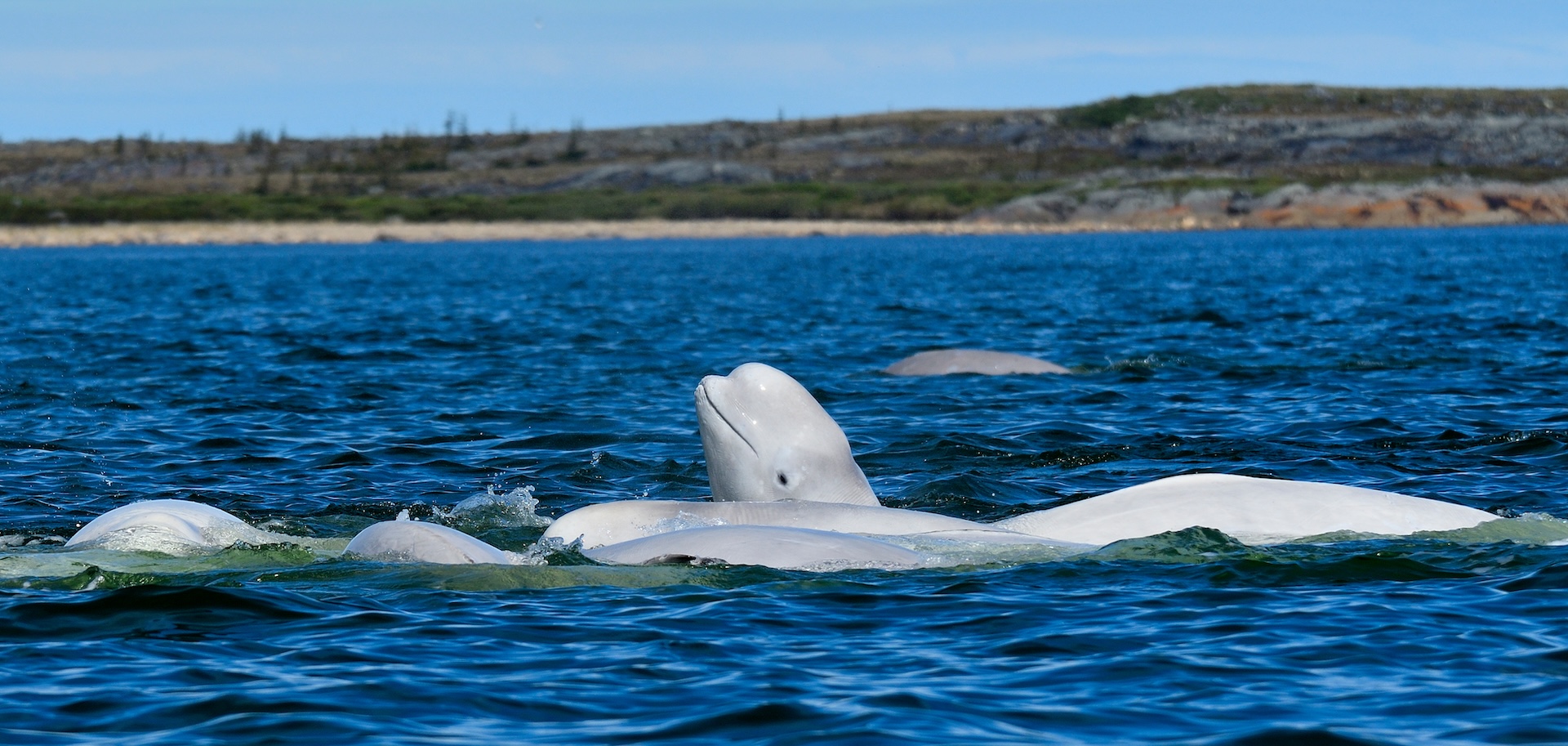
  • Beluga whales in summer
  • Northern lights viewing
  • Arctic tundra landscapes

RV Notes

  • Roads only reach as far as Thompson
  • Travel to Churchill typically by train or plane

5. Manitoba Prairie & Heritage Trail

https://travel.destinationcanada.com/_next/image?q=75&url=https%3A%2F%2Fadmin.destinationcanada.com%2Fsites%2Fdefault%2Ffiles%2Fimages%2Farticle%2Friding-mountain-national-park-bison-fall_credit_travel_manitoba.jpg&w=1920
https://upload.wikimedia.org/wikipedia/commons/8/85/Steinbach_windmill.jpg
https://images.openai.com/static-rsc-3/fJpDt0jmPUQA9MRZ6ZCiff2fQLvbbiug71lJMiupSoM5R34TIz7WX2lgbcs-nWJ_AZwvOAFdY_4wQjSPN4JNC-t9yWg9jQUL6ndj5ZmuEYU?purpose=fullsize&v=1

4

Route:
Winnipeg → Steinbach → Morden → Winkler → Winnipeg

Distance: ~300 km
Ideal length: 2–3 days

Highlights

  • Mennonite Heritage Village
  • Prairie farmland scenery
  • Rolling hills in the Pembina Valley
  • Local farmers markets and bakeries

RV Stops

  • Morden Lions Campground
  • Plum Coulee Campground

6. Northern Manitoba Wilderness Drive

https://www.travelmanitoba.com/imager/assets_simpleviewinc_com/simpleview/image/upload/crm/manitoba/03-Pisew-Falls_9b9299a5-5056-a36f-235cda3ef582f91a_bc0d2157d501d4729a3d5631708a6b2e.jpg
https://www.gov.mb.ca/sd/images/parks/popular_parks/grass_river.jpg
https://cdn.crowdriff.com/in-use/92e14125-0956-117c-a411-8442463d7275/1080.jpg

4

Route:
Winnipeg → The Pas → Grass River Provincial Park → Thompson

Distance: ~900 km
Ideal length: 6–8 days

Highlights

  • Pisew Falls and Wekusko Falls
  • Remote boreal forests
  • Canoeing and fishing lakes
  • Northern wildlife

RV Stops

  • Wekusko Falls Campground
  • Paint Lake Provincial Park Campground

Quick Comparison

TripBest ForLength
Whiteshell LakesLakes & outdoor recreation2–3 days
Riding MountainNational park wildlife3–4 days
Lake Winnipeg BeachesSand dunes & beach towns3–4 days
Churchill RouteArctic wildlife7–10 days
Prairie HeritageCulture & farmland2–3 days
Northern WildernessRemote forests & waterfalls6–8 days

Alaska RV Road Trips

Alaska is one of the ultimate RV adventure destinations 🚐🏔️—with vast wilderness, glaciers, wildlife, and some of the most scenic highways in North America. Below are some great RV road trip routes across Alaska, from classic highway drives to remote wilderness expeditions.


1. Seward Highway Coastal Adventure

https://images.openai.com/static-rsc-3/oYnztl4BqzZaK0sJ0T426DyrNjg6k_qgggWN5YbMJB-Owj2DXxdhgUe2TYZydG1PfuWimKoENHHipH20nfvd7YRd-BaGuY2oHFei7LUD0ys?purpose=fullsize&v=1
https://images.openai.com/static-rsc-3/qL3tJybRLUIIVP24EvuPHTxSebtXF6pEkdcywJ36Cuzyed-Mej2kLanA5fwTCZAJG3UJ0GGWBQ-TgsEFkYrgr6rkTQJiXlSs6531iL1jlQQ?purpose=fullsize&v=1
https://images.openai.com/static-rsc-3/2_tlgWwZLYY3hO_mP4t2vTKB3i-5sRdsbUuDoX5-5c30gHFKxqgU6Sis7yP8N9SFMppirRZgHAzu5OP6FIyvvfPehsym8HkoO7-W7MbxNUA?purpose=fullsize&v=1

4

Route:
Anchorage → Turnagain Arm → Portage Glacier → Seward

Distance: ~125 miles (200 km)
Ideal length: 2–3 days

Highlights

  • Dramatic coastal mountains along Turnagain Arm
  • Whale and beluga sightings
  • Boat tours in Kenai Fjords National Park
  • Exit Glacier hiking

RV Stops

  • Williwaw Campground
  • Seward Waterfront Park Campground
  • Bird Creek Campground

2. Denali National Park Adventure

https://images.openai.com/static-rsc-3/tVphd83t9zEKsODDZ8H4t49eX_T-weNqy6J0ZMDPSW6EHmAIYR4XerXQUYcYTCJJk2EqmtHwI3SusElpvoabYxhECTqJArZF3hEasbX1w6I?purpose=fullsize&v=1
https://images.openai.com/static-rsc-3/Dz7p8wNZsGUpaDIPca6WeBeCG1Zsvm9rqbIV7nCRiMh67NaxEG9wU1UMSVDVgo0lE1HhUa4g3O9NIXlkE3T6mcBTvpHFBX_xLbcLWbLBCi4?purpose=fullsize&v=1
https://images.openai.com/static-rsc-3/PVoD8h2wYIiWntUgDgmjqf7ffzQ-2Dbaf0IlAXG5xxGEZT2UcXH5yCCAGZ65aVV7MtPGyBUVniJTcexRKrGlnOzD3y6w5eCwbwOsp3qNC6U?purpose=fullsize&v=1

4

Route:
Anchorage → Talkeetna → Denali National Park → Fairbanks

Distance: ~360 miles (580 km)
Ideal length: 4–6 days

Highlights

  • Views of Denali (North America’s tallest mountain)
  • Wildlife: bears, caribou, wolves
  • Scenic tundra landscapes
  • Flightseeing tours from Talkeetna

RV Stops

  • Riley Creek Campground
  • Savage River Campground
  • Denali Grizzly Bear Resort

3. Kenai Peninsula Explorer

https://images.openai.com/static-rsc-3/n2-r4FYQeuboumBuwkJ4BqUjXKInEvFd3Nj5dSDWH40Nxl-71ZnSOUFlw2sgAhYaIEpsTHQ2jT8Hd3lXljzVpRySLzioe83vbkk_WN1E5xo?purpose=fullsize&v=1
https://static.toiimg.com/thumb/msid-39674848%2Cwidth-550%2Cheight-433/39674848.jpg
https://www.travelalaska.com/sites/default/files/styles/hero_xxl/public/2021-12/Destinations_ParksPublicLands_Kenai%20River%20Special%20Management_Hero_%28ATIA%2C%20Michael%20DeYoung%29_0.jpg?itok=nSYIJshr

4

Route:
Anchorage → Soldotna → Homer → Seward → Anchorage

Distance: ~450 miles (720 km)
Ideal length: 5–7 days

Highlights

  • Salmon fishing on the Kenai River
  • Scenic coastal town of Homer
  • Glacier and wildlife cruises
  • Kayaking in Kachemak Bay

RV Stops

  • Homer Spit Campground
  • Centennial Campground (Soldotna)
  • Russian River Campground

4. Alaska Highway (Inside Alaska Section)

https://images.openai.com/static-rsc-3/Q99kB6hDuOMdi-xXDk74HvQB_QZKF5KSSlftkkfVxrJofqenwvl_RdgrvywavprgRTM4HZJxMRADRX3BYkd5gJussQzQ5wWYfYwh9_bhb4Q?purpose=fullsize&v=1
https://www.fws.gov/sites/default/files/images/2024-11/20240801-tetlin-preview-hupp-2264.jpg
https://images.openai.com/static-rsc-3/xnZTIP2KEYpIwdlJAXGXlCfaKvWSrhpzB3qYDgHhp1774TJi7cpazUhWQdFaVyeMVMzV81L7_TjFUKlrvMQfj_ns-1jKMoCkYz5VG00gArE?purpose=fullsize&v=1

4

Route:
Tok → Tetlin National Wildlife Refuge → Delta Junction

Distance: ~100 miles
Ideal length: 1–2 days

Highlights

  • End of the historic Alaska Highway
  • Vast wilderness landscapes
  • Birdwatching and wildlife viewing

RV Stops

  • Tok RV Village
  • Delta State Recreation Site

5. Dalton Highway Arctic Adventure

https://images.openai.com/static-rsc-3/jUG0Rzo6p5_n4h7Dl07Mb8CPz5lyEz9lT1M8f4ugrQVtzHPy8Cr11pLOKc4YkNcyBlUbpu7U7N1PnuG1lgKlQx9aKE2SGc8HIDKgfi7GrYM?purpose=fullsize&v=1
https://images.openai.com/static-rsc-3/ek0W7KVThmb96Ha8tiiGj8Zro88CyFLQWyXFif6Y73RqAY7pNPdxGkdLIfEHl_i0HrID790ETZ0LSBZtKC2wHpOXtX9tAT4vmNIu6rLvwHs?purpose=fullsize&v=1
https://upload.wikimedia.org/wikipedia/commons/a/ad/Atigun_Pass%2C_Dalton_Highway_.jpg

4

Route:
Fairbanks → Yukon River → Arctic Circle → Atigun Pass → Deadhorse

Distance: ~414 miles (666 km) one way
Ideal length: 5–7 days

Highlights

  • Crossing the Arctic Circle
  • Driving through the Brooks Range
  • Remote tundra landscapes
  • Views of the Trans-Alaska Pipeline

RV Notes

  • Remote road with limited services
  • Best for experienced RV travelers

6. Alaska Marine Highway + Coastal Towns

https://assets.simpleviewinc.com/sv-juneau/image/fetch/c_limit%2Ch_800%2Cq_75/https%3A//assets.simpleviewinc.com/simpleview/image/upload/crm/juneau/11_57760B89-044B-408B-AFD64812941A835D_29baedbc-984d-4e4b-b5411635c4bcaf12.jpg
https://images.openai.com/static-rsc-3/DJb6eW7Fj7F3nKJPih3Y8LT3Nh9SvjVAZs9aQfngn9Cr443mruQ3bqcBSJ0qbKbSNVAHNzHacItCbmHTeZA9gp5tIKKyCyllNW14IXVVFbo?purpose=fullsize&v=1
https://www.travelalaska.com/sites/default/files/2021-12/ExploreAlaska_Itineraries_Relive%20Alaska%E2%80%99s%20Gold%20Rush%20History_Hero_%28ATIA%2C%20Reinhard%20Pantke%29_0.jpg

4

Route:
Haines → Skagway → ferry → Juneau → ferry → Ketchikan

Distance: Ferry + driving segments
Ideal length: 5–8 days

Highlights

  • Scenic ferry travel along the Inside Passage
  • Historic gold rush towns
  • Glacier viewing
  • Whale watching

RV Notes

  • RVs can be loaded directly on ferries

Quick Comparison

TripBest ForLength
Seward HighwayCoastal scenery & glaciers2–3 days
Denali AdventureWildlife & mountains4–6 days
Kenai PeninsulaFishing & coastal towns5–7 days
Alaska HighwayHistoric highway drive1–2 days
Dalton HighwayArctic expedition5–7 days
Marine HighwayFerry + coastal Alaska5–8 days

British Columbia RV Road Trips

British Columbia 🇨🇦 is one of the best RV destinations in North America—with coastal rainforests, towering mountains, glaciers, islands, and remote wilderness highways. Below are some excellent RV road trip ideas across British Columbia, ranging from short scenic loops to major adventure routes.


1. Sea-to-Sky Highway Adventure

https://images.openai.com/static-rsc-3/WfIQHfJhTQd2qRlzpmVdHmuD5NdKsnNv9J7tUHjQy6L9RolwpUXpwr5krJmgw5N0oC0HwLrPzXQNqAVJqvuxBZVRtvz8vlIk5RtEGVG2wb0?purpose=fullsize&v=1
https://images.openai.com/static-rsc-3/mbPcBEkORPev4hgQ_7nYsGeLl_FkMJrj9WWnBdOcyLy6X9z8_-m88KWMCJyziNBEON_5glFAkS9lm0uisLvWsbIrSQOztbIbUSbFRyhMAII?purpose=fullsize&v=1
https://images.openai.com/static-rsc-3/KFPEUkXFW5xcwcwMra-jFiwt-NGJahPD3mQz4TBe3O1G-1Mmo-qQfag2k9wBhenh5JoiGiRYiVlWELu5u4fSonfXy1Y5Kw67kp31zJOfetY?purpose=fullsize&v=1

4

Route:
Vancouver → Squamish → Whistler → Pemberton Valley

Distance: ~120 km (75 miles)
Ideal length: 2–4 days

Highlights

  • Shannon Falls
  • Sea-to-Sky Gondola views
  • Alpine lakes and hiking
  • Olympic village in Whistler

RV Stops

  • Alice Lake Provincial Park
  • Whistler RV Park & Campground
  • Nairn Falls Campground

2. Vancouver Island Coastal Loop

https://cdn4.tropicalsky.co.uk/images/800x600/pacific-rim-national-park-coastline.jpg
https://images.openai.com/static-rsc-3/hmtZYDlI548Zr1wg0GHLF_AF5IkmdM4dMkMBCoZKvWPAAppdKq9H0S9Hj9w1ie7SxOXntFqnlmMutKvw0QquCD-Xz10l916QGHbVaCa_p_w?purpose=fullsize&v=1
https://images.openai.com/static-rsc-3/KfFYvOIF0vqXZTWouA5wu-0zrygMbMQHIcD5krVTVDoVqaEFgaCdJE_7aGWku1t5j7gX8FHLHlC95T9b5AADijd3i6zFCeJ4cXfHC939tso?purpose=fullsize&v=1

4

Route:
Victoria → Nanaimo → Tofino → Ucluelet → Victoria

Distance: ~500 km
Ideal length: 5–7 days

Highlights

  • Pacific Rim National Park Reserve
  • Surf beaches in Tofino
  • Old-growth forests at Cathedral Grove
  • Whale watching tours

RV Stops

  • Green Point Campground
  • Surf Junction Campground
  • Living Forest Oceanside Campground

3. Canadian Rockies via BC (Banff–Yoho–Kootenay)

https://images.openai.com/static-rsc-3/uKMGZO4byPNtaYnioPER1lA0znm2BLwmihWVJy-YWg9iJ3uxqWPUU-YTBN2-T2ZtHs9hpjUOl377Nac0neVTFBBfcubDCoPZPTWFxCPNO1g?purpose=fullsize&v=1
https://images.openai.com/static-rsc-3/cCuuetoNpeUfqyvRA14jkhzrSS8Vm4aejYSD1kyjlo_4Ett7Y_aszr4V4bS7eQKXXaHAO5CHcC7fX0bklnigwbo6mN7_hy9autMcZk_LcK4?purpose=fullsize&v=1
https://images.openai.com/static-rsc-3/OylwAyhVlQ5TbVKA9YLpijl-jc_o34u1sUmQUWN1WXtcmUQA5UYPOBHf3IVDkrQ4nZVeKXeCO7H0mghP7TE-xTapyQtAhSanPYcyaVDXk1c?purpose=fullsize&v=1

4

Route:
Golden → Yoho National Park → Kootenay National Park → Banff National Park

Distance: ~250 km
Ideal length: 4–5 days

Highlights

  • Emerald Lake
  • Takakkaw Falls
  • Marble Canyon
  • Lake Louise

RV Stops

  • Kicking Horse Campground
  • Monarch Campground
  • Tunnel Mountain Campground

4. Cariboo Gold Rush Trail

https://upload.wikimedia.org/wikipedia/commons/d/d7/Barkerville_at_150_-_22_%287987539796%29.jpg
https://landwithoutlimits.com/resources/uploads/2019/10/CCCTMA-Images-Website-Clinton-Gold-Rush-Trail-DBC-Michael-Bednar-2048x1152.jpg
https://www.quesnel.ca/sites/default/files/styles/banner_image/public/2024-11/migrated/images/bridge_lit.jpg?itok=pzeqo_iX

4

Route:
Hope → Cache Creek → Williams Lake → Quesnel → Barkerville Historic Town

Distance: ~650 km
Ideal length: 5–6 days

Highlights

  • Historic gold rush towns
  • Pioneer heritage sites
  • Cariboo lakes and forests

RV Stops

  • Ten Mile Lake Provincial Park
  • Barkerville Campground
  • Lac La Hache Provincial Park

5. Kootenay Lakes & Hot Springs Route

https://www.hotspringsofbc.com/attractions/photos/hotspringsofbc.com/large/1223/99a87bce.jpg
https://images.openai.com/static-rsc-3/cnzEQcIjtQT0TYkf5J1SQ7LLCFZNFI25k9DrbYLcGLWE24rIQH6aU0F93wpVq-8QaOcsF2Kzk8lo3Hl-BkFof0XhhsHy0eid9QXOn6aJdN8?purpose=fullsize&v=1
https://images.curiocity.com/uploads/2024/09/shutterstock_2347474643-1.jpg?format=auto&h=1364&w=2051

4

Route:
Cranbrook → Nelson → Kootenay Lake → Kokanee Glacier Provincial Park

Distance: ~350 km
Ideal length: 4–5 days

Highlights

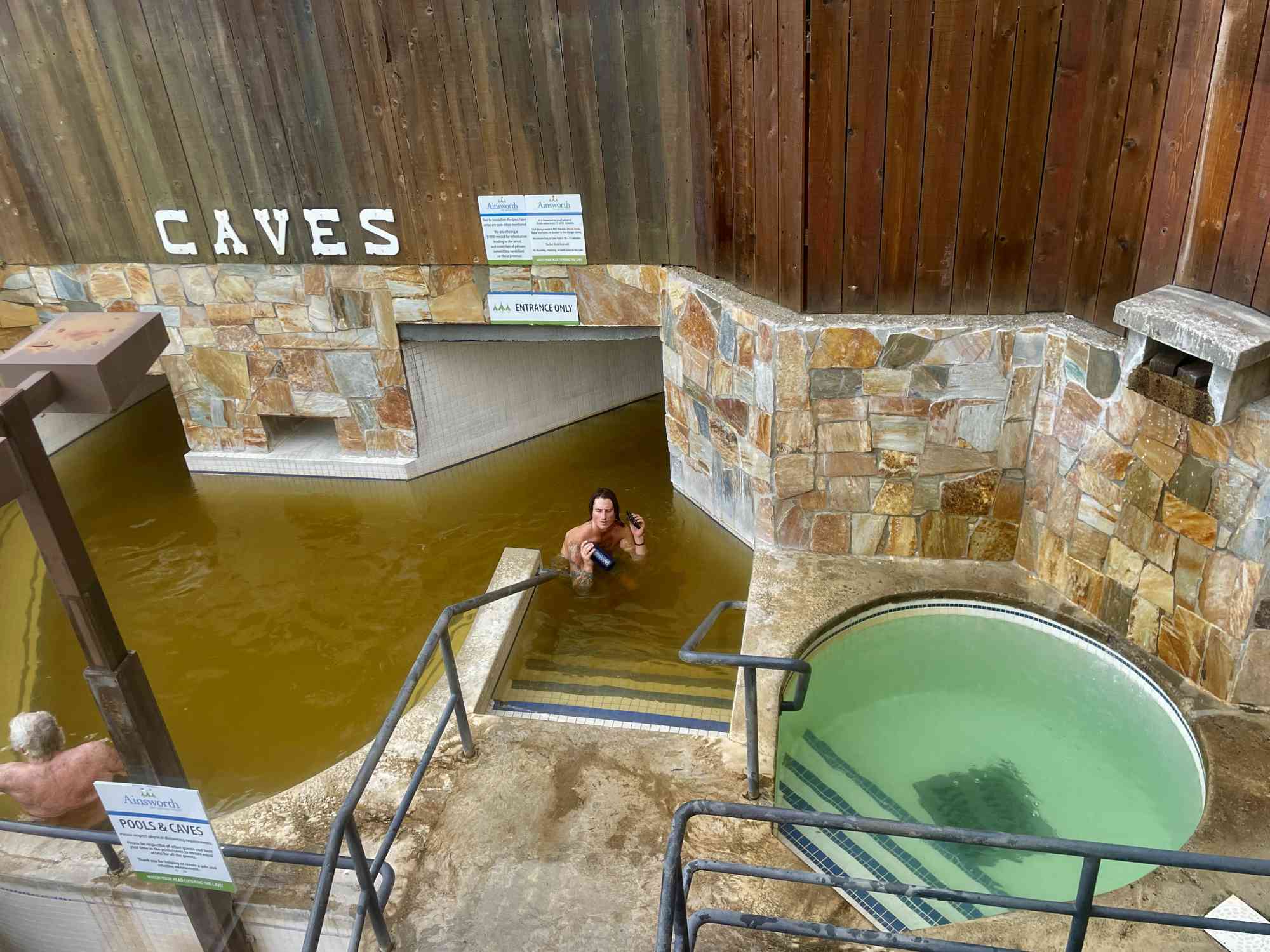
  • Ainsworth Hot Springs
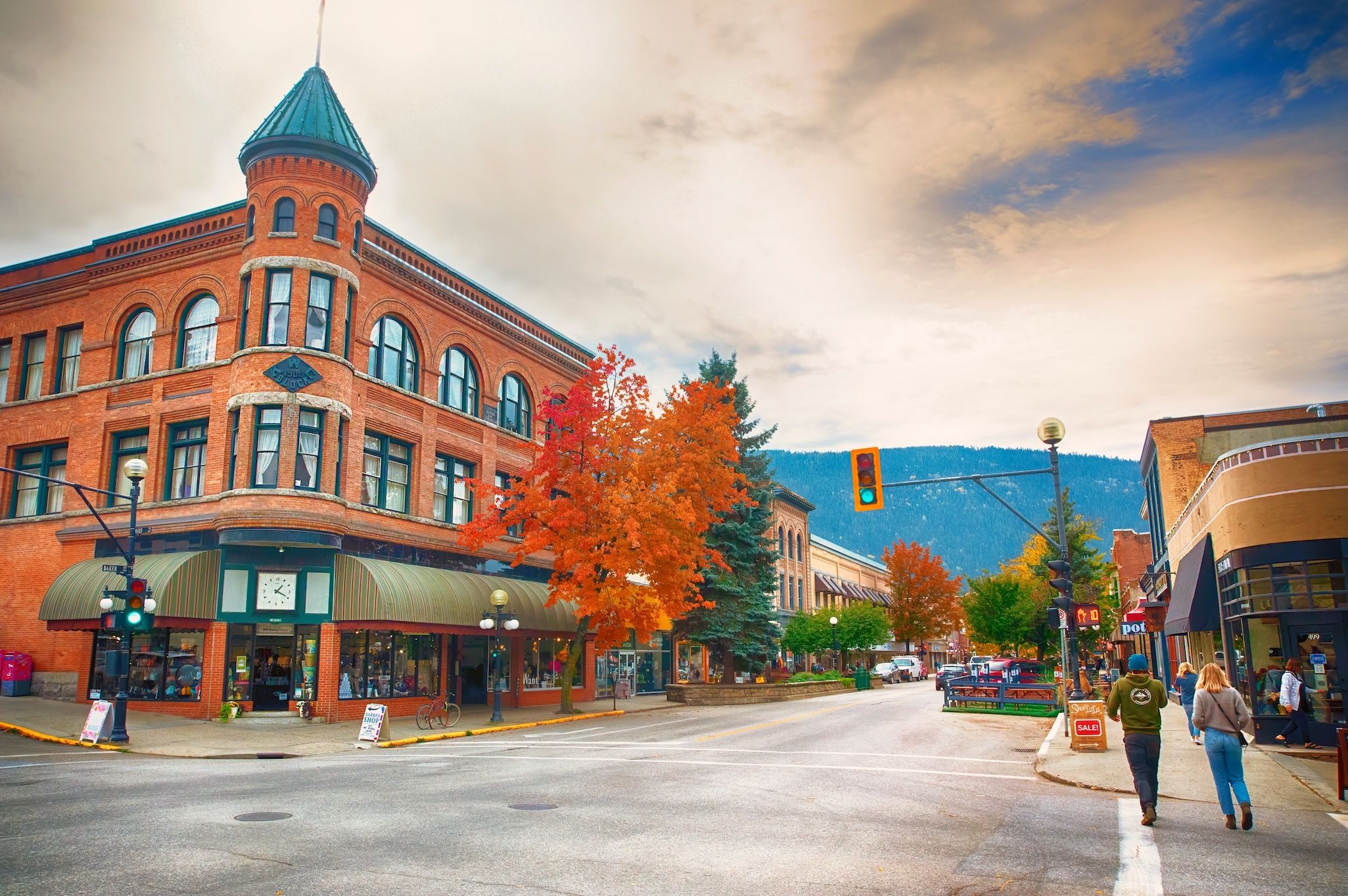
  • Historic Nelson downtown
  • Scenic lake ferries
  • Alpine hiking

RV Stops

  • Kokanee Creek Provincial Park
  • Nelson City Campground
  • Lost Ledge Provincial Park

6. Northern BC Wilderness Highway (Alaska Highway Section)

https://images.openai.com/static-rsc-3/AecDvDSztGB65E2F4gv8q_ZCYveeLL-xi-N8SomMVgrAEkHvHmUaClsGN9RATQiGxVlBnL-nwdL2sXVtBYZtHM8eXMQCaM0DzZ1QYdrXmNQ?purpose=fullsize&v=1
https://upload.wikimedia.org/wikipedia/commons/thumb/d/da/Muncholake.JPG/330px-Muncholake.JPG
https://images.squarespace-cdn.com/content/v1/54ef6d8ee4b0ddefb662b98d/1621042441506-51DMT2NPHJQQAHNARVYV/Northern%2BRockies%2BLodge%2Band%2BAlaska%2BHighway%2BAlcan.JPG

4

Route:
Fort St. John → Stone Mountain Provincial Park → Muncho Lake Provincial Park → Watson Lake (Yukon)

Distance: ~600+ km
Ideal length: 5–7 days

Highlights

  • Remote wilderness driving
  • Bison and wildlife sightings
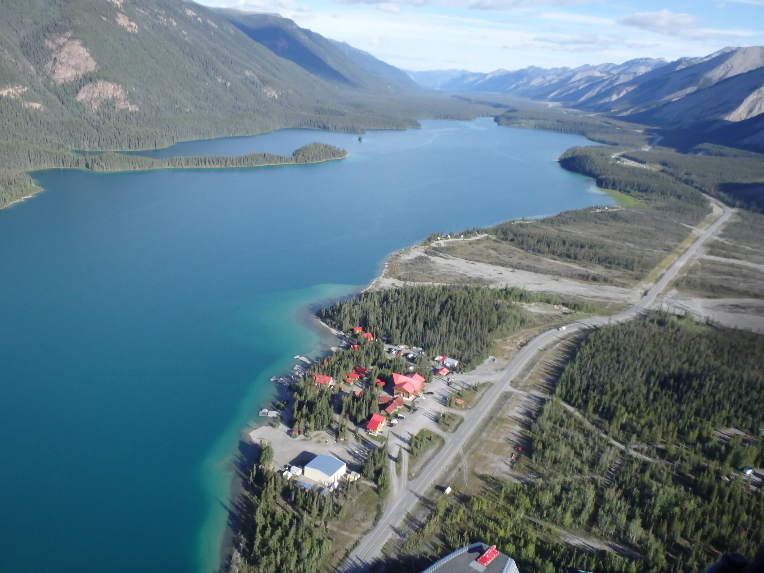
  • Turquoise Muncho Lake
  • Northern Rockies scenery

RV Stops

  • Tetsa River Campground
  • Strawberry Flats Campground
  • Muncho Lake Provincial Park

Quick Comparison

TripBest ForLength
Sea-to-Sky HighwayCoastal mountains2–4 days
Vancouver Island LoopBeaches & rainforest5–7 days
BC Rockies ParksIconic mountain lakes4–5 days
Cariboo Gold RushHistory & forests5–6 days
Kootenay LakesLakes & hot springs4–5 days
Alaska Highway BCRemote wilderness5–7 days

Travel the Trans-African Highway

Did you know that the Trans-African Highway network is a planned set of roads and highways that will span across the African continent, connecting various regions and countries together? The project aims to promote trade, tourism, and economic development by improving transportation infrastructure in Africa.

The idea for the Trans-African Highway network was first proposed in the 1970s by the United Nations Economic Commission for Africa. Since then, several routes have been identified and designated to link countries from North to South and East to West. One of the main goals of the project is to facilitate easier movement of goods and people within the continent, ultimately boosting regional integration and cooperation.

Despite its ambitious goals, the Trans-African Highway network still faces challenges such as funding, coordination among participating countries, and security concerns along certain routes. However, with increased investment in infrastructure and stronger partnerships between nations, the project has the potential to significantly improve connectivity and transportation efficiency throughout Africa.

One notable statistic is that currently, only about one-third of the planned Trans-African Highway network is operational. This highlights the need for continued support and investment in the project to ensure that all routes are completed and fully functional. As more sections of the network are completed, the economic benefits for countries along the routes are expected to increase, making travel and trade more efficient and profitable.

Are You Ready to Explore the Trans-African Highway?

Travel the Trans-African Highway is an incredible opportunity to embark on a journey through the diverse landscapes and cultures of Africa. This highway connects various countries across the continent, providing a unique way to experience the beauty and richness of Africa. Whether you are seeking adventure, cultural immersion, or simply a new experience, traveling the Trans-African Highway offers something for every type of traveler. Read on to discover the wonders that await you on this epic road trip.

Visiting the Trans-African Highway

Traveling along the Trans-African Highway is a dream for many adventure-seekers and road trip enthusiasts. This vast network of roads spans across the African continent, connecting regions from Cairo in Egypt to Cape Town in South Africa. The highway offers a unique opportunity to experience the diverse landscapes, cultures, and people of Africa.

Route Options

There are several route options to consider when traveling the Trans-African Highway. One popular route starts in Cairo, Egypt, and travels through Sudan, Ethiopia, Kenya, Tanzania, Zambia, Zimbabwe, and finally ends in Cape Town, South Africa. This route offers a mix of desert landscapes, lush forests, and bustling cities.

Another common route starts in Lagos, Nigeria, and travels through Benin, Togo, Ghana, Ivory Coast, Burkina Faso, Mali, Senegal, and ends in Dakar. This route showcases the vibrant cultures and rich history of West Africa.

Recommended Stops

Along the Trans-African Highway, there are numerous must-see stops that shouldn’t be missed. In Egypt, take some time to explore the ancient pyramids of Giza and the bustling markets of Cairo. In Kenya, embark on a safari in the Maasai Mara National Reserve to witness the incredible wildlife of Africa up close.

Don’t forget to visit Victoria Falls, one of the largest waterfalls in the world, located on the border of Zambia and Zimbabwe. And in South Africa, enjoy the stunning views along the Garden Route as you make your way to Cape Town.

Challenges and Tips

  • One of the main challenges travelers may face on the Trans-African Highway is poor road conditions in some areas. It’s important to research road conditions before embarking on your journey and be prepared for long stretches of isolated roads.
  • Border crossings can also be time-consuming and bureaucratic, so make sure to have all necessary documents and be patient during the process.
  • It’s essential to pack plenty of water, snacks, and emergency supplies, as services may be limited in remote areas.

Despite the challenges, traveling the Trans-African Highway is a once-in-a-lifetime experience that will leave you with unforgettable memories and a deeper appreciation for the beauty and diversity of the African continent.

According to recent statistics, over 500,000 travelers embark on a journey along the Trans-African Highway each year.

What is the Trans-African Highway?

The Trans-African Highway is a network of highways that crisscross the African continent, connecting countries and regions from north to south and east to west.

How long is the Trans-African Highway?

The Trans-African Highway network spans over 60,000 kilometers, making it one of the longest highway systems in the world.

Are the roads on the Trans-African Highway safe?

While some sections of the Trans-African Highway are well-maintained, others may be in poor condition and lacking modern infrastructure. It is important for travelers to exercise caution and be prepared for varying road conditions.

Do I need a special permit to travel on the Trans-African Highway?

Permit requirements vary by country, so it is advisable to check with the relevant authorities in each country you plan to visit along the Trans-African Highway.

What are some popular destinations along the Trans-African Highway?

  • Cairo, Egypt
  • Cape Town, South Africa
  • Lagos, Nigeria
  • Nairobi, Kenya
  • Casablanca, Morocco

Is it safe to travel on the Trans-African Highway alone?

Traveling alone on the Trans-African Highway can pose certain risks, especially in remote areas. It is recommended to travel with a companion or in a group for added safety.

What are the best modes of transportation for traveling on the Trans-African Highway?

Popular modes of transportation on the Trans-African Highway include buses, shared taxis, and rental cars. Some sections may also be accessible by train or ferry.

Are there accommodations along the Trans-African Highway?

Accommodations vary along the Trans-African Highway, with options ranging from luxury hotels in major cities to guesthouses and camping sites in more remote areas.

What is the best time of year to travel on the Trans-African Highway?

The best time to travel on the Trans-African Highway depends on the region you plan to visit. Generally, the dry season (typically from May to October) is considered more favorable for travel due to improved road conditions.

Can I use public transportation to travel on the Trans-African Highway?

Public transportation options such as buses and minibusses are available along certain sections of the Trans-African Highway. However, services may be limited in more remote areas, so it is advisable to plan your journey accordingly.

Conclusion

Traveling the Trans-African Highway is a journey full of adventure, cultural experiences, and challenges. From the iconic landmarks along the way to the diverse people you meet, this road trip offers a unique perspective on the vast continent of Africa. The article highlights the significance of this highway as a crucial transportation route linking different African countries, fostering economic development, and promoting regional integration.

Moreover, the article emphasizes the need for proper planning, cautious driving, and awareness of potential dangers while traveling on the Trans-African Highway. It is important to take necessary precautions, have backup plans, and be prepared for unexpected situations. Despite the challenges, the rewards of embarking on this journey are immeasurable – from breathtaking landscapes to unforgettable encounters with local communities. Overall, traveling the Trans-African Highway is a once-in-a-lifetime experience that offers a deep understanding of Africa’s beauty, diversity, and resilience. So, pack your bags, hit the road, and get ready for an unforgettable adventure along this iconic route.

Alabama RV Road Trips

Alabama is great for RV travel 🚐 — you get mountains, beaches, forests, historic towns, and civil rights landmarks all within one state. Here are several excellent RV road trip ideas across Alabama, ranging from short scenic drives to longer loops.


1. North Alabama Mountains & Waterfalls Loop

https://www.nps.gov/liri/planyourvisit/images/Falls-GBishop2.jpg
https://images.openai.com/static-rsc-3/-kMPdHYW1Vk-r2vyr1R2JxhZlq286x5PsvUfw5cqm-S1NHs5GfTEgaMZPfUE558t_Ct5ts4vA03uKeXZOS0jLx8qmst3rog6oabby2FWOrU?purpose=fullsize&v=1
https://www.southernliving.com/thmb/11qWXLZPdUJGIsqmQo27IGyp3N0%3D/1500x0/filters%3Ano_upscale%28%29%3Amax_bytes%28150000%29%3Astrip_icc%28%29/2799101_ALSecretFallIMG_0037_preview-67ef8d63c8b2461c994b22af13ff1a28.jpg

4

Route:
Huntsville → Little River Canyon National Preserve → DeSoto State Park → Gadsden → Huntsville

Distance: ~200 miles (320 km)
Ideal length: 3–4 days

Highlights

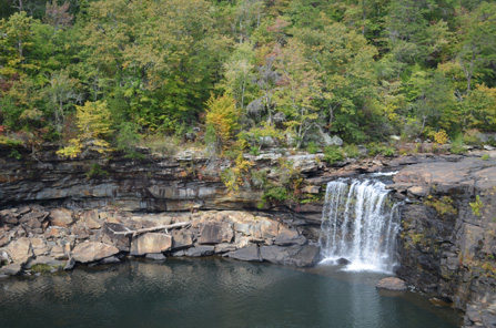
  • Scenic canyon drives
  • Waterfalls and hiking
  • Mountain town of Mentone
  • Noccalula Falls Park

RV Stops

  • DeSoto State Park Campground
  • Little River Canyon RV Park
  • Noccalula Falls Campground

2. Alabama Gulf Coast Beach Trip

https://images.openai.com/static-rsc-3/AHeMEamtyOcfuRYAY-5bGxXQ85Y-yZ7tZI_nVor1-ZLgHGH_pCMTb4X5ylRzKotx8WKMgPCH2zyTzXKm5cLnQvishM-Jls54OK5haAnSUss?purpose=fullsize&v=1
https://a0.muscache.com/im/pictures/prohost-api/Hosting-1232615261331553895/original/7f6fa287-36f0-4c27-a137-d2c5e913aa65.jpeg?im_w=720
https://images.openai.com/static-rsc-3/gvSfMrVArSiJw0wAYdvgtCWSSL09Bo9Jh7JE2Z8Vlg0x8LAHygeO_G07flH9spIzpIF8CzJ3sa5Uqh5e9JJWkzNcsxG_AfI8pwtoXGOTTjU?purpose=fullsize&v=1

4

Route:
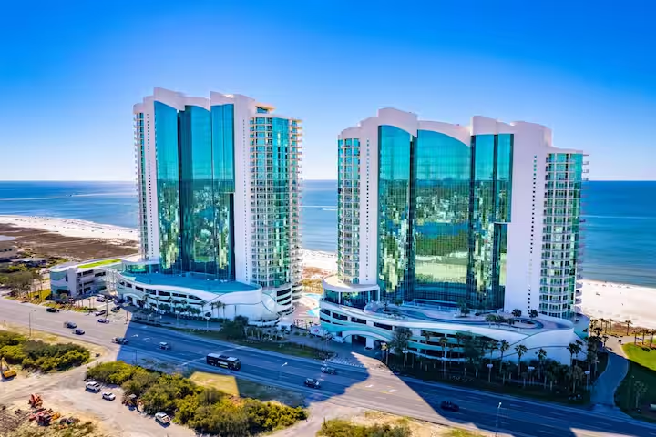
Mobile → Gulf Shores → Orange Beach → Fort Morgan Historic Site

Distance: ~100 miles
Ideal length: 3–5 days

Highlights

  • Sugar-white Gulf beaches
  • Deep sea fishing and dolphin cruises
  • Bike trails in Gulf State Park
  • Historic coastal forts

RV Stops

  • Gulf State Park Campground (one of the best in the Southeast)
  • Luxury RV Resort Orange Beach
  • Fort Morgan RV Park

3. Alabama Civil Rights Trail

https://images.openai.com/static-rsc-3/LpJGW-naO2jOUDc01hMBz25uY1OkSDEKbL8DYrnRUhcCcjKIdB4FSQ20GAD73BLZJBxHiRWUbx92VtIHWitMmlrCb-0tJHAreA6Olg0BynY?purpose=fullsize&v=1
https://dynamic-media-cdn.tripadvisor.com/media/photo-o/11/db/ec/d4/cri-in-birmingham.jpg?h=-1&s=1&w=1200
https://images.squarespace-cdn.com/content/v1/605f62c8df5a58288f18e53d/1617907114075-XSK9CURHU8N11L6819OI/3_15-sm.jpg

4

Route:
Birmingham → Selma → Montgomery

Distance: ~200 miles
Ideal length: 2–3 days

Highlights

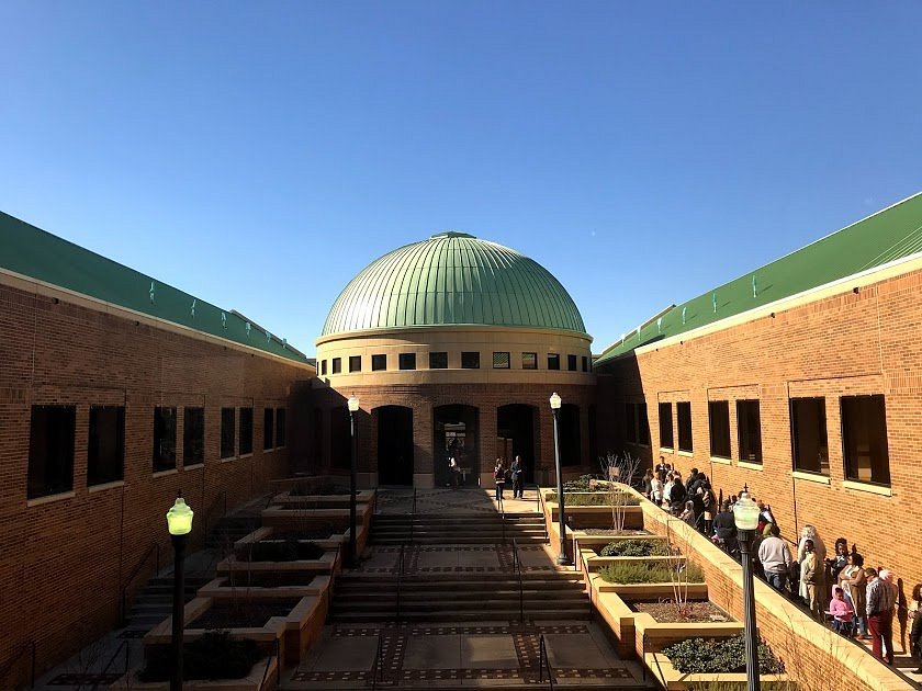
  • Birmingham Civil Rights Institute
  • 16th Street Baptist Church
  • Edmund Pettus Bridge
  • National Memorial for Peace and Justice

RV Stops

  • Birmingham South RV Park
  • Capital City RV Park (Montgomery)

Why it’s unique:
This trip explores one of the most important historical journeys in the United States.


4. Appalachian Alabama Scenic Drive

https://images.openai.com/static-rsc-3/uBY96GEFCc0p4EEPw0kgc__7wyJK9pchuk7u3Ssz2m-jK1Gx6cMtya09uZDM9qEnYiR40s918Ww6PsQQCzUpJ1X6tdLuRCIfTQkNqpVXxEk?purpose=fullsize&v=1
https://images.openai.com/static-rsc-3/2DWFbRh2Pju6iRvrYPasLDnn5cljllkrvpcMqrTXwsADyFu6GJvSe_ELkiBu2RqUHww0xgX7K8FHlFP7mPeEiF-oC2-ryUUECzRnYghzHoA?purpose=fullsize&v=1
https://www.alltrails.com/mugen/image/trail-app-router?q=75&url=https%3A%2F%2Fimages.alltrails.com%2FeyJidWNrZXQiOiJhc3NldHMuYWxsdHJhaWxzLmNvbSIsImtleSI6InVwbG9hZHMvcGhvdG8vaW1hZ2UvNTAzNDU4NTQvOTE2MDkzYjZlMGMyNThmMTI3MzM2MzJiZTQzNTQwOWEuanBnIiwiZWRpdHMiOnsidG9Gb3JtYXQiOiJ3ZWJwIiwicmVzaXplIjp7IndpZHRoIjoiMTA4MCIsImhlaWdodCI6IjcwMCIsImZpdCI6ImNvdmVyIn0sInJvdGF0ZSI6bnVsbCwianBlZyI6eyJ0cmVsbGlzUXVhbnRpc2F0aW9uIjp0cnVlLCJvdmVyc2hvb3REZXJpbmdpbmciOnRydWUsIm9wdGltaXNlU2NhbnMiOnRydWUsInF1YW50aXNhdGlvblRhYmxlIjozfX19&w=3840

4

Route:
Anniston → Talladega National Forest → Cheaha State Park → Talladega

Distance: ~150 miles
Ideal length: 2–3 days

Highlights

  • Alabama’s highest point: Cheaha Mountain
  • Scenic mountain roads
  • Hiking along the Pinhoti Trail
  • Fall foliage drives

RV Stops

  • Cheaha State Park Campground
  • Talladega Pit Stop RV Park

5. Alabama River & Black Belt Heritage Route

https://photos.smugmug.com/Alabama/Old-Cahaba/i-4hmZ2m8/0/LRvXsgQBwDdwTtrzZKBQVkC4cnJVF2vhKKv44xbQT/M/DSC_7267-M.jpg
https://images.squarespace-cdn.com/content/v1/55ac2d21e4b0c0d18bc5b925/1445481409384-5N435YZNAN8F5SXPYZOR/image-asset.jpeg
https://upload.wikimedia.org/wikipedia/commons/1/12/Pieced_Quilt%2C_c._1979_by_Lucy_Mingo%2C_Gee%27s_Bend%2C_Alabama.JPG

4

Route:
Tuscaloosa → Selma → Old Cahawba Archaeological Park → Gee’s Bend → Demopolis

Distance: ~250 miles
Ideal length: 3–4 days

Highlights

  • Historic ghost town of Cahawba
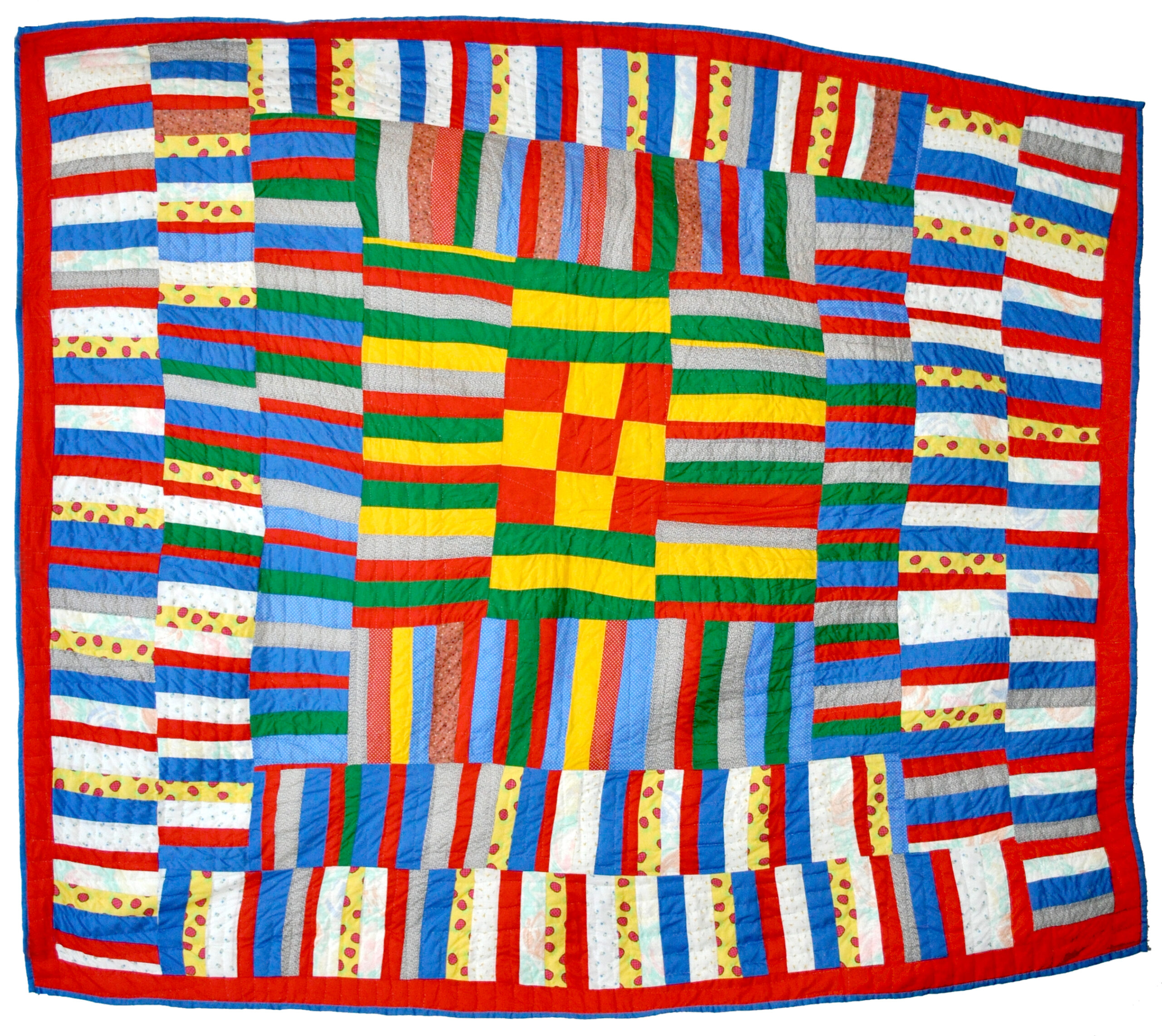
  • Famous Gee’s Bend quilts
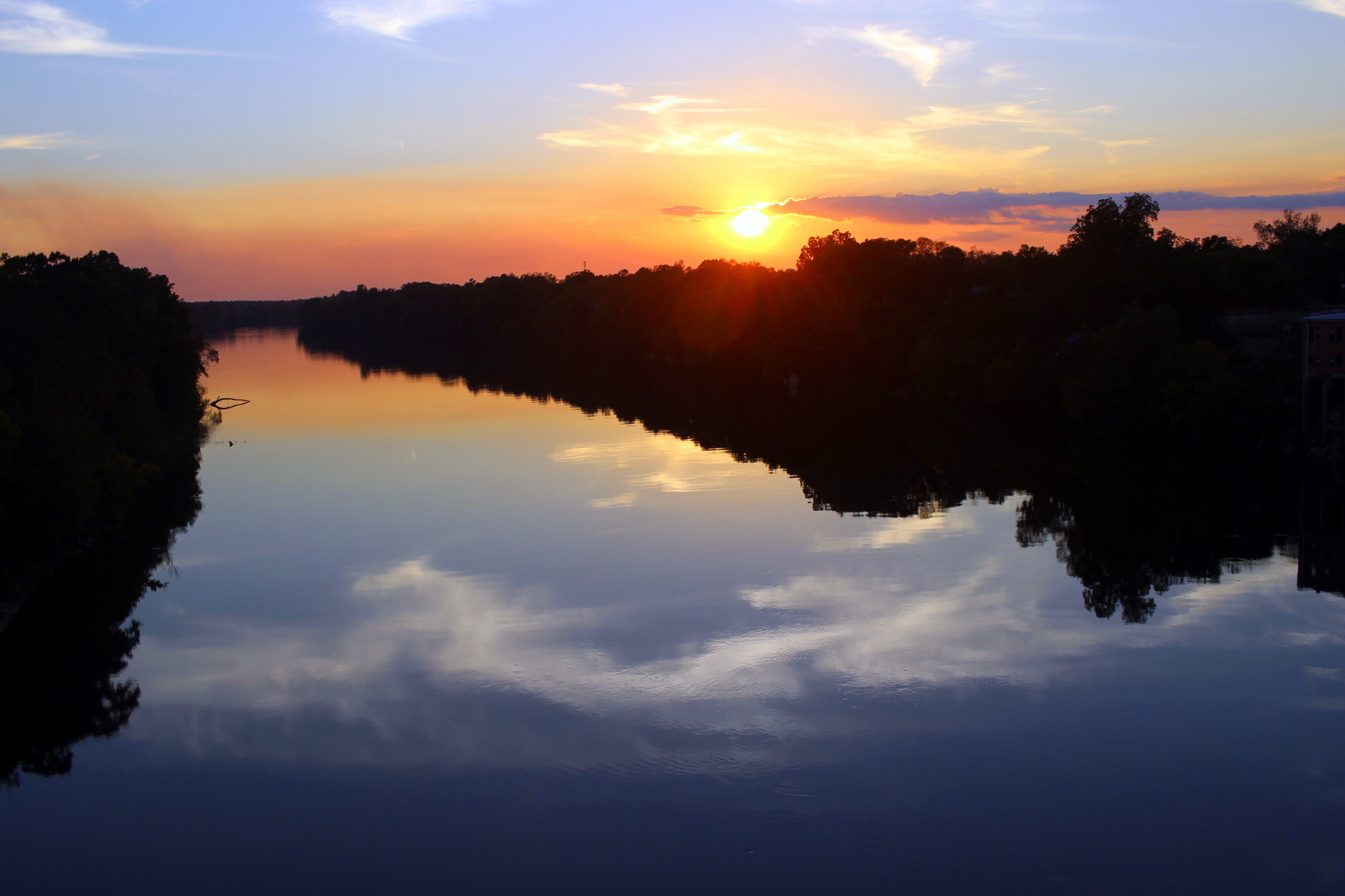
  • Alabama River landscapes
  • Southern heritage towns

RV Stops

  • Foscue Creek Park (Demopolis)
  • River City RV Park

6. Ultimate Alabama RV Loop

https://images.openai.com/static-rsc-3/DyEx7fvAEcRCu-Y3ImqmOJj-Z03t0iRaQ3SCqFJQOc9v7ud13T5U-gYwOG8nkPXAj7rP-RBgH-pHE-nTbc5qipcU9ZUHdueFfG1VCsYaxf0?purpose=fullsize&v=1
https://images.openai.com/static-rsc-3/DCByqbNsp5rG-8pDynM8OKTouvMms56clXmhpMqikH4UXq5Ype2TqVLJUNYgOC8cvWrr5hHE4WWGucs1QXS999h8PTdUEgZDj0ZLRzcs4qY?purpose=fullsize&v=1
https://images.openai.com/static-rsc-3/Kyw5nSxCU9o3-q6kHzoY9IOTmbDk9WVpF4JRfXLtTFo8YBaZ6YeTOLJUePtwJf5JB7UswCAUJ1O16k_QvAYuF-n4Dr9AyLr88u3eFc9f4MA?purpose=fullsize&v=1

4

Route:
Birmingham → Huntsville → Little River Canyon → Cheaha → Montgomery → Gulf Shores → Mobile → Birmingham

Distance: ~750 miles
Ideal length: 10–14 days

Highlights

  • Mountains
  • Beaches
  • Civil rights history
  • Scenic forests
  • Coastal seafood

Why it’s great:
This trip lets you experience the full diversity of Alabama in one RV adventure.


Quick Comparison

TripBest ForLength
North Alabama WaterfallsNature & hiking3–4 days
Gulf Coast BeachesRelaxing beach trip3–5 days
Civil Rights TrailHistory & culture2–3 days
Appalachian AlabamaMountain scenery2–3 days
Black Belt HeritageSouthern history3–4 days
Ultimate Alabama LoopFull state experience10–14 days

Alberta RV Road Trips

Alberta is fantastic for RV travel 🚐 — great highways, stunning mountains, huge parks, and plenty of campgrounds. Here are several RV road trip ideas in Alberta, ranging from short loops to longer adventures.


1. Icefields Parkway RV Adventure

https://images.openai.com/static-rsc-3/A5RBgg52uDwaJl0Kj7dYVnthsVmw5anNF2BOhUqJ91fSqNDScsQxKE2oyiD_xoYFDO2ii8WN6A3u9ukSU7j6MsNVgLaqJkhljJ8KhhHz1z8?purpose=fullsize&v=1
https://images.openai.com/static-rsc-3/L7XS8gJn77C5asoE-iNkzLTigLHzzxbB1pT03Acj3SeA8Rck0sUGIytn16PR_35YjItHyM81iD4OdKUsYhcqdA9uaVAdJnvL44nSXBs6oEQ?purpose=fullsize&v=1
https://images.openai.com/static-rsc-3/Az5animyuw6xK0AYx04JTHqT7pAsE-JiGjkBw2NfprzAVVKQelfUtbXsojjdJsX9LNCuXmzw3XKan7fcZ-tx_BfeQnOuv1hEjJ1RTcbA38c?purpose=fullsize&v=1

4

Route:
Banff National Park → Icefields Parkway → Jasper National Park

Distance: ~230 km (140 miles)
Ideal length: 3–5 days

Highlights

  • Athabasca Glacier
  • Peyto Lake viewpoint
  • Sunwapta & Athabasca Falls
  • Wildlife spotting (bears, elk, goats)

Good RV Stops

  • Lake Louise Campground
  • Rampart Creek Campground
  • Wapiti Campground (Jasper)

Why it’s great:
One of the most scenic drives in the world, perfect for slow RV travel.


2. Cowboy Trail & Alberta Foothills Loop

https://dynamic-media-cdn.tripadvisor.com/media/photo-o/19/d2/e2/43/rockiesmeet-prairies.jpg?h=-1&s=1&w=1200
https://cdn.sanity.io/images/lr9tta69/production/ab2c1f6fcc6655448529257e52689b65aee6e8bf-3843x2562.jpg
https://images.openai.com/static-rsc-3/4fy-UFmqhTXsApfvbsM5FkpZ79clIoW-nS9EC2HmdWL-wFfj8Vkn-YI5LDnri9hakVMS_v5zjiKIFEI_MW4nY74fmE1eX7D4mzBB9iMYMwM?purpose=fullsize&v=1

4

Route:
Calgary → Cowboy Trail (Highway 22) → Kananaskis Country → Pincher Creek

Distance: ~400 km loop
Ideal length: 3–4 days

Highlights

  • Ranch country landscapes
  • Small western towns
  • Kananaskis hiking and lakes
  • Bar U Ranch historic site

RV Stops

  • Sheep River Provincial Park
  • Chain Lakes Provincial Park
  • Castle Provincial Park

Why it’s great:
A classic western Alberta experience with fewer crowds than Banff.


3. Canadian Rockies Grand Loop

https://images.openai.com/static-rsc-3/y9Iso2JWs6sAkSNE4V0_sAP3hvUaB0_nH8vH9t4TEVG0dToTmw3MzzFwka89YwyqZC9YwekTFulAIGIbbaoKSyvhkNIw8WUkaMlMEDuC5Vs?purpose=fullsize&v=1
https://images.openai.com/static-rsc-3/BYb9HPtKgtmgxMASJhp5KCVOHasChTprBoovZxoM75y5Udf2u6ETIKAreeBqKnqZXLgx4qdOG8dFFEkUxopY5pWdWnHJYglGoD_LqBGeM8k?purpose=fullsize&v=1
https://images.openai.com/static-rsc-3/Qkrug77w52OJBcXe7BsNwQd5COLSiwQK92FNf5hgs9MZhFXZCBtxns2iZepE7LAByr55-O4U4BZzwoB7LhvqIZr9xwT6Q-BZto0mqmgn9Y8?purpose=fullsize&v=1

4

Route:
Calgary → Banff National Park → Icefields Parkway → Jasper National Park → Edmonton → Calgary

Distance: ~1,000 km
Ideal length: 7–10 days

Highlights

  • Moraine Lake
  • Maligne Lake boat cruise
  • Banff townsite
  • Columbia Icefield

RV Stops

  • Tunnel Mountain Campground (Banff)
  • Wapiti Campground (Jasper)
  • Elk Island National Park

Why it’s great:
This is Alberta’s ultimate RV loop combining mountains, glaciers, and wildlife.


4. Alberta Badlands Dinosaur Trail

https://images.openai.com/static-rsc-3/kKd4J0Zx-hkCfOsIBmBQq50KA-iVhGUBM2aZho0vwYmfoCBRZ4vp9jVh9PfbFDDfYiXklueiai2OGZeEiDYPevsmaGY4-zoxyLnZUP4eI3k?purpose=fullsize&v=1
https://tyrrellmuseum.com/sites/default/files/styles/max_730_x_400/public/images/exhibit/DinosaurHall_FEATURE.jpg?itok=uzvvji89
https://images.openai.com/static-rsc-3/mMVu4tYRkXuVnmxyz_E80ncN2f6v3lCJjQj9M7dNfwKDjyJySf0_4bJriqzhkbQEdXwyrEH7g4BjP4SyV-MAsf8DTqS1itucUviD17Javb8?purpose=fullsize&v=1

4

Route:
Calgary → Drumheller → Dinosaur Provincial Park → Medicine Hat

Distance: ~350–450 km
Ideal length: 2–4 days

Highlights

  • Hoodoos rock formations
  • Fossil exhibits at Royal Tyrrell Museum
  • Dinosaur digs
  • Unique desert-like landscapes

RV Stops

  • Dinosaur Trail RV Resort
  • Dinosaur Provincial Park Campground
  • Gas City Campground

Why it’s great:
Totally different scenery — prehistoric landscapes and fossils.


5. Northern Alberta Lakes & Wilderness

https://dynamic-media-cdn.tripadvisor.com/media/photo-o/0e/ee/2b/ff/devonshire-beach-lesser.jpg?h=1200&s=1&w=1200
https://images.openai.com/static-rsc-3/5TXR16OwLknzXTcxL_j5m_8Kc9yVL3q6DdP9voCC9vhQpoyR39m3sGiTfJd37V7spBAKGyEktyY_JlzJm1qpmWTzYx0ryxbQV6RM0y8Vz4A?purpose=fullsize&v=1
https://upload.wikimedia.org/wikipedia/commons/8/87/Sagitawa_Lookout%2C_Peace_River%2C_Alberta.jpg

4

Route:
Edmonton → Lesser Slave Lake Provincial Park → Peace River → Wood Buffalo National Park

Distance: ~900+ km
Ideal length: 7–10 days

Highlights

  • Huge northern lakes
  • Bison in Wood Buffalo
  • Sand dunes and salt plains
  • Remote wilderness

RV Stops

  • Marten River Campground
  • Peace River municipal campground
  • Pine Lake Campground (Wood Buffalo)

Why it’s great:
A less touristy Alberta adventure with big wilderness and wildlife.


Quick Summary of Alberta RV Trip Styles

TripBest ForLength
Icefields ParkwayEpic mountain scenery3–5 days
Cowboy TrailWestern culture & foothills3–4 days
Rockies Grand LoopFull Alberta highlights7–10 days
Badlands Dinosaur TrailUnique geology & fossils2–4 days
Northern WildernessRemote lakes & wildlife7–10 days

Amsterdam Städte Trip

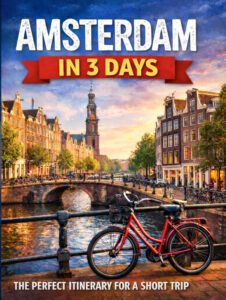
Amsterdam City Guide – Die perfekte 3-Tage-Reiseroute

Reiseziel: Amsterdam, Niederlande
Empfohlene Aufenthaltsdauer: 2–3 Tage
Reisestil: Städtereise
Format des Reiseführers: PDF / Druck
Sprachen: EN / DE / FR / ES

Amsterdam ist eine der charmantesten und eigenständigsten Städte Europas. Berühmt für seine historischen Grachten, eleganten Patrizierhäuser, Weltklasse-Museen und das lebendige kulturelle Leben, bietet die niederländische Hauptstadt ihren Besuchern ein unvergessliches Erlebnis. Ob Sie Meisterwerke der Kunst erkunden, entlang malerischer Kanäle radeln oder lebendige Viertel entdecken – Amsterdam verbindet historische Schönheit mit einer entspannten, modernen Atmosphäre.

Dieser Amsterdam-Reiseführer bietet eine sorgfältig ausgearbeitete 3-Tage-Reiseroute, die die wichtigsten Sehenswürdigkeiten abdeckt und gleichzeitig Zeit lässt, die Cafés, Märkte und Viertel der Stadt zu genießen. Mit seinen kompakten Straßen und dem hervorragenden öffentlichen Nahverkehr lässt sich Amsterdam leicht erkunden und ist ideal für einen kurzen Städtetrip.

Buttons:

  • Reiseführer kaufen
  • Probeexemplar herunterladen

Was dieser Reiseführer bietet

Dieser Reiseführer hilft Ihnen, Amsterdam effizient zu erkunden, indem er die berühmtesten Wahrzeichen der Stadt mit lokalen Vierteln und versteckten Schätzen verbindet.

Highlights sind:

  • Eine komplette 3-Tage-Reiseroute für Amsterdam
  • Einfache Spazierrouten durch das historische Zentrum
  • Insidertipps für Museen und Attraktionen
  • Restaurant- und Café-Empfehlungen
  • Vorschläge für malerische Grachtenspaziergänge
  • Praktische Reisetipps für Erstbesucher

Das historische Zentrum Amsterdams ist relativ kompakt, was bedeutet, dass viele Sehenswürdigkeiten zu Fuß oder mit dem Fahrrad erreicht werden können. Dieser Führer konzentriert sich auf die besten Orte für einen Kurzaufenthalt und führt gleichzeitig in die einzigartige Atmosphäre und Kultur der Stadt ein.

Vorgeschlagene 3-Tage-Reiseroute

Tag 1 – Historische Highlights

Ihr erster Tag in Amsterdam konzentriert sich auf das historische Herz der Stadt. Beginnen Sie Ihre Erkundungstour auf dem Damplatz, dem historischen Zentrum Amsterdams und einem der berühmtesten Wahrzeichen der Stadt.

Hier finden Sie das beeindruckende Königliche Schloss von Amsterdam, das ursprünglich im 17. Jahrhundert während des Niederländischen Goldenen Zeitalters erbaut wurde. Das Schloss spiegelt den Reichtum und die Macht Amsterdams in seiner Zeit als eine der wichtigsten Handelsstädte Europas wider.

Sehenswürdigkeiten in der Nähe sind:

  • Nieuwe Kerk (Neue Kirche)
  • Nationales Monument
  • Historische Einkaufsstraßen wie die Kalverstraat

Vom Damplatz aus gehen Sie weiter zum Grachtengürtel, einem UNESCO-Weltkulturerbe, das aus eleganten Kanälen besteht, die im 17. Jahrhundert angelegt wurden. Ein Spaziergang entlang der Grachten wie Herengracht, Keizersgracht und Prinsengracht ist eine der besten Möglichkeiten, den historischen Charakter der Stadt zu erleben.

Setzen Sie Ihren Weg fort zum Anne-Frank-Haus, einer der meistbesuchten Stätten in Amsterdam. Dieses Museum bewahrt das Versteck, in dem Anne Frank während des Zweiten Weltkriegs ihr berühmtes Tagebuch schrieb. Der Besuch des Hauses bietet einen eindrucksvollen Einblick in die Geschichte und die menschliche Widerstandskraft.

Am Nachmittag erkunden Sie das charmante Jordaan-Viertel, einst ein Arbeiterviertel und heute eines der attraktivsten Viertel der Stadt. Enge Gassen, kleine Kunstgalerien, Boutiquen und gemütliche Cafés schaffen eine einladende Atmosphäre.

Beenden Sie Ihren ersten Tag mit dem Abendessen in einem Restaurant am Kanal und genießen Sie die magische Abendstimmung, wenn die Brücken und Grachtenhäuser beleuchtet werden.
Tag 2 – Kultur & Museen

Tag zwei konzentriert sich auf Amsterdams außergewöhnliche Museen und kulturellen Attraktionen.

Beginnen Sie Ihren Morgen auf dem Museumplein, dem Museumsviertel der Stadt. Dieser große, offene Platz ist von einigen der wichtigsten kulturellen Einrichtungen der Niederlande umgeben.

Beginnen Sie mit dem Rijksmuseum, dem Nationalmuseum der Niederlande. Das Museum beherbergt Meisterwerke aus dem Niederländischen Goldenen Zeitalter, darunter berühmte Werke von Rembrandt, Vermeer und Frans Hals. Eines der bekanntesten Gemälde hier ist Rembrandts “Die Nachtwache”.

Besuchen Sie als nächstes das Van Gogh Museum, das die weltweit größte Sammlung von Werken Vincent van Goghs beherbergt. Das Museum bietet einen faszinierenden Einblick in das Leben und die künstlerische Entwicklung des Künstlers.

Ein weiteres beliebtes Museum in der Nähe ist das Stedelijk Museum, das sich der modernen und zeitgenössischen Kunst widmet.

Entspannen Sie sich am Nachmittag im Vondelpark, dem größten und bekanntesten Park Amsterdams. Einheimische und Besucher gleichermaßen genießen es, hier Rad zu fahren, spazieren zu gehen und zu picknicken, besonders in den wärmeren Monaten.

Erkunden Sie später das lebendige Leidseplein-Viertel, das für seine Restaurants, Bars, Theater und Musiklokale bekannt ist. Dieser Bezirk ist ein großartiger Ort, um Amsterdams Nachtleben und internationale Küche zu erleben.

Tag 3 – Viertel & Lokales Leben

Ihr letzter Tag konzentriert sich auf das Entdecken des alltäglichen Lebens und der einzigartigen Viertel Amsterdams.

Beginnen Sie Ihren Morgen auf dem farbenfrohen Albert-Cuyp-Markt im lebendigen Viertel De Pijp. Dieser berühmte Straßenmarkt bietet eine große Auswahl an lokalen Lebensmitteln, frischen Produkten, Kleidung und Souvenirs. Er ist auch ein großartiger Ort, um traditionelle niederländische Snacks wie Stroopwafels und Hering zu probieren.

Nachdem Sie den Markt erkundet haben, setzen Sie Ihren Spaziergang durch De Pijp fort, ein multikulturelles Viertel, das für seine Cafés, Restaurants und seine lebendige Atmosphäre bekannt ist.

Besuchen Sie als nächstes die Heineken Experience, die sich im ursprünglichen Heineken-Brauereigebäude befindet. Das interaktive Museum erzählt die Geschichte einer der berühmtesten Biermarken der Welt.

Am Nachmittag geht es weiter in das Viertel Negen Straatjes (Neun Sträßchen), ein malerisches Gebiet mit kleinen Grachten und charmanten Boutiquen. Dieses Viertel ist ideal zum Stöbern in unabhängigen Geschäften, Vintage-Läden und Cafés.

Später könnten Sie eine Grachtenrundfahrt machen, eine der entspanntesten Arten, Amsterdam zu erleben. Die Bootstouren fahren durch die historischen Kanäle der Stadt, vorbei an schönen Brücken und eleganten Patrizierhäusern.

Beenden Sie Ihre Reise mit der Erkundung der Amsterdamer Uferpromenade an der IJ, wo moderne Architektur einen Kontrast zum historischen Zentrum der Stadt bildet.

Stadtplan erkunden

Das historische Zentrum Amsterdams ist leicht zu navigieren, und viele Sehenswürdigkeiten liegen in fußläufiger Entfernung voneinander.

Vorgeschlagene Spazierrouten:

  • Route Tag 1: Damplatz → Grachtengürtel → Anne-Frank-Haus → Jordaan-Viertel
  • Route Tag 2: Museumplein → Rijksmuseum → Van Gogh Museum → Vondelpark → Leidseplein
  • Route Tag 3: Albert-Cuyp-Markt → De Pijp → Negen Straatjes → Grachtenrundfahrt → IJ-Ufer

Die Verwendung eines Stadtplans oder einer Navigations-App hilft Ihnen, entlang des Weges kleinere Kanäle, versteckte Innenhöfe und malerische Aussichtspunkte zu entdecken.

Warum Amsterdam besuchen?

Amsterdam ist eine der eigenständigsten Städte Europas, berühmt für seine Grachten, historische Architektur und kreative Kultur. Die entspannte Atmosphäre der Stadt macht sie besonders angenehm für Erkundungen mit dem Fahrrad oder zu Fuß.

Gründe, Amsterdam zu besuchen, sind:

  • Wunderschöne historische Grachten und Brücken
  • Weltklasse-Museen und Kunstsammlungen
  • Einzigartige historische Architektur
  • Lebendige Café-Kultur und Nachtleben
  • Hervorragende Rad- und Wanderwege

Amsterdam bietet zudem eine einladende internationale Atmosphäre und zieht Besucher aus der ganzen Welt an.

[Bitte fügen Sie hier 3 Stadtfotos ein]

Für wen ist dieser Reiseführer geeignet?

Dieser Führer ist ideal für:

  • Erstbesucher Amsterdams
  • Reisende, die einen 2-3-tägigen Städtetrip planen
  • Kulturliebhaber, die sich für Kunst und Museen interessieren
  • Besucher, die gerne durch historische Städte spazieren oder Rad fahren
  • Reisende, die eine klare Reiseroute für einen Kurzaufenthalt wünschen

Holen Sie sich den kompletten Amsterdam-Reiseführer

Laden Sie den vollständigen Reiseführer herunter, um Zugang zu erhalten zu:

  • detaillierten Wanderrouten
  • Beschreibungen der Sehenswürdigkeiten
  • Restaurantempfehlungen
  • Reisetipps und praktischen Ratschlägen

Buttons:

  • PDF-Reiseführer kaufen
  • Gedruckten Reiseführer kaufen
  • Beispielseiten ansehen

Weitere Städtereiseführer

Diese könnten Ihnen auch gefallen:

  • Paris City Guide (Reiseführer für Paris)
  • Barcelona City Guide (Reiseführer für Barcelona)
  • Vienna City Guide (Reiseführer für Wien)
  • Prague City Guide (Reiseführer für Prag)

Häufig gestellte Fragen

Wie viele Tage benötigt man in Amsterdam?
Zwei bis drei Tage reichen in der Regel aus, um die Hauptattraktionen zu sehen und das historische Zentrum zu erkunden.

Was ist die beste Reisezeit für Amsterdam?
Frühling und Herbst bieten angenehmes Wetter und weniger Menschenmassen, obwohl der Sommer ebenfalls beliebt ist.

Ist Amsterdam für Touristen gut zu Fuß erkundbar?
Ja. Die meisten Sehenswürdigkeiten befinden sich im kompakten historischen Zentrum und können leicht zu Fuß erkundet werden.